
Day 2 (Hvanngil to Emstrur–Botnar)
We woke up refreshed, with maybe a little stiffness, but eager to experience the day ahead. After the long haul and demanding terrain yesterday, we were looking forward the relatively flat lava fields we would be covering today on our 7.3 mi (11.8 km) hike to Emstrur-Botnar
A half hour into the hike we encountered another river crossing and went thru the routine of changing footwear and raising our pant legs above the knee. We decided this would be a great place for Chris to fly his drone to get some video of the crossing.
As an aside, I mentioned earlier that one of Chris’ goals was to unplug. Clearly I must have been mistaken, or his definition of unplugging means carrying a 4 lb drone and all its components; an insta360 panoramic camera, a GoPro, and multiple batteries and battery packs. He tells me that he’ll spend a few weeks to put all of the various clips into a stunning video of our adventure. When it’s available, I’ll be sure to link it to this blog. [Author’s Note: As of February 2025 I am still waiting for the video compilation… so I guess he was a little optimistic in his estimate!]

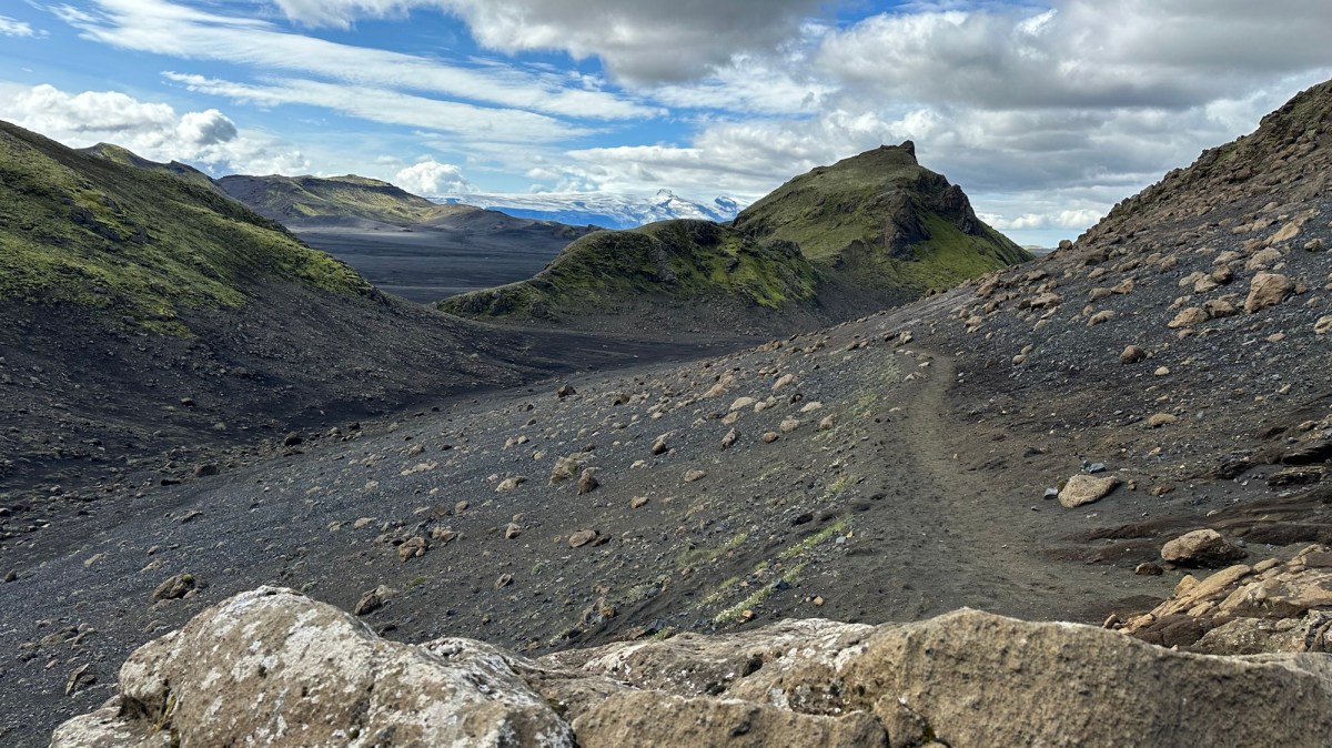
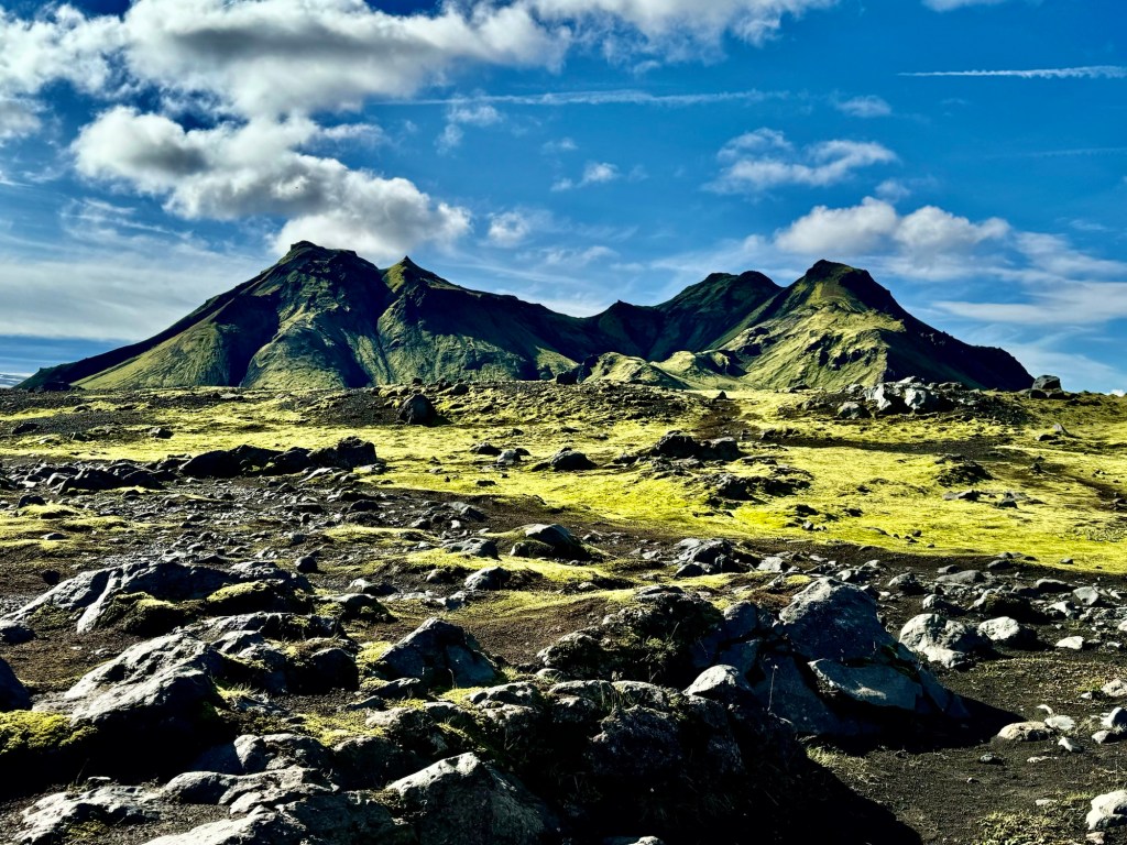
As we hiked southward on the relatively smooth lava sand trail, the massive Entujökull Glacier loomed above us to the east, while to the west were green, sharply rising hills jutting up from the barren charcoal gray lava field we were crossing. The hiking was easy and the sun warmed the air around us, allowing us to remove some layers and soak in the sun.
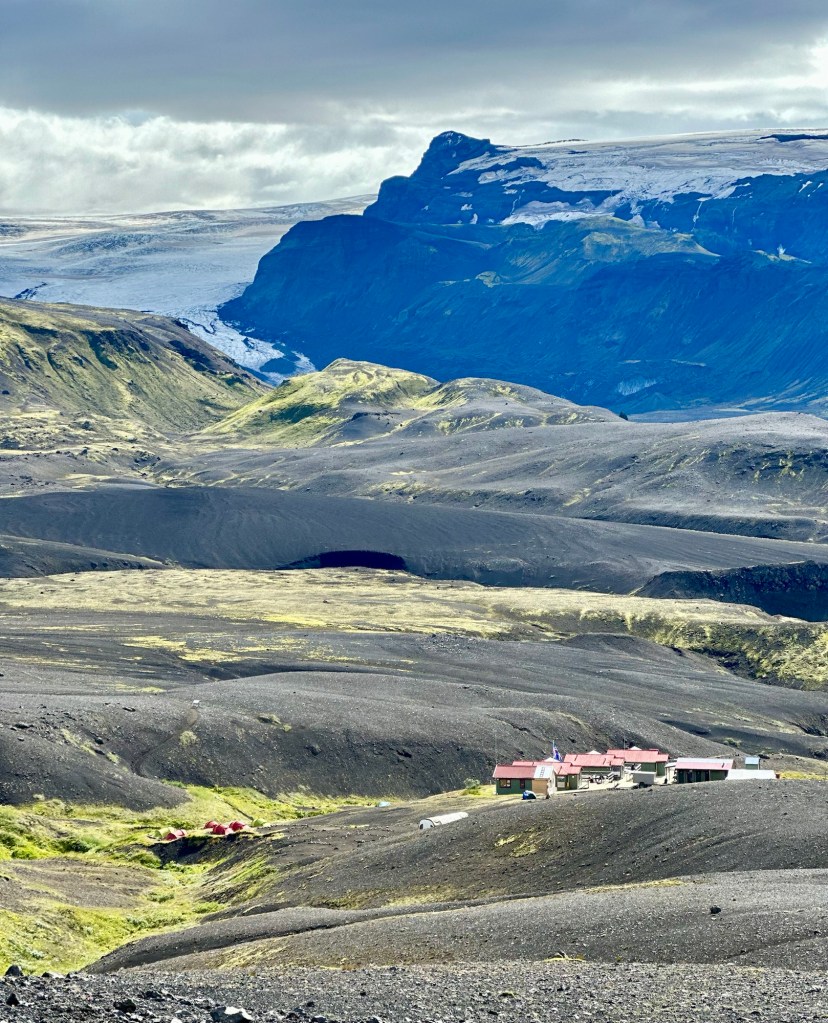
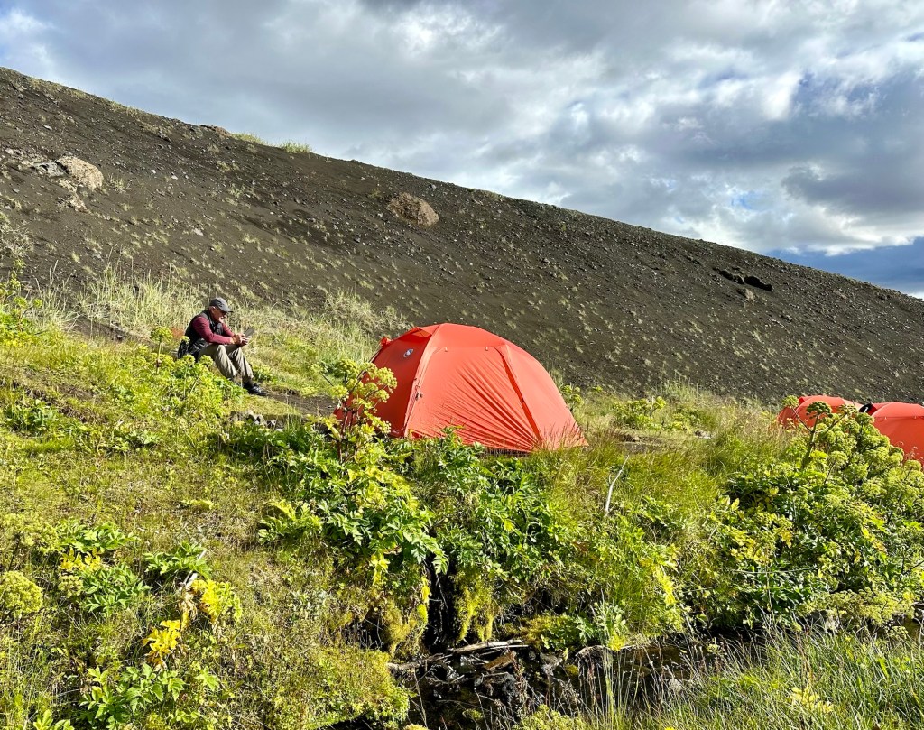
At around noon we crested the final lava bluff and could see our destination for the day, Emstrur-Botnar. Once again we paid the tent camping fee. Since we were some of the earliest hikers to arrive, we got to select some of the best tent sites in a protected area next to a gently babbling stream.
After lunch, we decided to take a short hike to the nearby Markarfljótsgljúfur Canyon. This extracurricular excursion was well worth the time and effort as we crested a hill and saw a massive gash in the landscape. The precipitous cliffs, over 200m high, were formed only 2,000 years ago by floodwaters produced by the melting of the Mýrdalsjökull Glacier.
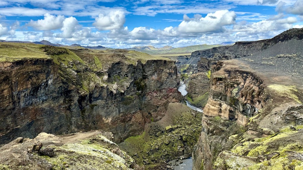
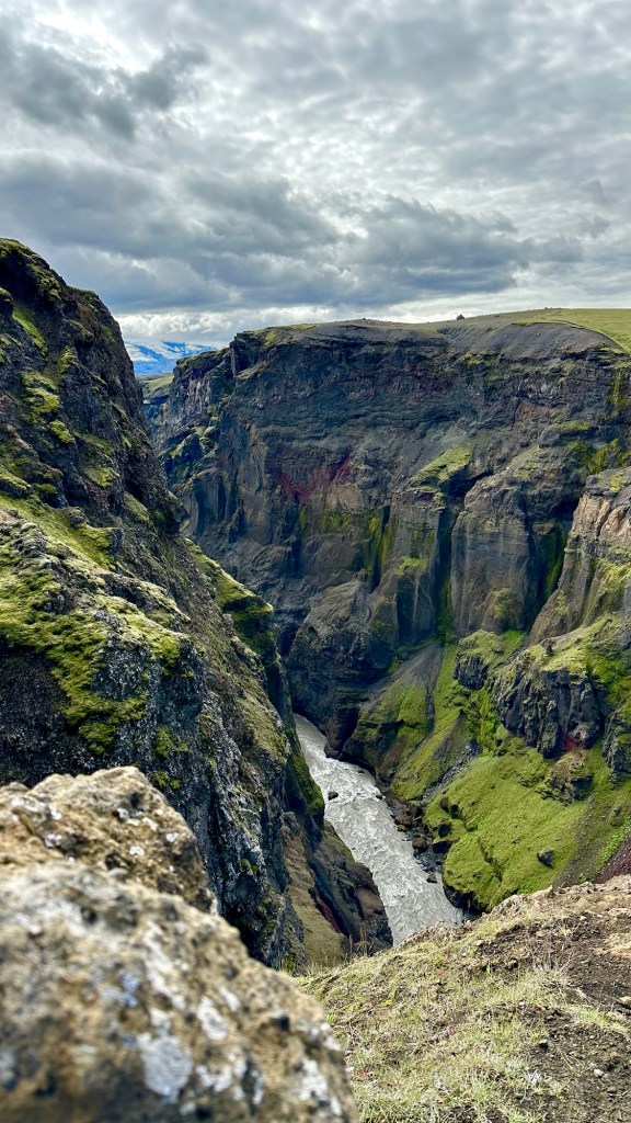
We carefully approached the edge to look down into the narrow chasm to the glacier fed river far below… a great way to wrap up day 2 of our Icelandic adventure.


So beautiful. Gre
LikeLike