

Day 8: Acclimatization Hike to 15,300’ (4,665m)
We spent the first of two nights in Dingboche at an elevation of 14,300’, which allows us a chance to acclimatize to the higher elevations we will experience in the next couple of days. Our morning was spent taking a leisurely hike up the hillside behind the village to an elevation of 15,300’, which is at least 800’ higher than the highest point in the continental United States (aka the lower 48). We relaxed at the top, taking in the views all around us while we became acclimated to the thinner air.

While we were relaxing, a vigorous debate broke out between the Sherpa guides and us, the clients. Our fantastic guides, who have a tremendous amount of knowledge about the Himalayan region, were absolutely insistent that we were sitting at 4,800m (15,745’), while we were equally convinced that we were at 4,665m (15,300’), due to three separate GPS devices saying we were at that elevation! It was actually quite amusing to hear our guides debating in Nepalese while they consulted a map of the region. In the end they concluded that they were right. So in the interest of not creating an international incident, we politely agreed with their conclusion while we held onto our view that a GPS locked into 12 different satellites with an accuracy of +/- 12’ was really the elevation we had attained. After about an hour at the top, we descended steeply back down to our tea house, the Summit Hotel.
This particular hotel seems to have an on again, off again relationship with running water, which makes it a bit of a guessing game when it comes to using the toilet; I will probably be writing a blog post at some point simply to describe the wide variety of bathroom experiences we’ve “enjoyed” during our trip.
Click here for the “Bathroom Blog” post
Day 9: Dingboche to Lobuche (final stop before EBC)
We are excited to be close to the destination of the trek, Mt. Everest Base Camp, and everyone is preparing for the long days ahead. Today was our final “short” day as we hiked from Dingboche to the even smaller village of Lobuche, which lies at an elevation of 16,175’ (4,930m). Half of the 5.7 mile hike was in a large gradually rising steppe which was very pleasant, especially since the sun was shining and there was only a light breeze. After crossing the headwaters of the Khumbu River, which originates at the famous Khumbu Glacier at the base of Everest, we (… that should really read “I”) enjoyed a nice lunch of fried rice and garlic soup… I thought it was pretty good, but some of the more picky eaters chose to forego it in lieu of the snacks they brought with them.

After lunch, the real work began as we climbed a steep rocky path up to Lobuche. Along the way we passed the memorial site to some of the many climbers who have lost their lives on Everest. From this point forward, the days will be very long. Tomorrow, April 16th, we will pass through Gorak Shep, a very small outpost a few miles from Everest, on our way to Everest Base Camp (17,600’ / 5,365m). Then we will return to Gorak Shep for the night. The next morning we will get a very early 4:00 am start so we can climb to the top of Kala Patthar (18,500’ / 5540m) for what we hope will be an up-close sunrise view of Mt. Everest. Then the long hike back thru Gorak Shep (for breakfast), before we head downhill for about 7.5 miles all the way to Periche. After a night there, we have two more long hikes (Periche to Namche Bazaar & Namche Bazaar to Lukla).


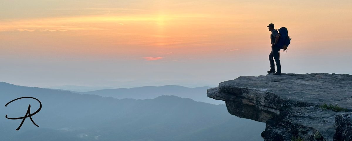
Just stunning pics of the views! I just hope that the dark blue ball cap Ron is wearing in these photos is not one that says “Navy” anywhere on it, because I know he did not bring that cap with him (he doesn’t own anything blue)!
LikeLike