Virginia Triple Crown: Day 3

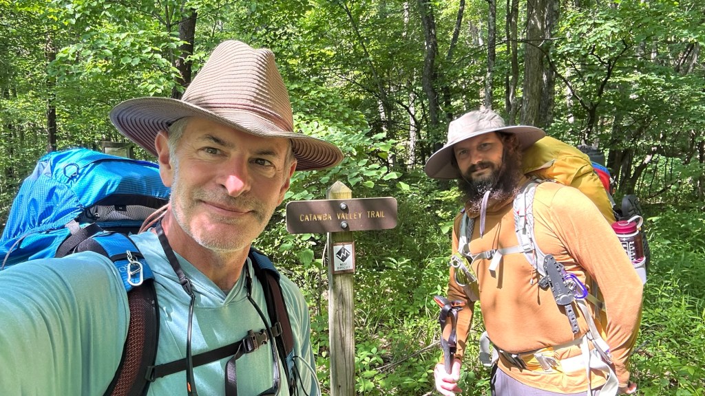
This is our final day, but also the one most anticipated because the main attraction of the Triple Crown, McAfee Knob, is waiting in the dark 1.5 miles away and a 1,000 feet above us. Although I set my alarm for a 4 am wake up, it was unnecessary because throughout the night some very loud birds were endlessly chirping away, making for a fitful sleep. Morgan, on the other hand, seemed to be sleeping soundly 10 feet away in his own tent!

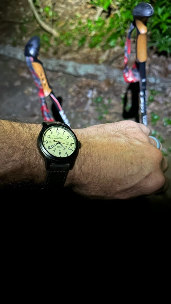
Our plan was to wake up at 4 am, break down camp, pack our gear, and be on the trail by 4:30 so we could experience sunrise at McAfee Knob. Since it was still dark, we would be using our headlamps, so with one final scan of the campsite to ensure we had left no trace, we started up the trail at 4:40 am… a little late, but well within the timeframe needed to reach the top before sunrise.

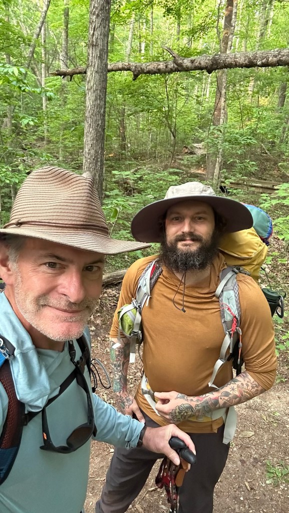
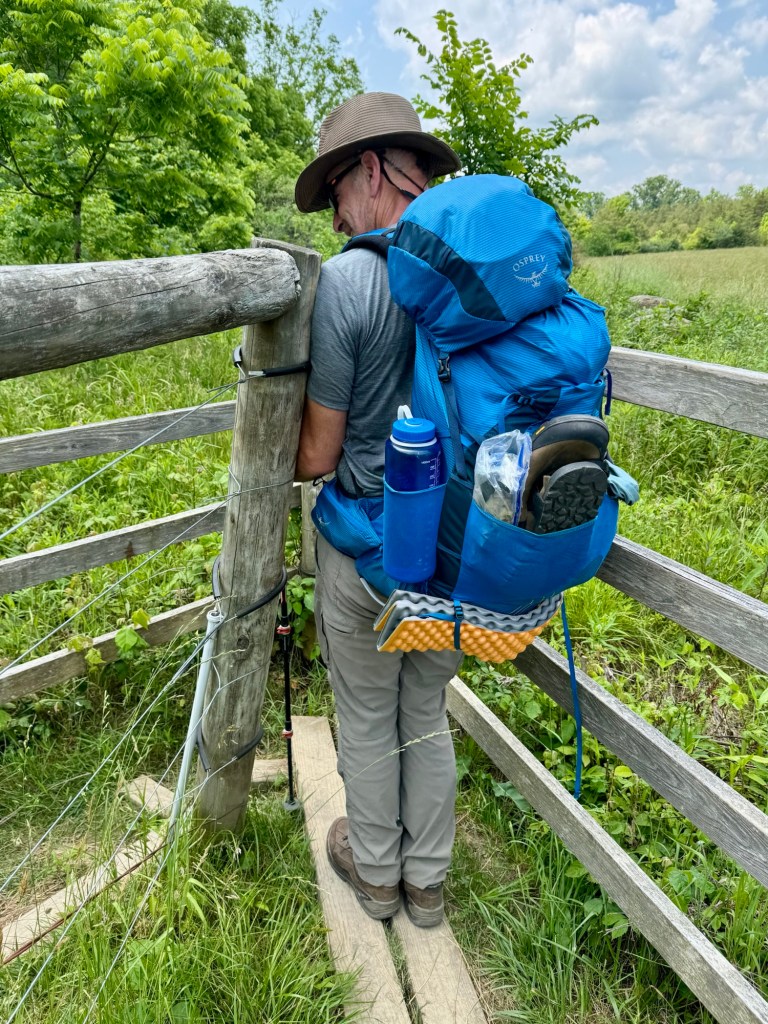
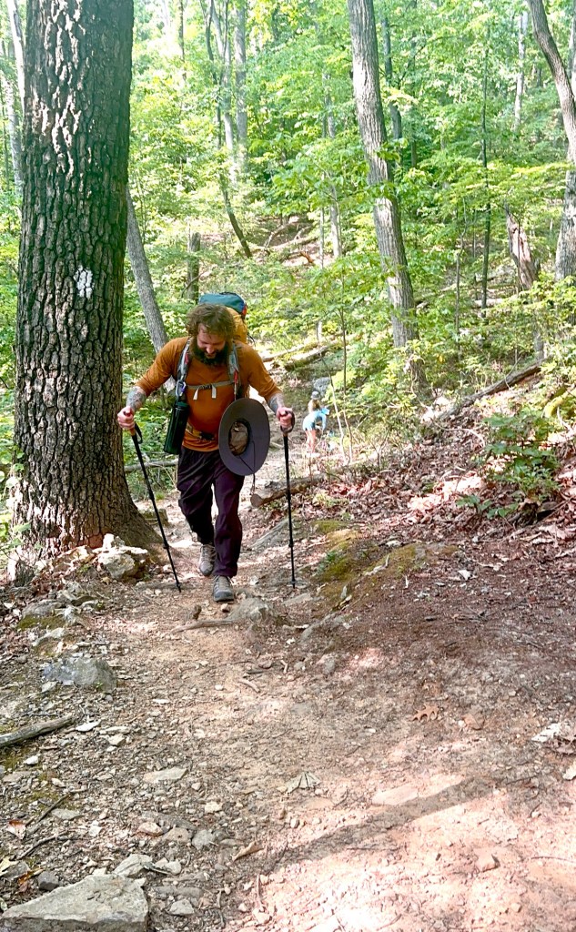
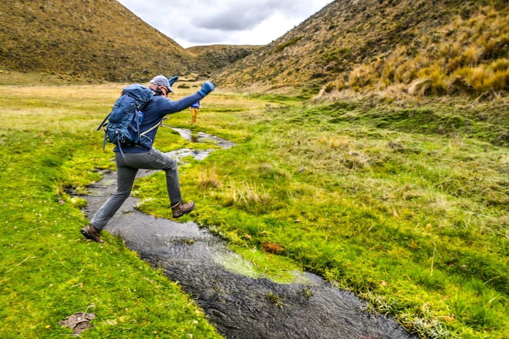
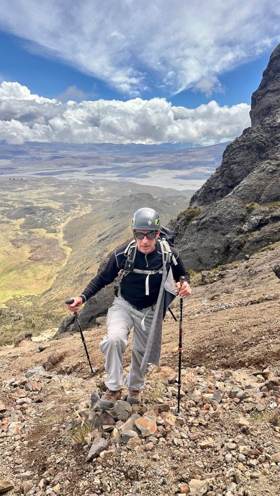
Morgan made a wardrobe change for the day, instead of hiking in long pants (which I personally like to do to minimize the scratches and insects), he was wearing shorts (his preferred summer wear) and sandals. The sandals were due to a blister he had developed on his little toe. My only caution to him was to be careful with his foot placement on the rocky trail since he had nothing protecting his toes if he struck a rock.

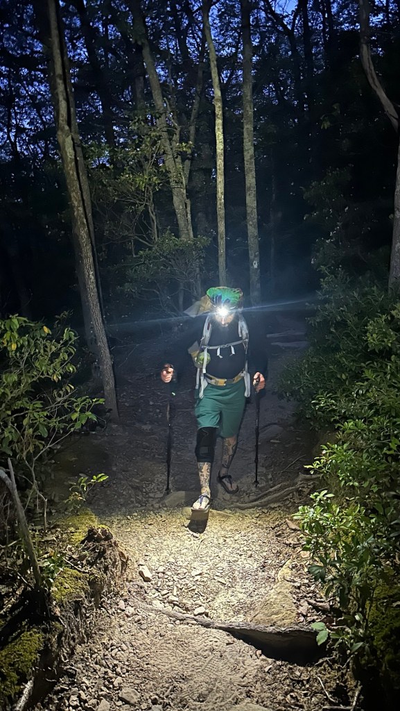
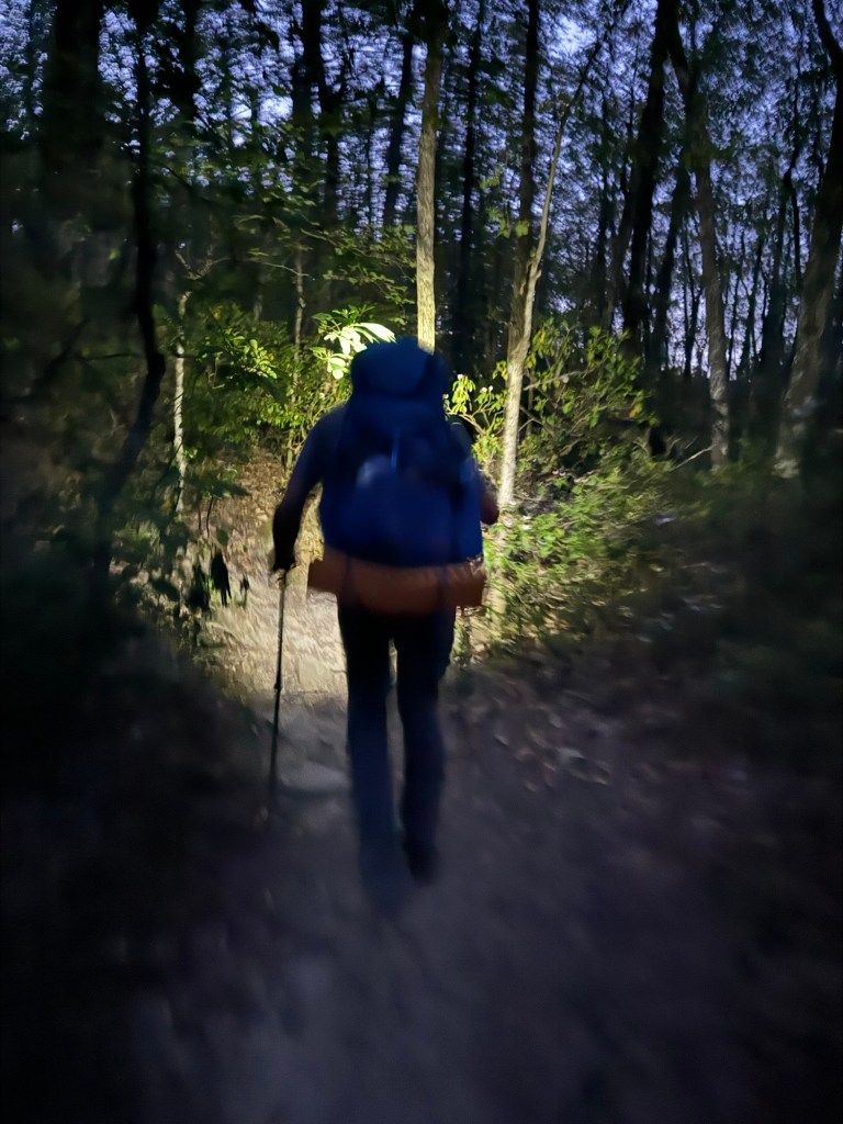
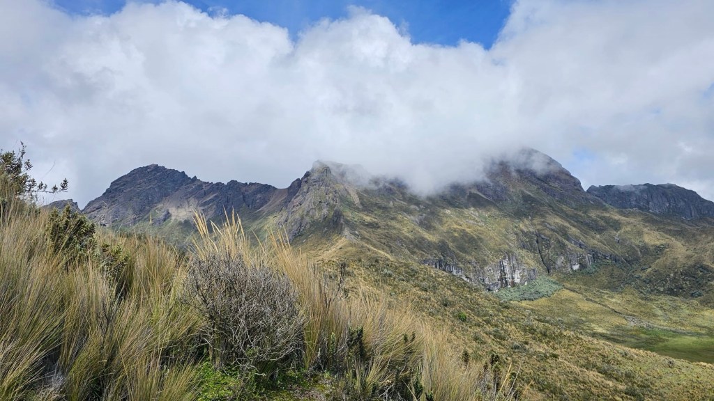
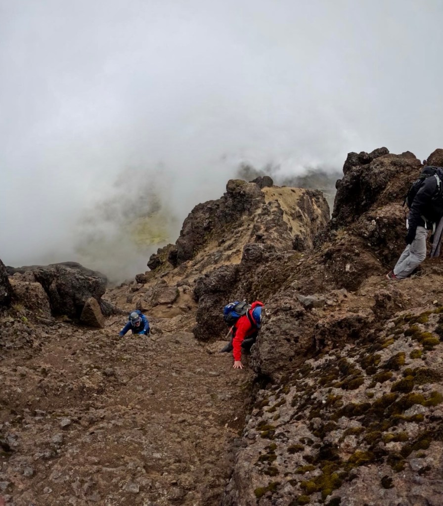
In a way hiking in the dark, especially on challenging terrain, seemingly makes the effort less strenuous. Perhaps it is due to the simple fact that you can only see a few feet in front of you, and not the entire trail steeply rising ahead. So as we settled into our pace we were feeling quite good while the predawn sky slowly lighted and began to reveal more detail around us.

Perfectly timed approach at sunrise

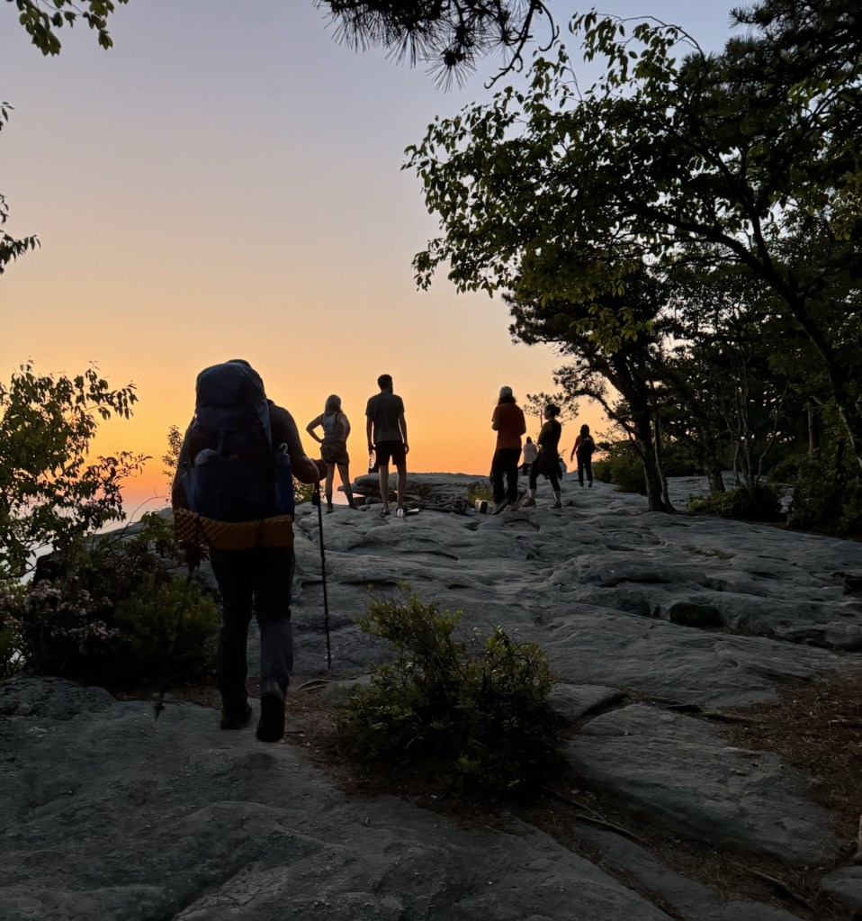
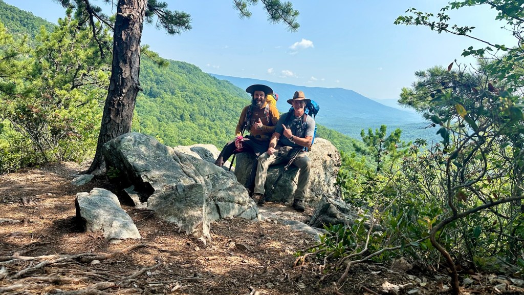
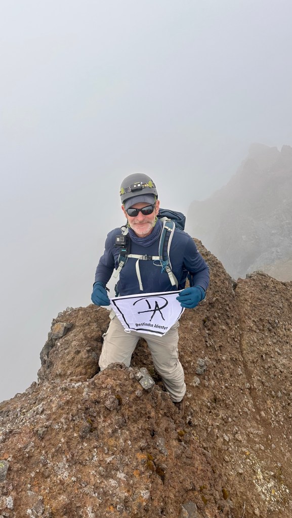
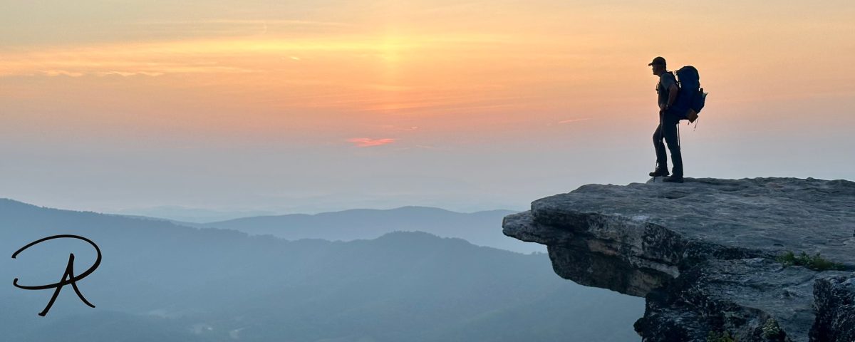
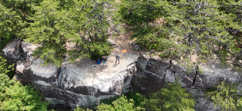
Finally, the moment we had been anticipating… we heard voices ahead as the trail surface changed to flat rock and we took the final steps onto McAfee Knob. It was immediately clear that we had made the right decision the day before to get here at sunrise. Before us was a magnificent orange predawn sky that backlit the iconic rock slab and our fellow hikers who were waiting patiently to get their personal photo at this stunning vista.

I was personally impressed with the courtesy everyone was showing to allow the different groups and individuals to get all the pictures they wanted, then moving out of the view for the next person in the queue. When it was time for us to get our photos, one of the differences between Morgan and I surfaced. While I posed, he dutifully took multiple photos, clicking the shutter rapidly to absolutely ensure that there would be at least one good shot to choose. I on the other hand, carefully framed my shot of him and took a single photo. In the end, I felt a little bad that I only gave him one pic to choose, while he had provided me so many. Morgan, a gentle and gracious soul, didn’t seem to mind since the moment had been suitably captured.

The iconic sunrise backpacker photo at McAfee Knob

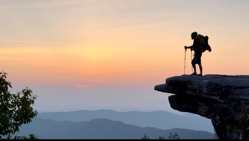
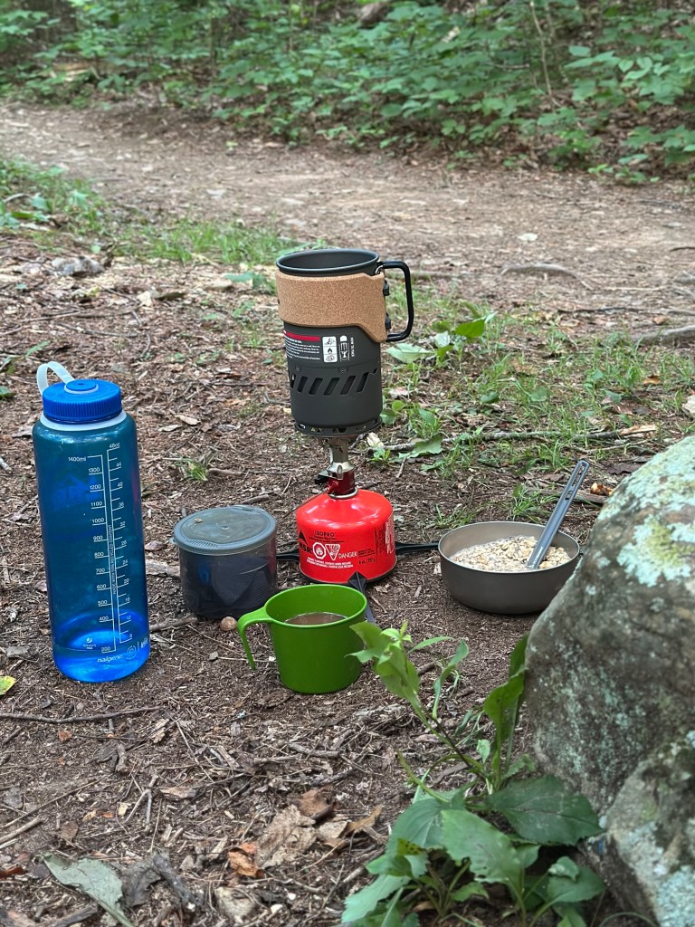
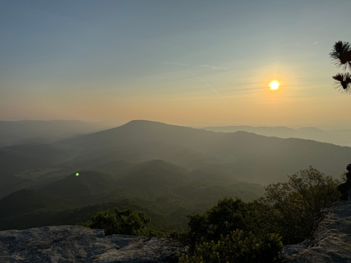
For the next hour we simply enjoyed nature’s show on the grandest of scales. The orange eastern horizon bathed the distant ridges in a warm, soft light while the light gray Tuscarora sandstone slab we were standing on stood out brightly in the morning light. We also took the opportunity to enjoy breakfast with a view, breaking out our camp stoves to boil water for a breakfast of oatmeal and coffee.

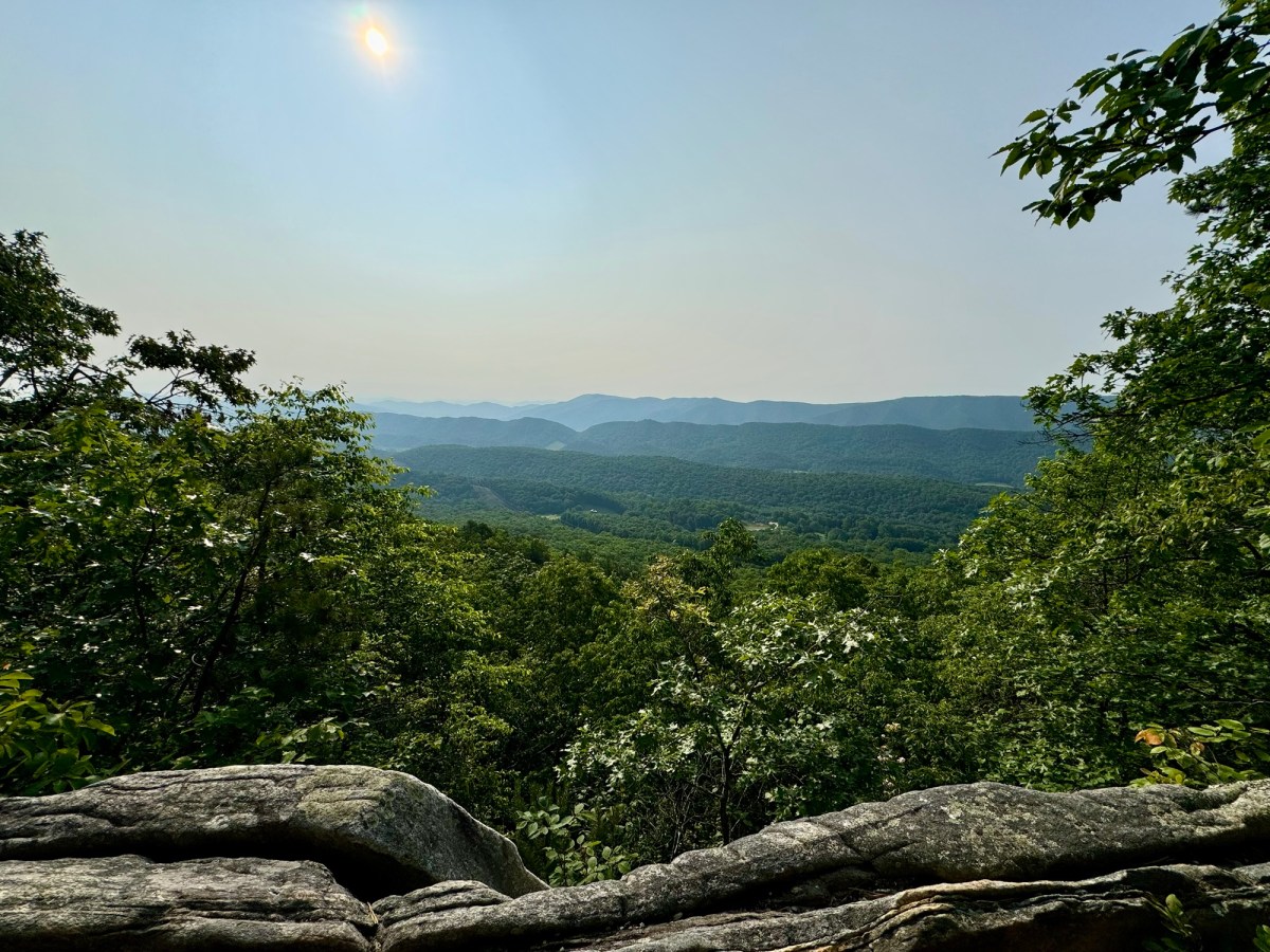
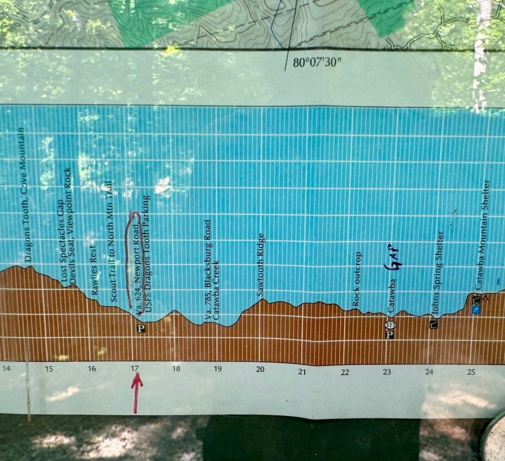
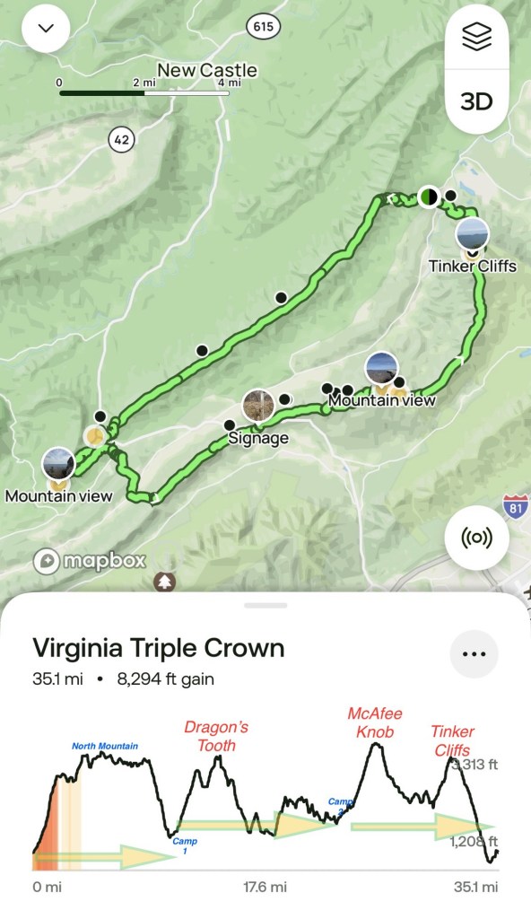
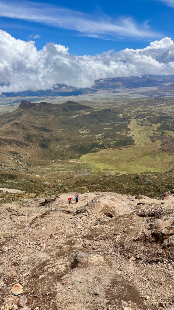
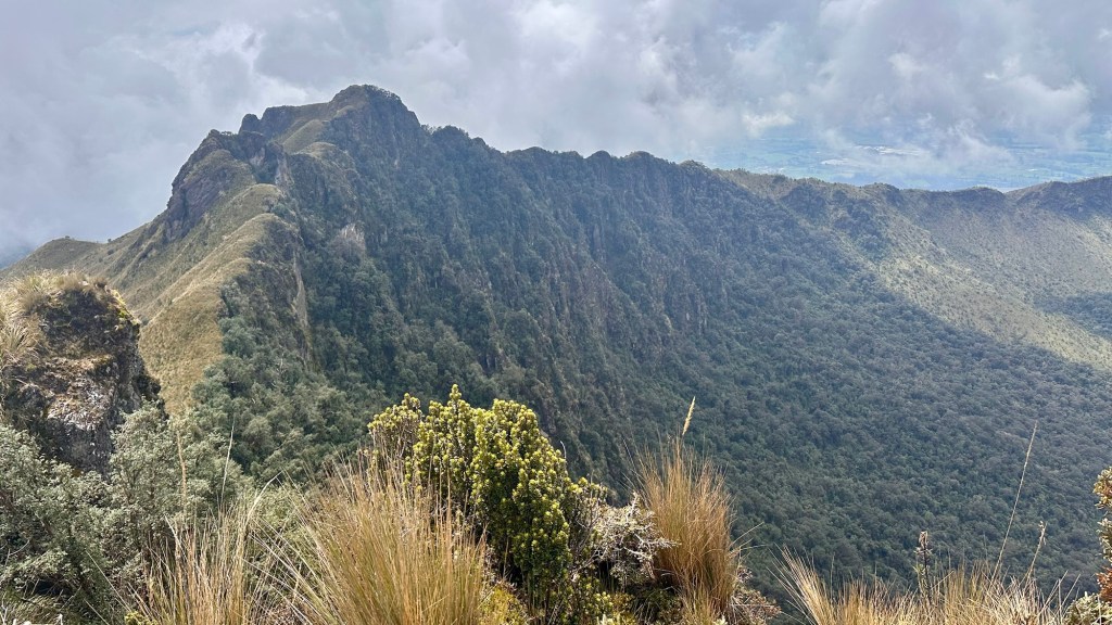
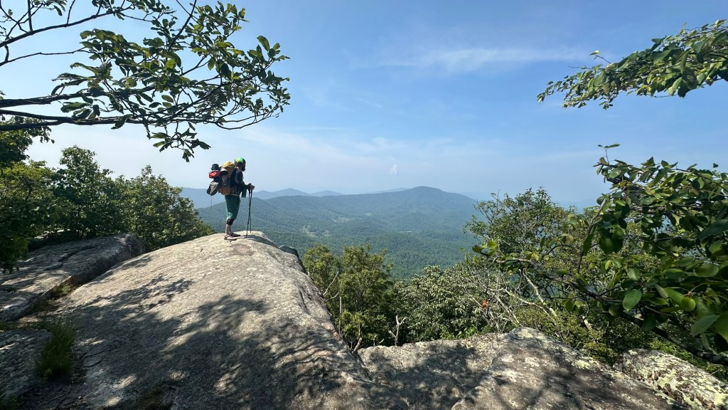
From the McAfee Knob vantage point we were easily able to see the entire route we had traversed during days 1 and 2, and the remainder today’s hike that would take us along a connecting ridge to Tinker Cliffs 5 miles distant, and the final 3.5 mile descent to the parking area where we began 3 days ago.

McAfee Knob from the skies

Finally, after spending 1.5 hours soaking in the sights and enjoying conversation with our fellow hikers, it was time to get back on the trail to the final Triple Crown vista, Tinker Cliffs. A mile into our descent, we came upon the Campbell Shelter campsite which was bustling with activity. Many of the same hikers we had just spent time with up at McAfee Knob had camped here (and this was where we had originally intended to hike to on day 2 before we changed the plan).

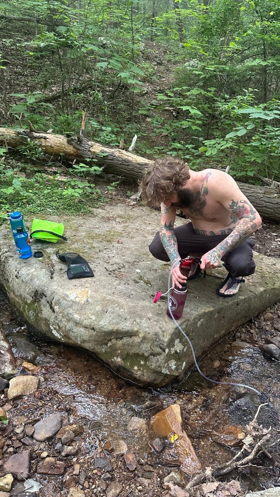
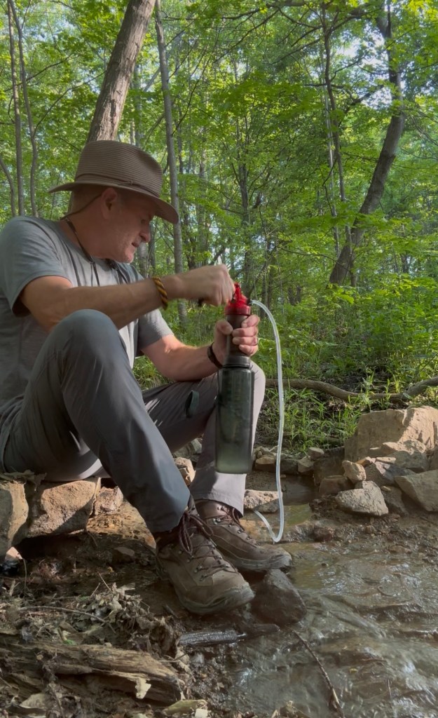
Since this was the last viable place to get water for the remainder of the day, we took a short side-trail to the marked spring to top off our water bottles. Here we met a couple of old-timers who seemed to spend a lot of time in the area. One remarked that he had just seen the resident bear, named Dennis the Menace, foraging nearby. Another, a thru-hiker named NoRush was clearly in no rush. His life philosophy was boldly scrawled on his tent… essentially, distilled down to “enjoy the moment you are experiencing… don’t stress about what lies ahead.”

Moving once again, we were eager to complete the final leg of the Triple Crown as we headed toward Tinker Cliffs. The hike there was quite pleasant as we traversed the connecting ridge between Catawba Mountain and Tinker Mountain.

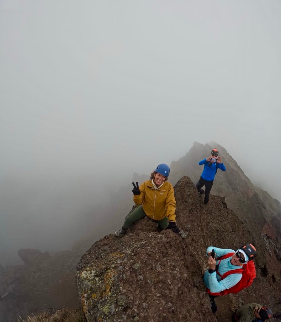
Unlike McAfee Knob, we had Tinker Cliffs all to ourselves. Once again we enjoyed the views that allowed us the opportunity to see our entire 3-day route and reflect on all we had experienced together while we enjoying a final trail lunch. A fitting final stop before tackling the final few miles of the Triple Crown Loop.

As we neared the end of the hike we met a father hiking with his 12 year old daughter. They were on day 2 of their own Triple Crown hike, essentially doing our route in reverse, having started where we had ended on day 1. We shared some insights on best places to camp and where to get water. Since they had a ways to go before the next water stop, we filled their water bottles with what we had remaining and wished them good luck.

Pointing the way home!!

After one final mile, we reached the end of our journey. It was nice to unclip the pack, clean a bit of the dust and sweat from our bodies, and relax in the air conditioned truck as we headed home. The experience lived up to the hype… definitely a hike I will do again!


Author’s Note: If you enjoyed this post, leave a comment or repost to your social media. Also, feel free to explore past adventure series by clicking the “HOME” button below.

Virginia Triple Crown: Day 2

Our plan for day 2 was to wake up, make breakfast, breakdown our camp, pack our gear and be on the trail by 7:30 am. The plan for today was a challenging 16 miles of trail and we felt it was important to get on the trail early… we beat our goal by 20 minutes!

Once on the trail, we immediately realized that we were feeling pretty good after a strenuous first day. Staying hydrated and getting a decent night of sleep certainly helped… but so did the ibuprofen I took last night and again this morning!

Our immediate destination for the morning was the Dragon’s Tooth rock formation. After a 1 mile climb from camp on the Dragon’s Tooth Trail we intersected the Appalachian Trail (AT). The intersection doubles as an informal campsite called Lost Spectacles Gap where Morgan had the brilliant idea to stow our 38 lb packs behind some fallen trees since we’d be reversing course after seeing Dragon’s Tooth.

Rock scramble on the way to Dragon’s Tooth… happy to have shed the pack!

Relieved of our heavy packs, we easily made our way another mile through a series of rock scrambles that culminated in a wide plaza flanked by quartzite rock spires, including the 35 ft Dragon’s Tooth formation.

Dragon’s Tooth from the sky
Morgan contemplating life with Dragon’s Tooth looming above

After spending about 30 minutes to enjoy the view, we headed back down to retrieve our packs and continue northbound on the AT for the long 13 mile haul to our planned campsite. This was going to be a long day, so we kept a steady, deliberate pace, but the sharply rising and descending trail definitely tapped into our energy reserves.

Throughout the day we frequently encountered AT through-hikers who were 700 miles into their nearly 2,200 mile journey from Springer Mountain, Georgia to Mt. Katahdin in Maine. They had unique trail names, like: All Day, Shorty, Switch, Truck Stop, TBD, Caboose, and NoRush. It was fun chatting with them and learning some of the ins-and-outs of through-hiking.

Most of them had been on the trail since late March or early April, so they’d been hiking for over 2 months. Some were quirky and carefree, others driven by the goal to complete the AT in one epic 5 to 6 month hike. But each had a unique story and interesting anecdotes of things they’d experienced on the trail.

Since the temperatures were in the mid 80s, we made sure to stay well hydrated. We each carried 2.5 liters of water, but took every opportunity to refill our bottles when we encountered a stream. This habit allowed us to take in adequate fluids as we exerted ourselves during the hottest part of the day.

Enjoying a short break

We specifically planned this 3 day hike during mid-week, hoping to avoid the big crowds that descend on the area during the weekends. There are quite a few day hike trails that allow access to the individual sights; a popular option for those who don’t want to tent camp or hike as many miles.

For me, the only thing I needed to clear from my schedule was my weekly guitar lesson, so I was a bit surprised when I looked up and saw a hiker coming toward me while strumming a guitar… was this a message from my guitar teacher to reconsider the priorities in my life?! Who knows… nonetheless it was an interesting coincidence.

… a free-spirit hiking along while strumming his guitar

As the day wore on and energy was waning, we began to discuss other options for camping. The original plan for day 2 was to hike 16 miles to a campsite just beyond McAfee Knob, which would give us a late day view of the iconic rock feature and the option to wake up early the next morning to reverse hike for a sunrise experience.

A convenient map to make alternative plans

Based on campsite locations and water sources, we had 3 viable options:

1) Stick with the original plan and gut out a few more miles even though we were both getting tired.

2) Modify the original plan, but forego the morning visit to McAfee Knob which would shorten day 3’s hike by 2 miles.

3) End the day at 13 miles and camp before McAfee Knob at the Catawba Mountain Shelter, foregoing the late afternoon view, then get up early the next day to catch sunrise at the knob.

Morgan and I had a good discussion about the pros and cons of each option and settled option 3. We would finish the day at the Catawba Mountain Shelter, get to bed early, then break camp at 4:30 am in order to reach McAfee Knob at sunrise.

Our decision made, we completed the final two miles of the day and were happy to reach the shelter. We shared the campsite with two through-hikers; “Swith,” a chef from Kentucky; and “TBD,”a registered nurse working in trauma care from Pennsylvania.

Even though we were a bit tired, we quickly erected our tents and refilled water. Finally we could relax and enjoy some dinner with our new companions before turning in for the night.

Our tent site at the Catawba Mountain Shelter

The final task of the day was to place all of our remaining food and accumulated trash in the convenient bear box located near the shelter… we definitely didn’t want some hungry bear nosing around for snacks in the middle if the night!

Stay tuned for the culmination of the Virginia Triple Crown, coming soon…


Author’s Note: If you enjoyed this post, leave a comment or repost to your social media. Also, feel free to explore past adventure series by clicking the “HOME” button below.

Virginia Triple Crown: Day 1

Many of you reading this post may be familiar with horse racing’s a Triple Crown; bestowed if there is a single-season winner of three premier horse races that occur during a six week span beginning on the first Saturday in May and ending on the first Saturday in June. The races (the Kentucky Derby, the Preakness Stakes, and the Belmont Stakes) differ in length and track conditions. Those characteristics, coupled with a relatively short 2 week span between races, make the Triple Crown one of the rarest achievements in sport. In fact, there have been only 13 Triple Crown winners in over 100 years of thoroughbred racing.

So why am I writing about the Triple Crown and what does it even have to do with the theme of this blog? Simply put, it was the inspiration to complete the hiking version of the Triple Crown in the Blue Ridge Mountains of southwest Virginia, USA. This version of the Triple Crown is a 35 mile (56 km) loop hike that features three iconic natural features along the Appalachian Trail: Dragon’s Tooth, McAfee Knob, and Tinker Cliffs.

Keeping with the “triple” theme, my hiking partner Morgan and I planned a 3-day, 2-night hike where each day we will hike different distances (11, 13, and 11 miles) and experience steep climbs, inspiring vistas, and jarring descents along the challenging trail profile.

Trail profile with sights and camp locations annotated

There are several factors to consider when planning a multi-day hike. Since everything needed has to be carried, it is imortant to pack what you know you’ll need for the conditions you expect to encounter, plus some things you hope you won’t need (e.g. first aid kit and rain gear). Weight and volume (based on pack size) will certainly be factors that affect your individual pack kit. Another very important consideration, especially when it comes to route planning and campsites, is access to water. In my opinion, you should plan to consume about 4 liters of water per day. Nobody wants to carrry that much water (because each liter weighs 1 kg / 2.2 lbs), so the ability to filter water from natural sources along the route is critical.

After researching the route, I learned that there were no water sources on the North Mountain Trail. So, it was a logical decision to make this our first day objective since we could “camel up” by fully hydrating before the hike even began, then consume the 2.5 liters we would be carrying through the rest of the day.

Morgan filtering water at our first campsite

Although our first day began with a 3.5 hour drive to get to the trailhead, it was a opportunity for Morgan and I to get better acquainted since we hadn’t really spent a lot of time together. The drive was quite scenic and we had some pleasant conversation as we shared stories and insights.

Morgan is a tattoo artist, so as someone who has no tattoos, I was naturally interested in how he got into the business and how he learned the craft. For his part, he learned of my own background and interests. Even though we are 18 years apart in age and have vastly different backgrounds and experiences, we quickly fell into an easy conversational cadence.

Eager for the adventure to begin

Upon arriving at our start point for the day, the Catawba Valley Trailhead, we quickly geared up and set out for a challenging 11 mile hike. For the first two miles we climbed from the valley floor to the ridge atop the North Mountains where we intersected the North Mountain Trail. After a nice lunch break we continued southbound for 8 miles along the ridge line trail that passed through a healthy forest of dispersed trees, presenting nice sight lines through the foliage the distant hills to both the east and west.

Roanoke, Virginia off in the distance

From our vantage point on the North Mountain ridge, we caught a glimpse of Roanoke, Virginia 15 miles in the distance. At another point we were even able to look east across the Catawba Valley and make out the distinctive rock shelf of McAfee Knob high up on the parallel ridge line that we plan to reach at sunrise on day 3 of this trip.

Maintaining a comfortable pace, we took our time while experiencing a surprisingly unlevel trail along the ridge line. Even when we got to the point where we would drop back down into the valley floor campsite, we both remarked that it seemed like we were spending more time going up than down.

After one final mile of steep descent off of the ridge line, we reached the end of our first long day of hiking. We were definitely ready to relax in camp and eat some dinner, before turning in for the night!

Warm, dry night expected, so no rain fly needed for the tents!!

Once we found a suitably level spot for our two tents, we quickly set up camp. Then it was onto the task of refilling our water bottles by filtering water from a nearby stream, cooking dinner (I had chicken pesto pasta, while Morgan enjoyed a vegan burrito bowl). Our bodies refueled, it was now time to rest and recover the trail ahead.


Author’s Note: If you enjoyed this post, leave a comment or repost to your social media. Also, feel free to explore past adventure series by clicking the “HOME” button below.

Day 12: Chimborazo Attempted & Epilogue

Day 12: Summit Chimborazo [20,562’ / 6,267m]… at least that was the plan!


Author’s Note: The elevation of Chimborazo cited on this page is from the Global Navigation Satellite System (GNSS) survey of Ecuador peaks conducted in 2016. This survey used GNSS data to update measurements derived from barometric and trigonometric triangulation methods used in the 19th century.


Background Info

Chimborazo is massive inactive double volcano that, based on its eruption history, features four distinct peaks. The highest of these four peaks is the Whymper summit, followed by Pico Vientimilla, Cumbre Politénica, and C. Nicholás Martinez.

Our planned route takes us up a seemingly never-ending 40° slope that starts at the high camp [5,350m / 17,552’] and ends at the 2nd highest summit Pico Vientimilla [6,228m / 20,433’]. Then, it actually descends for a bit before sharply rising to the Whymper summit [6,267m / 20,562’]. Needless to say, any climb at these elevations is challenging.

Planned route from High Camp shown in green

Due to its height and location on the equatorial bulge, Chimborazo’s Whymper summit is the closest point on earth to the sun. When measured from the center of the earth, Chimborazo is more that 2.1km higher than even Mt. Everest!


The Climb

Our summit attempt began with an 2300 wakeup after a not so restful attempt to get about 5 hours of sleep. The geodesic dome, shared by 2 guides and 4 clients was surprisingly comfortable and quite roomy, allowing us to gear up before heading to the mess tent for a hot drink and light snack. Similar to the Cotopaxi summit night, the plan was to depart at midnight, but the route was much longer and steeper, so we steeled ourselves for a 7 hour ascent followed by a 3 hour descent back to high camp. Once there, we’d pack up and descend another 2,000 feet to the refuge, followed by a 4 hour car ride back to Quito… it would be a very long day!

From the moment we left high camp, the trail was steep. At first we hiked along a coarse lava path at the base of a towering rock wall, called the Castle Ridge. At the end of this traverse, we had to scale a steep 35’ section of ice and snow encrusted lava rock that required the use of crampons to get a solid foot hold, the ice axe to implant in the rock/ice to gain a point of leverage, and the other hand to grab anything for balance and support. This rock climb at over 18,000’ of elevation in the dark of the night took quite an effort. Fortunately we were roped together and Camilo, our guide, provided a reassuring belay that added a measure of safety.

35’ wall encountered in the dark on the way up, and again during the descent (picture shows Camilo down climbing)

After the Castle Ridge, we were faced with an unrelenting 40° snow slope, aptly named “eternal ridge” that led to the Pico Vientimilla summit, over 2,000’ of elevation gain in about 0.5 miles… very steep!

To add to the difficulty factor, large sections of this snow path to the summit, featured powdery snow that caused you to slip partially backwards with each step taken… it was exhausting!

Pico Vientimilla Summit w/ turnaround point

After 5 hours of effort, with at least another Two hours needed to get to the summit, Ron and I assessed our strength and what energy was still needed for the physically demanding descent, and made the hard decision to abandon the summit goal and begin our long descent. Even though we didn’t stand on Chimborazo’s summit, we still achieved a significant milestone for us, to get above 20,000’ elevation and bust through 6,000m elevation. We ended up getting to 20,055’ or 6,112m.

Trail next to crevasse
Sunrise during the descent

After a brief rest, we began the long slow 3 hour descent back to high camp, it was still dark, but we could still sense the significantly steeper terrain due to the strain in our legs. About 1 hour into the descent the skies began to lighten and we got our first real good look at the steep slope we were going down and how high we had climbed.

Arriving back at high camp nearly 8 hours after we began

Finally, just before 8 am, we arrived back in high camp. We spent about 1 hour there to get a small bite to eat, and pack up our gear for the final 1.5 hour descent to the Refugio and our transportation back to Quito.


Epilogue

This entire trip was a great adventure that will be fondly engraved in our memories. Ecuador is a beautiful country with a rich history and stunningly varied regions.

The whole gang (from l to r: Ron, Becca, Don, Allison, Derrick, Camilo, and Chad)… photo taken on Cotopaxi

Most of all it is the people we shared the experience with that made it truly memorable. We couldn’t have asked for better companions than Derrick, Allison, Chad, and Rebecca. And, our primary guide, Camilo, was not only one of the best in the business, but he was engaging, fun, and adventurous.


Author’s Note: If you enjoyed this post, leave a comment or repost to your social media. Also, feel free to explore past adventure series by clicking the “HOME” button below.

Day 10-11: Rest then on to Chimborazo

Day 10: Rest day in Baños de Agua Santa

Fun Before the “Not So Fun

After a full day of fun and relaxation in Baños de Aqua Santa, plus two nights of restful sleep, Ron and I have recovered from the fatigue we felt after summiting Cotopaxi two days ago. We are as ready as we’ll ever be to tackle the biggest mountain in Ecuador.


A quick summation of our day in Baños… The day began at the Pailón del Diablo, a waterfall on one of the many tributaries of the Amazon River. There was even the opportunity to go behind the cascading water after crawling through a narrow tunnel carved into the cliffside. It was a fun and refreshing experience… until my head banged the rough rock ceiling on the way out! After a lot of dramatic bleeding and a quick field dressing (some hydrogen peroxide followed by a series of paper towels to staunch the bleeding), we were on to the next stop for the day, the town of Puya on the edge of the Amazon.

In Puya we had a wonderful lunch and a unique after-lunch snack… grilled chontacuro. What is chontacuro, you ask? It is the larvae of the palm beetle that is both nutritious, and surprisingly not too bad for someone not too accustomed to exotic foods.

Finally, on the way back to Baños, we stopped at a roadside adventure park where we had the opportunity to swing out over the cliffside, walk across some rope bridges, and climb a 120 rung ladder to a treetop perch high above the steeply sloping terrain. For the swing and the ladder climb, we were harnessed into the devices making them very safe and enjoyable.


Day 11:  Continue to Chimborazo Advanced Base Camp [5,350m / 17,552’’]

The Approach

Now onto the final challenge of this adventure: Chimborazo. After a warm goodbye to our new friends Derrick & Allison, and Chad & Rebecca, We transferred all our gear to a 4WD vehicle for the drive to Chimborazo National Park.

Due to its height and location on the equatorial bulge, it’s summit is the closest point on earth to the sun. When measured from the center of the earth, Chimborazo is more that 2,000m higher than even Mt. Everest!

Our climb began the day before summit day with our approach hike/climb from the Refugio Carrel [4,800m/ 15,750’] to the Advanced Base Camp at Campamento Arista [5,350m / 17,552’]. This camp, about the size of two tennis courts, is perched on one of the few flat sections on the mountain slopes. It consists of 4 large and one small geodesic domes. One of the large domes is the mess tent for cooking and meals, while the other four domes are used for sleeping.

The 2.5 hour hike up to high camp gave us a good sense of how our legs recovered from the Cotopaxi climb. Fortunately we both felt good on this portion of the climb. Tomorrow will undoubtedly test our physical endurance and our mental strength.


Author’s Note: If you enjoyed this post, leave a comment or repost to your social media. Also, feel free to explore past adventure series by clicking the “HOME” button below.

Day 9: Cotopaxi Summit Success!

Day 9: Ascent of Cotopaxi [19,332’ / 5,892m]

Author’s Note: The elevation of Cotopaxi cited on this page is from the Global Navigation Satellite System (GNSS) survey of Ecuador peaks conducted in 2016. This survey used GNSS data to update measurements derived from barometric and trigonometric triangulation methods used in the 19th century.

Our long day began very early with a 2300 wake up call, so we could have adequate time to prepare ourselves and our gear for the scheduled departure from the Refugio at midnight. The hour was spent busily getting dressed in the dim light of the 8 person bunk room we were sharing. All the bunk rooms were full and the Refugio was overflowing with climbing teams all hoping to take advantage of the good weather window.

The routine to get ready is to get dressed, eat something light, and drink a warm beverage. After that it’s time to hit the bathroom, because nature calls during the next 9-10 hours will be a bit more challenging. The final item to put on, over all the various layers, is the climbing harness.

Geared up and ready to go as midnight approaches

Our climb began with a clear sky, little wind, and a chill in the air. As we began the first portion of the climb up the loose volcanic sand slope that we climbed on day 6, we set a slow, but deliberate pace. With the effort to climb, our core feels warm enough. In fact, too much warmth is bad since it causes one to sweat, which can make you cold when you stop.

The lights of Quito at 3 am, at about the halfway point of the ascent

At this point we are not roped together and we don’t have our crampons on. After our first hour of climbing we reach the snow line, so we take a short break to put on our crampons. After another 20 or 30 minutes, the snow got deeper and the terrain got steeper, so we roped together into our rope teams for the remainder of the climb.

Teams of climbers high on Cotopaxi at 4 am

The rest of the climb is on steep ice and snow, so it is important to always consider proper ice axe placement and mentally review self-arrest techniques in the event that anyone on the team slips.

When the guide senses that we need a break, we stop for just a couple of minutes. During the breaks we have to be efficient with our time in order to take care of anything we need to do… sip water, have a snack, adjust layers, etc.

We were definitely blessed with the weather today. We were informed that the weather on the mountain can be temperamental and unpredictable due to the influence of moisture rising from the Amazon. But we are enjoying mild temperatures, clear skies with a half moon illuminating the snow covered slopes, and what amounts to an occasional light breeze. Of course, as we ascend higher it gets colder, but the effort to climb the steep terrain warms our bodies.

We took the yellow route to and from the summit

Our climb to the summit took a little over 5 1/2 hours. The final hour to the summit was the steepest section, and we were certainly feeling some exhaustion seeping into our legs. On the way up I kept reminding myself of the many challenging training hikes completed in preparation for this mountain… they definitely paid off!

With one final push we reached the summit just as the eastern horizon was glowing orange before the sun appeared. Camilo had targeted our arrival time for this moment and we hit it on the spot!

We spent over an hour at the summit, an unusually long time, but the temperatures and lack of wind made it possible. During our time on the summit we were provided respirators to breathe through due to the sulphur laden steam rising from the crater of this active volcano.

Cotopaxi summit video

Although Derrick and Allison did not summit, they succeeded in climbing to over 18,000 feet on the mountain, before making the tough decision to turn around.

After Chad and Rebecca summited, we spent a few more minutes at the top to congratulate their achievement, then began our 3-hours descent back to the Refugio to pack our things and head out for some well deserved R&R in the own of Baños de Agua Santa, where their natural hot springs will undoubtedly rejuvenate our tired bodies.

Cotopaxi descent video


Author’s Note: If you enjoyed this post, leave a comment or repost to your social media. Also, feel free to explore past adventure series by clicking the “HOME” button below.

Day 7-8: Active Rest and Final Preps

For two days we’ve enjoyed a bit of rest and relaxation, while staying at the Tambopaxi Lodge within Cotopaxi National Park. From our rooms we have unobstructed inspiring views of the entire expanse of Volcán Cotopaxi. We’ve also enjoyed a lot of great meals, making the downtime between hikes something to look forward to. After dinner it has become our custom to play a fun card game called SkyJo, that leads to some fun competitive banter and trash talk!

As we look ahead to our summit attempt in the days ahead, we are finalizing our preparation. Our acclimatization routine is complete and we are all feeling great! No one has even had a headache, which is remarkable considering some of the elevations we’ve reached in the past week.

Today, we enjoyed a relaxing 7.5 mile hike in the high grasslands at the base of Cotopaxi. Along the way we briefly visited a replica of a hut used as a shelter by local herders and some stacked stone that date back to the Incan Empire. Our ultimate destination was the head spring of the Río Pita, the river that flows south from Cotopaxi into the Los Chillos Valley… the same river we hiked along on days 2 and 4 of the trip.

It was interesting to see the actual source of the river emanating from the base of a small grass covered hill.

On the way back to the lodge, our trailblazing skills honed on day 4 came in handy once again. We reprised our need to break trail along a narrow ridge above the river, then we all got to practice our long jump skills to jump about 4’ from one side to the other. The form ranged from awful to graceful! Fortunately no one landed short into the river… although we had one close call.

The day ended with Camilo teaching us the essential rope team and ice axe skills needed for our ascent and descent. We will be climbing in three separate 3-person rope teams, each with a dedicated guide.

We all feel physically ready for the challenge ahead. Although our mental fortitude will no doubt be tested high on the mountain where we know there will be some suffering… ultimately we are confident the effort will be rewarded.

Day 8: Ascend to Cotopaxi Hut [4,864m / 15,748’]

The final day before we depart for the summit at around midnight tonight was spent finalizing our gear for the mountain and simply resting. Camilo checked all of our gear to ensure we had the specific gear and clothing needed for the summit push.

Final gear loadout

At lunch we met our other two guides, Christian and Mauricio, completing our 9 person summit team. We will depart for the Refugio later in the afternoon where we will undoubtedly play SkyJo and try to get some rest before the midnight wake up call.

Ready for the summit!!

Stay tuned for what happens next!…


Author’s Note: If you enjoyed this post, leave a comment or repost to your social media. Also, feel free to explore past adventure series by clicking the “HOME” button below.

Day 5-6: Rumiñahui & Prep Hike to 5,000m

Day 5: Ascent of Cerro Rumiñahui [4,630m/ 15,190’]

As we sat around the breakfast table finalizing the details of today’s acclimatization hike, some were nervous and some were excited for the challenge ahead, Rumiñahui (a dormant stratovolcano that has been heavily eroded over time). What remains is a sharply rising ridge of volcanic rock that features three distinct peaks. Our job today was to summit the central peak, Cerro Rumiñahui.

Cerro Rumiñahui with some cloud cover

This mountain is named after an Incan general from the 16th century who led a 1533 uprising against the Spanish in the northern part of the Incan Empire  (modern-day Ecuador). According to tradition, he ordered the city’s treasure to be hidden and the city burned. Although captured and tortured, he never revealed the location of the treasure.

We weren’t going to need that level of fortitude for today’s climb, but a little inspiration doesn’t hurt! Before we set out, Camilo cautioned us that the weather would dictate how far we got up the mountain. Rain was predicted for later in the day, so we planned an early departure to improve our odds of missing the weather.

The hike consisted of three distinct sections, a gradually rising section thru grasslands and shrubs, a steep section of loose volcanic soil, and a final even steeper section of rock scramble that required sure footing and good handholds.

The three sections of Rumiñahui

You would think that a trail that starts at around 12,600’ and tops out at over 15,200 would leave you out of breath. But, the deliberate acclimatization schedule we have been following, along with slow, consistent pacing has allowed our group to tackle these challenges with relative ease and no altitude sickness issues.

Allison and Derrick starting the sandy section (note the steep terrain)

Fortunately the rain held off and we got our chance to climb to the summit. Once we reached the steeper loose volcanic soil section, we put on our climbing helmets as a precaution against loose rocks falling from above. Before the rock scramble near the top, we steeled our nerves and got into “mountain goat” mode and carefully made our way to the top.

Ron, Chad, and Don climbing the rock scramble

We only spent about 10 minutes at the top, because we wanted to ensure we could get off the steepest sections before they got slick with rain. At the summit it was remarked that we were standing over 700’ higher than any point in the continental U.S., even though our ultimate goal for the trip was still several thousand feet higher!

The helmet precaution paid off when one of the group had a minor fall when his boot caught a rock and caused a stumble. Fortunately, he was able to control his fall with an instinctive tuck and roll. But, as he was coming to a stop, the top of his helmet impacted a rock. His form and helmet prevented a serious injury. In fact the worst thing that happened is he had a minor tear in his shirt!

As we continued to descend to the final grassy section, we began to hear thunder and feel some rain drops, so we put on our rain jackets and hustled down the rest of the way.

All in all, it was a phenomenal acclimatization hike that gave us a lot of confidence for the challenges ahead.


Day 6: Acclimatization Hike to 5000m on Cotopaxi [5,000m / 16,405’]

Today’s acclimatization hike was straightforward and simple… hike up to the 5000m (16,405’) elevation on Cotopaxi then head back down. Nothing too complicated.

Perhaps the hardest part of the trip was the drive up the mountain to the Cotopaxi car park located at 4,620m / 15,157’. Our driver, Bruno, expertly navigated his sprinter van up the heavily rutted dirt road, while we bounced around violently in our seats. We stopped about a quarter mile short of the parking lot simply due to the nearly impassable road (at least for a heavily loaded van).

Refugio José Rivas high above the car park

Since we’ve been walking all week, the little extra distance was insignificant. From there we hiked for about 50 minutes in weather that was quite overcast and foggy. We ascended about 800’ until we reached the Refugio José Rivas, where we stopped for a short break. Camilo was gracious and bought us coca tea or hot chocolate.

While enjoying our beverages, different groups of tourists and other trekkers began arriving. Some hoping to get a glimpse of Cotopaxi’s summit high above, and others doing as we were, preparing for their own future summit attempt. We also learned that all the summit attempts from the previous night had been either abandoned or not even attempted due to the heavy snow that was falling when their attempts started.

Cotopaxi’s summit… Our goal in a few more days

After our short break, we began the final climb above the Refugio to the targeted 5000m elevation. The volcanic soil was quite easy and forgiving, and the final climb only took about 40 minutes to reach our 5000m goal. As we climbed higher the clouds soon gave way to spectacular views of the snow covered summit still nearly 3,000’ above us.

The entire group at 5000m on Cotopaxi with the summit high above

Importantly, the hike gave us confidence that our chances for success to summit in 3 days would be high… if the weather and conditions are favorable.

Finally, we headed back down to the Refugio for a tasty lunch, then hiked back down to the car park for our ride to our hotel for the next two nights, the Tambopaxi Lodge that operates inside the Cotopaxi National Park. We’ll be returning to the Refugio in two days for a brief rest before we depart for the summit around midnight.

An inspiring view while writing this blog

Check back in in a few days to find out how our summit attempt goes.


Author’s Note: If you enjoyed this post, leave a comment or repost to your social media. Also, feel free to explore past adventure series by clicking the “HOME” button below.

Day 4: Outlaws

Day 4: Hike to Hacienda Los Mortiños [3,600m / 11,811’]

Nothing crazy today… or so we thought! What was billed as a relatively tame 8 mi hike along the upper part of the Río Pita that ended at our next hotel, the Hacienda Los Mortiños, ended up being a bit more interesting… but more on that in a bit.


Ecuador is a relatively small country with temendous diversity in its geography. Located in northwestern South America, it borders Columbia to it’s north and Peru to the south and east. To the west lies the Pacific Ocean and the Gálapagos Islands (a territory of Ecuador located 621 miles out in the Pacific Ocean). Straddling the equator, the mainland features three distinct regions: The Coast; The Highlands; and The Amazon.

We are spending our time in The Highlands, where most of the country’s volcanoes and all of its snow-capped mountains are located. Since we are at the equator and at high elevations, the UV index tends to remain in the very high to extreme ranges during the middle of the day when we are generally hiking. Therefore sun protection is paramount, and we make it a priority to either cover or apply sunscreen to exposed skin several times throughout the day.


Now… back to the day’s eventful hike. At the outset we were enjoying a leisurely hike along the riverside trail. We learned that this river is one of three that channel glacial melt, mud and lava from major eruptions of Cotopaxi. The remnants of the last major eruption in 1876 were evident in the different layers of mud and lava flows in the walls of the river basin.

After about 30 minutes of hiking, we encountered the Cascada del Fuego (Waterfall of the Fire). From there it became clear that the rest of the trail didn’t get a lot of use (I’ll postulate that most people who use the trail come to see the waterfall and then turn around). We used our best bushwhacking skills to make our way through sections of overgrown brush, while occasionally encountering some steep unstable sections that required focused attention to ensure stable hand and footholds were planned in advance.

Breaking new trail… or at least navigating overgrown trail!

At times, the trail narrowed to the point we had to carefully place one foot in front of the other to avoid slipping down the steep embankment to the river below. At one point we even took the precaution to unbuckle our backpacks just in case we found ourselves floating down the river due to a poorly placed foot.

After awhile, the forest opened up to a broad river watershed and we were at the point where we were supposed to proceed directly to the main road that would take us to our hotel. None of us relished the idea of hiking another 3 miles on a deeply rutted road, and Camilo gave us the option to forge an alternative path that would allow us to continue hiking along the river basin. The caveat was the we would be entering Cotopaxi National Park without permit. We unanimously noted to go renegade and opt for the alternative route.

Forging a new route in the river basin

When we came upon the national park boundary, Camilo explained that the park had been established in 1975 and the Ecuadorean government used eminent domain to claim private homesteads within the boundaries of the park to be established. When we approached the boundary, we could still see the remnants of one of these former homesteads.

Boundary of Cotopaxi National Park with remnants of a homestead

Unbeknownst to us, this fateful decision would result in ducking through several barbed wire fences, evading the park authorities, and pleasantly coming across seven horses that were grazing peacefully on protected land. The horses allowed us to approach and feed them some apples that were leftover from our lunches. It was a fun diversion!

Note to self, horses are not big fans of bananas! Ron decided to feed a banana to one of the horses, then while Rebecca was feeding the same horse an apple, it spit the banana mush out, resulting in a small yelp from Rebecca and a hearty laugh from the rest of the group.

One of many encounters with barbed wire fences
Sharing an apple with Palamino horse

Ultimately we joined back with the road, after another encounter with barbed wire, and hiked the final half mile to the hotel. But wait… we still weren’t done with barbed wire fences! Camilo led us from the road to the back of the hotel property, which, no surprise, had a barbed wire fence!

Chad escaping from Cotopaxi National Park

Finally after an eventful and fun adventure we arrived at our destination for the next two nights. After cleaning up and relaxing, we joined for dinner and discussed our plan for the next day, a hike that would take us to an elevation higher than any in the contiguous United States.

More on that soon…


Author’s Note: If you enjoyed this post, leave a comment or repost to your social media. Also, feel free to explore past adventure series by clicking the “HOME” button below.

Day 1-3: Exploring and Acclimating

Day 1: Arrival

And so it begins… after dealing with some flight cancellations and several rebookings due to an unusual winter storm that impacted hundreds of flights into and out of Atlanta, we arrived in Quito 24 hours later than planned. Fortunately we had built an extra day into our itinerary, so the delay didn’t affect the overall schedule.

On the ground we quickly cleared customs and met our driver who took us to our hotel about 20 min outside of Quito. As soon as we arrived we were greeted by the rest of our group, who had arrived the previous day. They all made it a point to stay up and wait for our arrival, a very nice and much appreciated gesture.

We immediately hit it off and fell into an easy camaraderie that had us looking forward to the many hours we would be spending together on the trails. And so, our intrepid gang of six was complete as we joined Derrick and his wife Allison from Logan, Utah, and Chad and his wife Rebecca, from Eagle, Idaho. Derrick and Chad are brothers, so this was a family venture for them.

Derrick, Allison, Ron, Rebecca, Chad, Don

Day 2: Acclimatization hike to Cascada Cóndor Machay

After a restful and sound night of sleep at Casa Ilayaku, a quaint and comfortable hotel in the foothills outside of Quito, we were ready for the day ahead. During breakfast we met our on ground coordinator, Javier, and our lead guide, Camilo. Everyone shared a little about themselves and Javier gave a brief overview of the weeks ahead. After breakfast our gear was inspected to ensure we had all the equipment needed for the technical climbs to occur in the coming weeks.

Once finished it was time to load up the van and head to our first acclimatization hike, a nearly 7 mile hike in the Valley of Los Chillos alongside the Río Pita to the Cascada Cóndor Machay… a beautiful waterfall at the end of the valley.

Camilo (guide) leading the way
Cascada Cóndor Machay

Even though we were hiking above 10,000’, no one seemed to be affected by the elevation. All in all, it as a rather easy day of hiking that ended at the tranquil Hacienda Cotopaxi Pungo, our hotel for the night. To our pleasant surprise, there was even a hot tub!… so, of course, we couldn’t pass up the opportunity to partake in this unexpected luxury!

Day 3: Ascent of Vocán Pasochoa [4,200m / 13,780’]

We woke up to an inspiring view of Cotopaxi this morning! The view of the green highlands leading up to the towering volcano were truly breathtaking (and not just because we were sitting at nearly 11,000’ elevation!).

View of Cotopaxi from our room at Hacienda Cotopaxi Pungo

One of the things that is constantly stressed while at altitude is to stay well hydrated. Generally we try to drink 5L of water each day, which is a lot! To manage that level of intake we’ve adapted to the mantra of “camel up” which essentially means to consume at least 2L of water before we even begin our hike.

In the morning, the skies were relatively clear and we were able to see the second, third, and fourth highest mountains in Ecuador (Cotopaxi, Cayambe, and Antisana respectively) from the lawn outside of the hotel.

Today we are climbing an extinct volcano in the inter-Andean range called Volcán Pasochoa, a 9 mile hike with 3,000’ of elevation gain, topping out at 13,780’. This will be a good challenge and an important acclimatization test as we practice the “hike high, sleep low” method that over time allows our bodies to adapt to being more efficient while exposed to the higher elevations to come.

Today’s hike began after a short drive to the trail, which sits entirely within 760 acres of privately owned land.Camilo, our head guide, contacted the owner to arrange access. We began with a slow and steady pace up the steep dirt road that was flanked by green rolling hills that fell away to the valley far down below. Off in the distance we could see the southern parts of Quito, the capital of Ecuador with a population of nearly 2 million.

AllTrails stats of the climb

After about 2 1/2 hours of hiking we reached a narrow path that rose sharply toward the summit and we continued to push on for another hour. Upon reaching the top, the group enjoyed a long break and lunch while taking in the vistas all around. Lava mounds and the ancient caldera walls that fell steeply from the summit were clear remnants of this mountain’s volcanic past.

After a leisurely lunch break at the top, we donned our packs for the long descent to the start point. There, we rendezvoused with Bruno, our driver, who was standing by to drive us to our lodge for the night, the Chilcambamba Hotel, located on the periphery of Cotopaxi National Park.

Derrick, Allison, Chad and Rebecca at the summit
Just some horses enjoying the day alongside the trail

Tomorrow will be an easy 9 mile hike next to the Río Pita, along a section that begins just above the Cascada Cóndor Machay that we saw on Day 2.

So far the trip has exceeded our expectations, and we are looking forward to the days ahead that will take us to even greater heights and provide an opportunity to practice the technical mountaineering skills we will need high on the glacier of Cotopaxi.


Author’s Note: If you enjoyed this post, leave a comment or repost to your social media. Also, feel free to explore past adventure series by clicking the “HOME” button below.