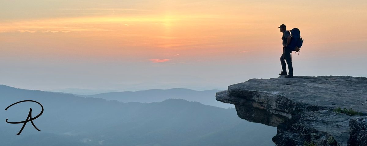
Adventure can occur right around the corner or in far off, distant lands. This site exists to share my enthusiasm for adventure using vivid stories and amusing anecdotes. I hope it inspires your own desire to explore the world around you… Select a DESTINATION and begin your ADVENTURE!!
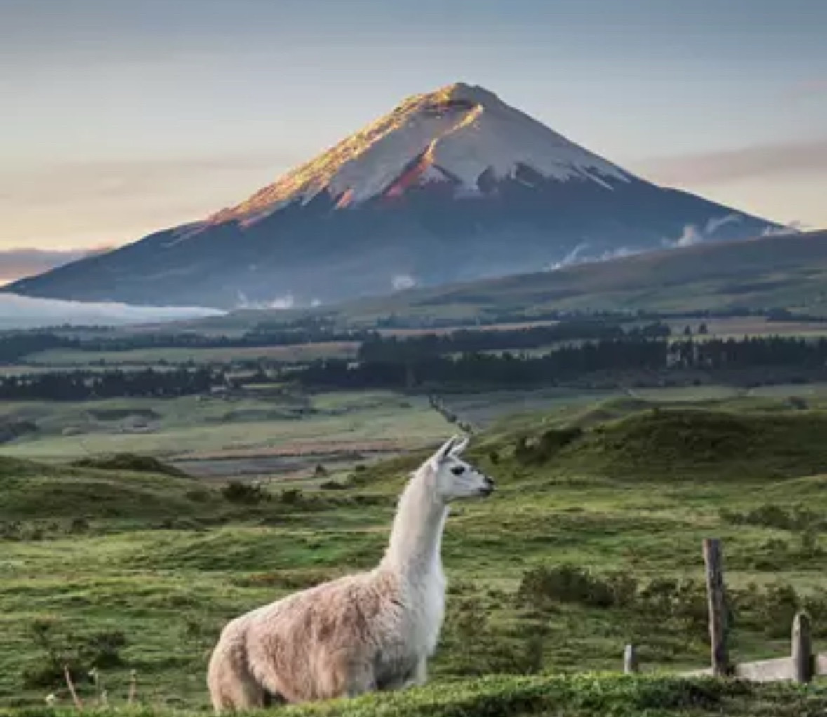
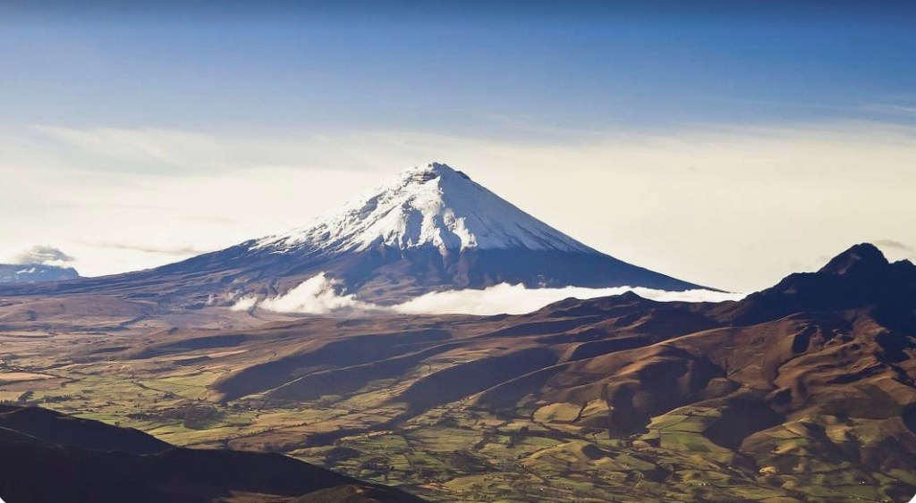
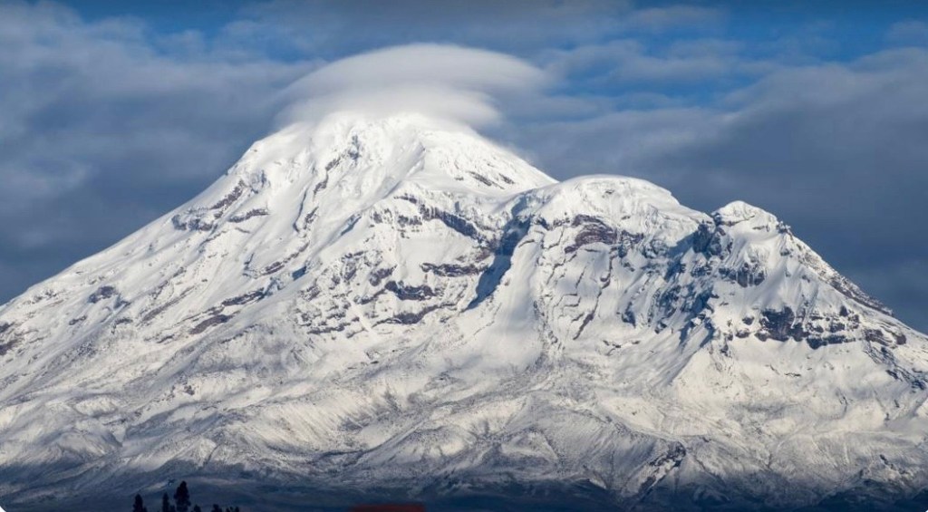
Planning and training for the next ambitious adventure is well underway. My brother Ron and I will be heading to Ecuador in January 2025 for a two week trek that will culminate with attempts to climb two big stratovolcanoes, Cotopaxi [19,332’ / 5,892m] and Chimborazo [20,562’ / 6,267m]
Cotopaxi (left) & Chimborazo (right)
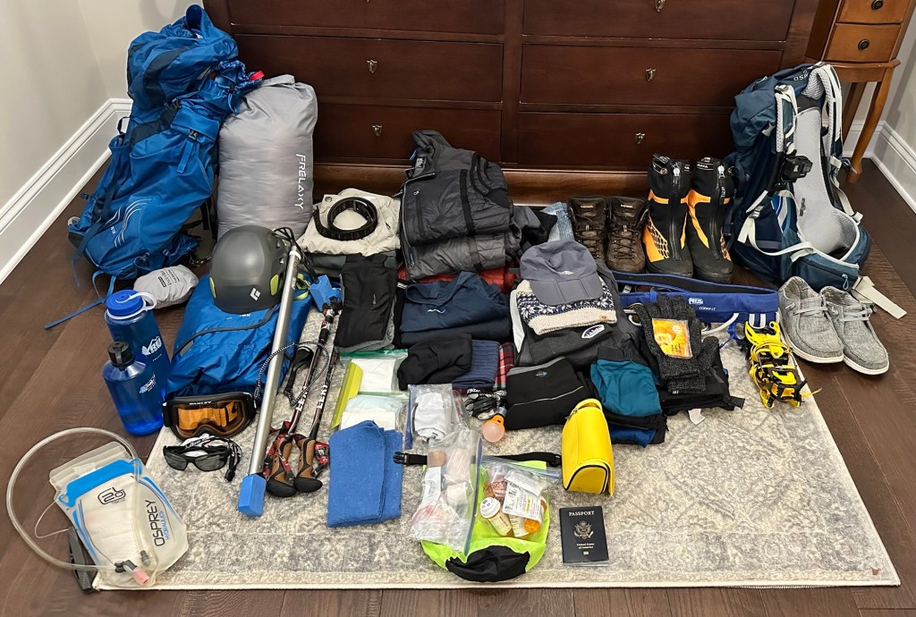
This will be a physically demanding challenge that requires deliberate and disciplined training. In addition, due to the technical climbing elements on both mountains, we have been accumulating the array of specialized equipment needed to safely attempt these high summits.
Gear for Ecuador
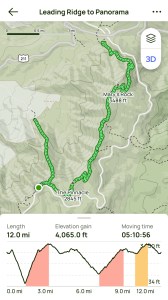
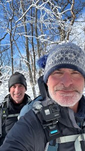
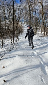
Over the past several months we have become quite familiar with the myriad of hiking trails in and around Shenandoah National Park in Virginia. We have gotten into a good routine of two hikes per week. To adequately prepare, we tend to look for the most challenging trails that feature long, steep, rugged climbs and descents. With distances ranging from 8 miles to over 12 miles, we have easily hiked over 300 miles in the past 4 months. On top of that we’ll generally carry 35 to 40 lb packs to further elevate the level of difficulty.
Typical training hike profileFinal training hikeBreaking trail thru fresh snow
I generally hike fast without too many breaks, but am not particularly interested in hikes that take more than 4 to 4.5 hours. Ron, on the other hand, has seriously been upping the mileage, which means that I have reluctantly added length to my hikes. When we hike together, I relish the opportunity to “punish” him on the hills by setting an unrelenting pace (my passive-aggressive way to let him know that hikes in excess of 5 hours will come at a cost!).
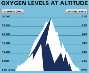
As the days and weeks tick down to our departure date, we are reviewing the inventory of gear and supplies we’ll need for what is essentially 8 days of acclimatization hikes and 4 days of serious technical mountaineering. The “acclimatization phase” is something that we are quite familiar with given past adventures to Everest Base Camp (Nepal), Kilimanjaro (Tanzania), and Huayna Potosi (Bolivia). In this phase we will be enjoying a series of day hikes of gradually increasing elevation to get our bodies accustomed to performing at higher elevations with significantly less oxygen.
Acclimatizing prepares the body to function effectively at lower O2 levels [Cotopaxi (49%) & Chimborazo (47%)]
A successful acclimatization schedule that follows the mantra of “hike high, sleep low” and occurs over an adequate period of time increases the body’s ability to produce more oxygen-carrying red blood cells. This physiological change partially offsets the effects of lower oxygen at higher elevations, and most importantly reduces the chance of experiencing Acute Mountain Sickness (AMS).
The trip itinerary listed below is a good illustration of the exposure to gradually increasing elevations over the first eight days of the trip. This schedule is designed to adequately acclimatize our bodies for the stresses of the two summit attempts that occur on Day 9 (Cotopaxi) and Day 12 (Chimborazo):
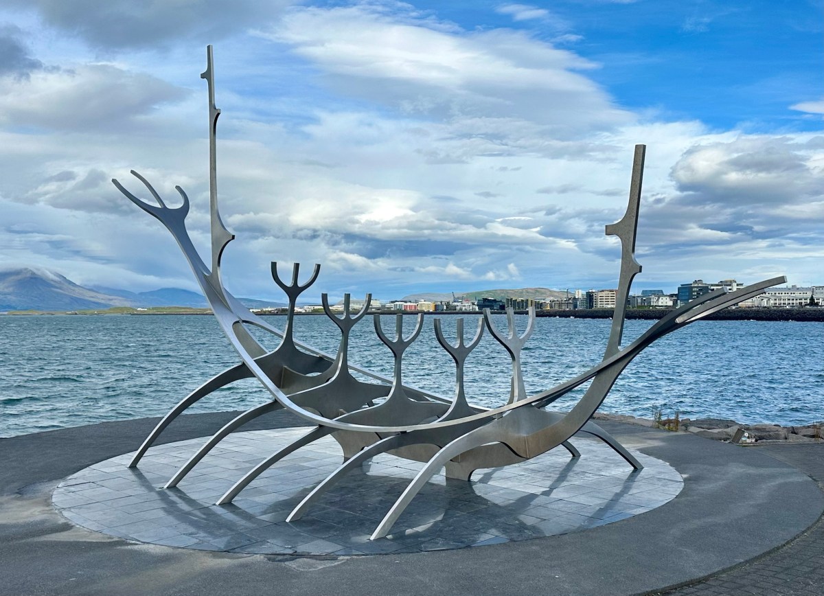
Joanie joined me in Reykjavík for some post-hike tours and sightseeing. Upon arriving from the overnight flight, she navigated her way from the airport to the main bus station, where I met her for the short 15 min walk to our hotel.
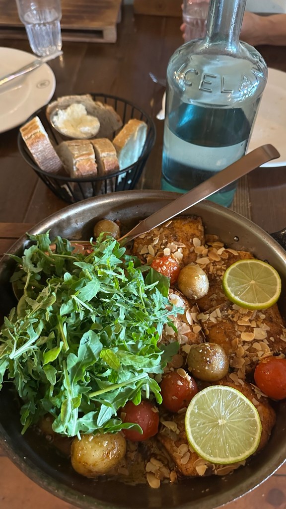
She took an opportunity to rest up before our afternoon activity, the Reykjavík Food Walk. If ever in Iceland, I highly recommend this 3 hour experience. We were met at the Harpa Concert Hall by Katrín, a young university student studying tourism.
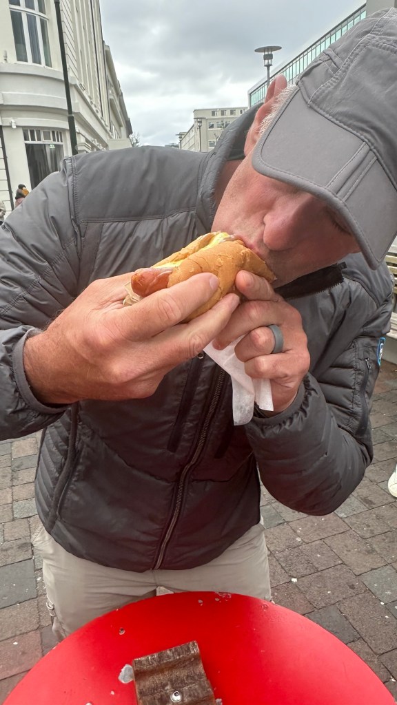
During the tour, we visited 5 different restaurants and got to try some very tasty Icelandic cuisine ranging from Arctic Char (similar to salmon) to lamb stew and the famous Icelandic hotdog, among many other dishes. We even had the opportunity to sample something quite exotic and clearly an acquired taste, hákarl, or fermented Greenland shark.
Arctic Char at Messin Restaurant Icelandic hot dog with all the fixings
For those of us brave (or gullible enough) to try this traditional Icelandic dish it was an experience we don’t need to repeat! Let me describe how it’s made:
Catch a Greenland shark
Behead the shark, gut it, and cut it’s flesh into strips
Bury the strips in the sand to ferment for 6-12 weeks
Unbury it and hang it to dry for several months to concentrate the flavors
And finally… Serve to the tourists, because frankly the Icelanders have evolved from ever needing this to be a staple of their diets!
Hákarl (fermented Greenland Shark)… small but powerful!
We bravely selected our sugar cube-sized morsel of shark, then were instructed to smell it (it evokes a strong essence of ammonia with a nuance of rotten fish) before placing it in our mouths and chewing it 8-10 times before swallowing. Then, and only then, could we chase it with a shot of a strong alcohol spirit called Brennevín. I can guarantee you that nobody had a compelling desire for a second portion!
During the Food Walk, Katrín shared some of the fascinating history of Iceland and her own experience growing up on Vestmannaeyjar, a small island off the south coast with a population of just over 4,000. One of the particularly interesting facts she shared was that every native Icelander, from its first settlers in 874 (Norwegian Chieftan Ingólfur Arnarson and his wife, Hallveig Fróðadóttir) to today have been entered into the Íslendingabók (a genealogy database with record of every Icelander, dating back more than 1,200 years). She showed us her account that displayed her entire genealogy of 31 generations back to Arnarson.
Adjusted Golden Circle itinerary… no Blue Lagoon ☹️
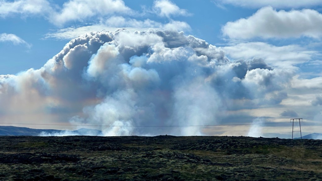
Our second day tour was intended to include the Golden Circle, a particularly full itinerary of natural wonders, culminating is a several hour soak at the famous Blue Lagoon. Unfortunately, we were notified in the morning that the Blue Lagoon was closed late the previous night due to an active volcanic event near the small town of Grindavík and the Blue Lagoon.
Site of active eruption
With our shortened itinerary, the day was still set to be a full one with a lot of sites to see, a few which I will describe.
Our first stop was Þingvellir National Park, a UNESCO World Heritage Site. The park straddles the area where the North American and Eurasian tectonic plates meet, so interestingly we were on two different continents in the span of a few minutes of driving. This site is was also the location of the first Icelandic Parliament, the Lögretta (Law Council) that met annually from 930 to 1262 to make laws, resolve disputes, and recite laws from memory to the assembly from the Lögberg (Law Rock).
Site of the LögbergEdge of the Eurasian tectonic plate
After Þingvellir we headed to see the Strokker Geyser. By the time we got there we were enjoying a cold, gale force wind as we waited patiently for the advertised eruption every 8-10 minutes. We saw two eruptions before we retreated into the gift shop/cafe for lunch.
Strokker GeyserWaiting for a treat
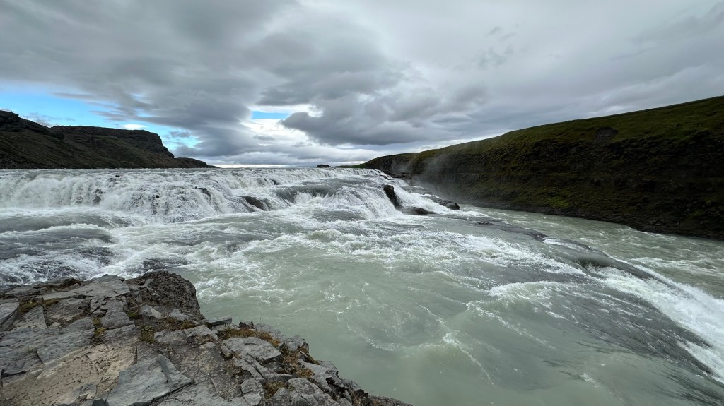
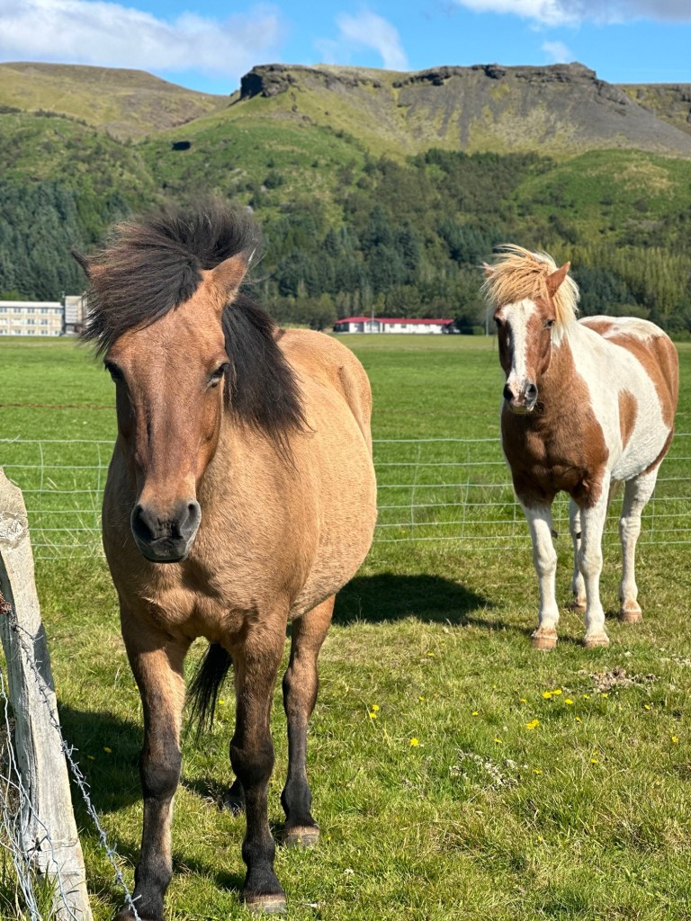
Then it was off to the magnificent Gullfoss waterfall. Along the way we stopped briefly to feed some Icelandic horses that were conveniently posted next to the roadside where we had the opportunity to supplement the farmer’s income by buying a small cup of “horse candy.”
Gullfoss (Golden Falls)
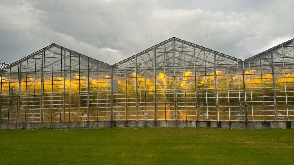
After Gullfoss, we briefly drove through a crop farm featuring massive geothermally heated greenhouses. The vast majority of Iceland’s fresh fruits and vegetables are grown locally in these greenhouses, without the need for fertilizers or pesticides, so everything is totally organic.
Greenhouses with tomatoes
Our final full day in Iceland just happened to coincide with the annual Reykjavík Culture Night… despite its name, this is a day long event where seemingly the entire Icelandic population descends on the capital city for a day of enthusiastic celebration, music, culture, eating, drinking, shopping and downright celebration. The long day of festivities began early in the day with the Reykjavík Marathon and culminated at 11:00 pm with a huge fireworks show over the city.
Downtown crowded with revealers
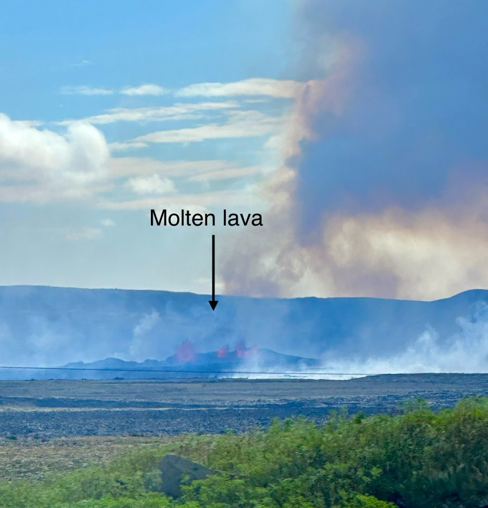
Finally it was time to say goodbye to Iceland. We dutifully hiked back to the main bus terminal for our FlyBus back to the airport. Along the way we were hoping to get a glimpse of of the volcanic eruption that disrupted our Blue Lagoon plans, perhaps some solace for the lost opportunity. Luckily we were seated in a prime location on the bus to see the area of the eruption as we approached the airport. Amazingly I was even able to capture a reasonably good picture through the window of the moving bus… a final indelible memory from the “Land of Fire and Ice.“
Author’s Note: If you enjoyed this post, leave a comment or repost to your social media. Also, feel free to explore past adventure series by clicking the “HOME” button below
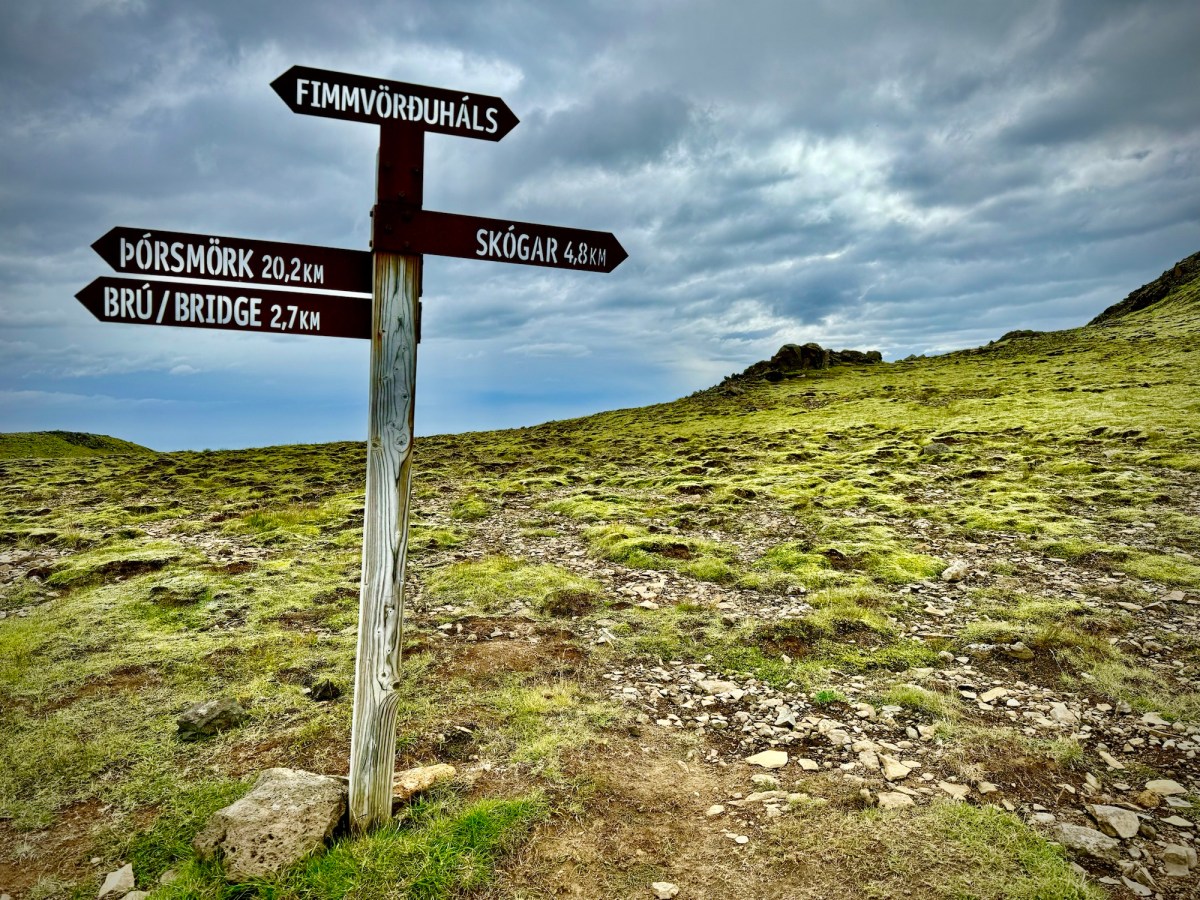
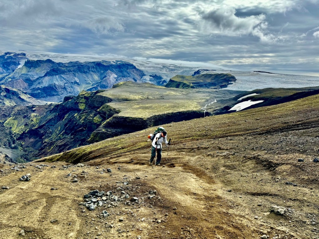
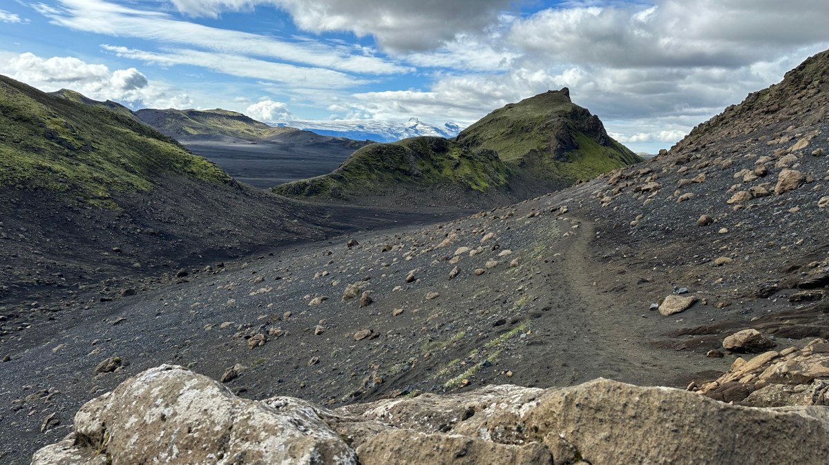
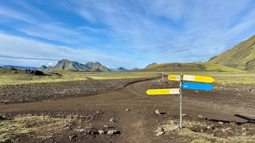
This trail has three distinct sections: 1) The steep climb out of the Krossá River basin near Þórsmörk; 2) The transit across the challenging rugged volcanic and glacial terrain between the Eyjafjallajökull and Mýrdalsjökull glaciers; and 3) The long descent along the Skógá River to the southern coastal town of Skógar.
Fimmvörðuháls Trail sections
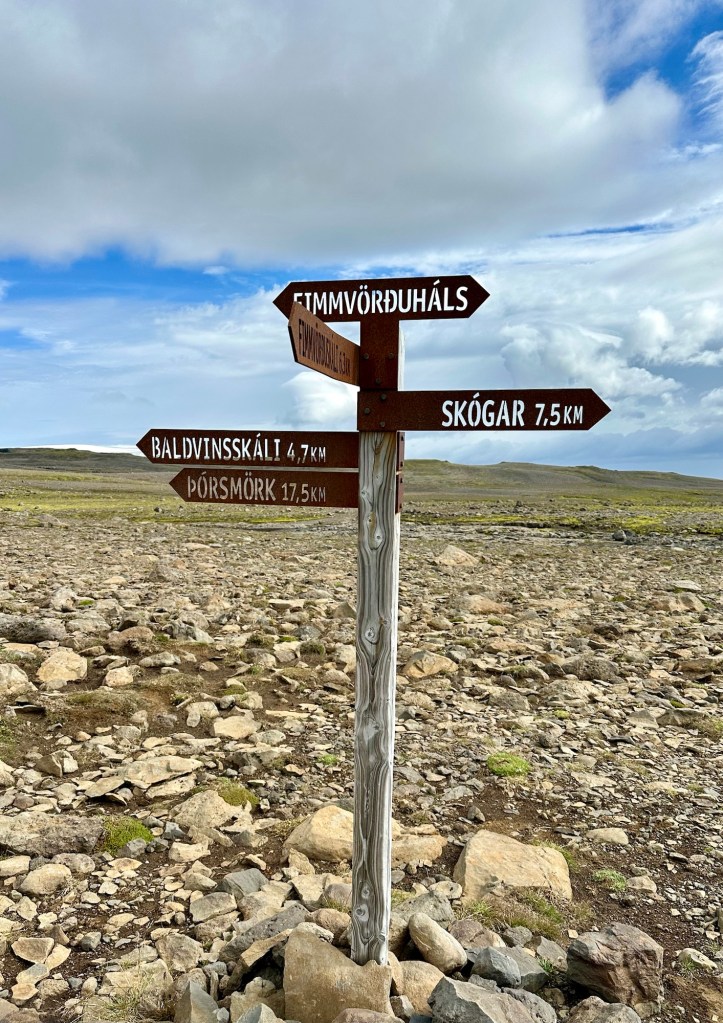
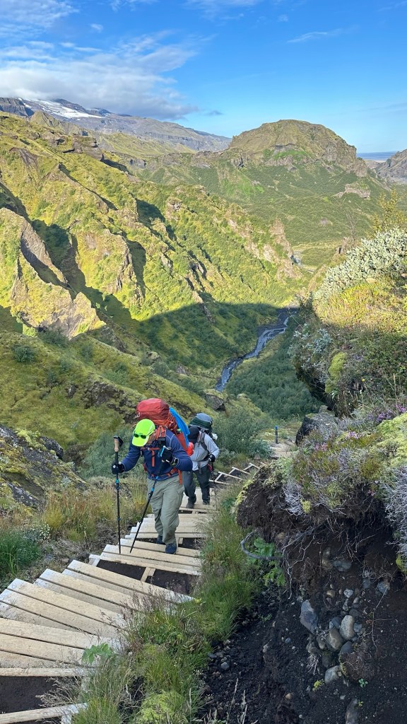
In the first 5 hours of our day we completed the first two sections. After a short 30 minute break at the Baldvinsskáli Hut to rest and eat lunch, it was time to tackle the final 8.5 mi (13.7 km) as we descend thru the Skógá River valley to Skogár.
Although we were tired and this final section would take about 4 hours to complete, we were looking forward to the change in scenery and the 26 waterfalls we’d see along the way. For awhile the trail simply followed a very rocky and unforgiving access road as we slowly began to descend. But, after about 45 minutes the trail separated from the road, and we began to see glimpses of the Skógá River and some of our first waterfalls of the day.
The beginning of the final section along the Skógá River
As we continued the long descent, the land transformed from rock and scrub to lush green fields. Seemingly around every turn or beyond every bluff was another waterfall.
We also noticed that there were significantly more people on this section of the trail. Some of them were either starting or finishing the “F” trail, but most appeared to be day hikers who were climbing the river trail from Skogár, to see the same falls we were enjoying.
Two of the many falls along the trail
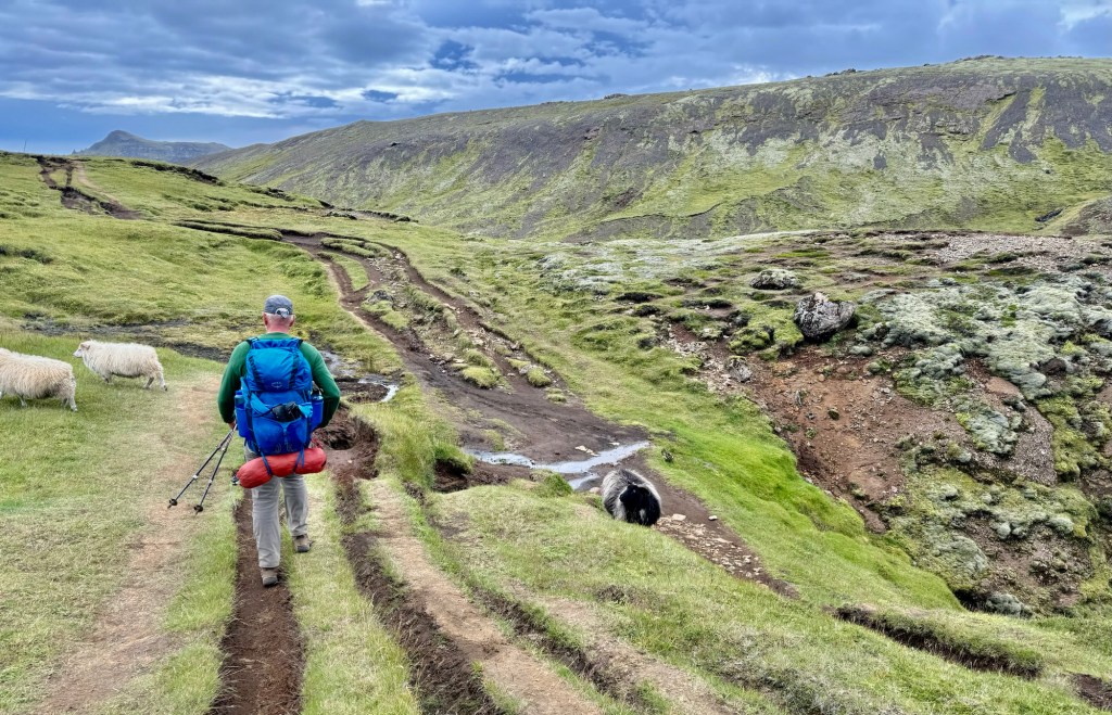
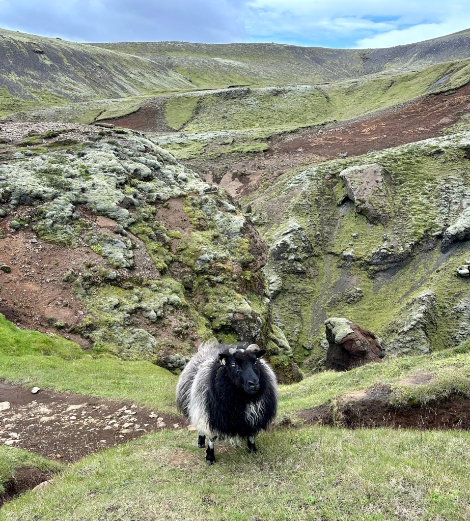
This part of the trail was also popular with sheep who seemed undeterred by the hikers as they went about their day grazing on the tender green grasses. In some cases, we could look up the rugged river valley and see sheep casually grazing on the steep canyon walls that were covered with a misty dew from the nearby waterfalls.
Sharing the trailThis guy let you know it was his trail!The Skógár River Canyon
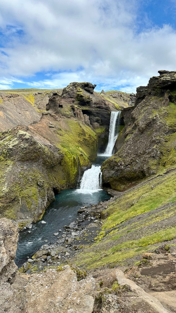
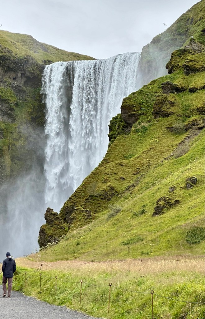
Nearing the end of our hike it was clear that the famous Skógafoss waterfall was close due to the sheer number of people we were passing on this lowest part of the trail. Surprisingly, we also passed some groups of hikers loaded down with heavy packs who were just beginning their day on the “F” trail as they passed us going the other way.
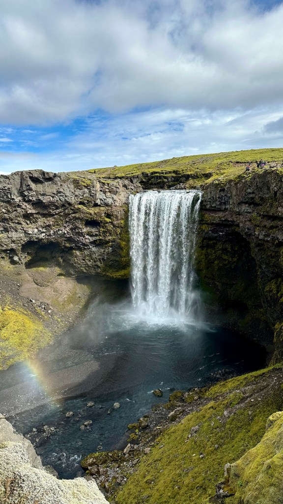
Finally, we reached the viewing platform at the top of Skógafoss visited by hundreds everyday. The only thing between us and the end of this adventure was nearly 500 metal stairs that would take us to the bottom of the falls and the end of the trail.
Skógafoss
Our adventure was over, but the memories of it would be lasting!
Epilogue:
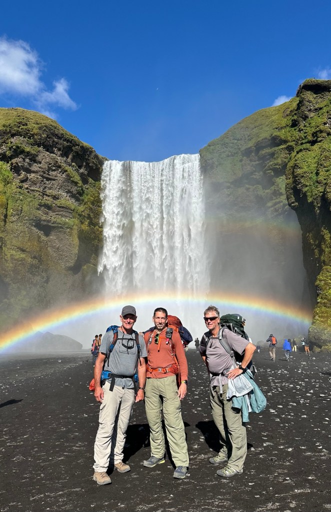
Chris, Phil and I rewarded ourselves with a hotel stay in Skogár after our successful 4-day completion of the Laugavegur and Fimmvörðuháls Trails. Although pretty basic with shared bathroom and shower rooms, it was a luxury we enjoyed. It was especially nice not shivering through the night!
The next day we woke up to a warm, sunny day. Phil treated us to a delicious fish and chips lunch at a very popular roadside trailer. Then we headed over to Skógafoss to get a group picture to memorialize our shared experience and wait for the Strætó bus back to Reykjavík.
Mmm… fish & chips!Icelandic horsesThe perfect picture to end this adventure!
Author’s note: Thanks for reading this series of stories. I hope you find inspiration for your own adventures in life.
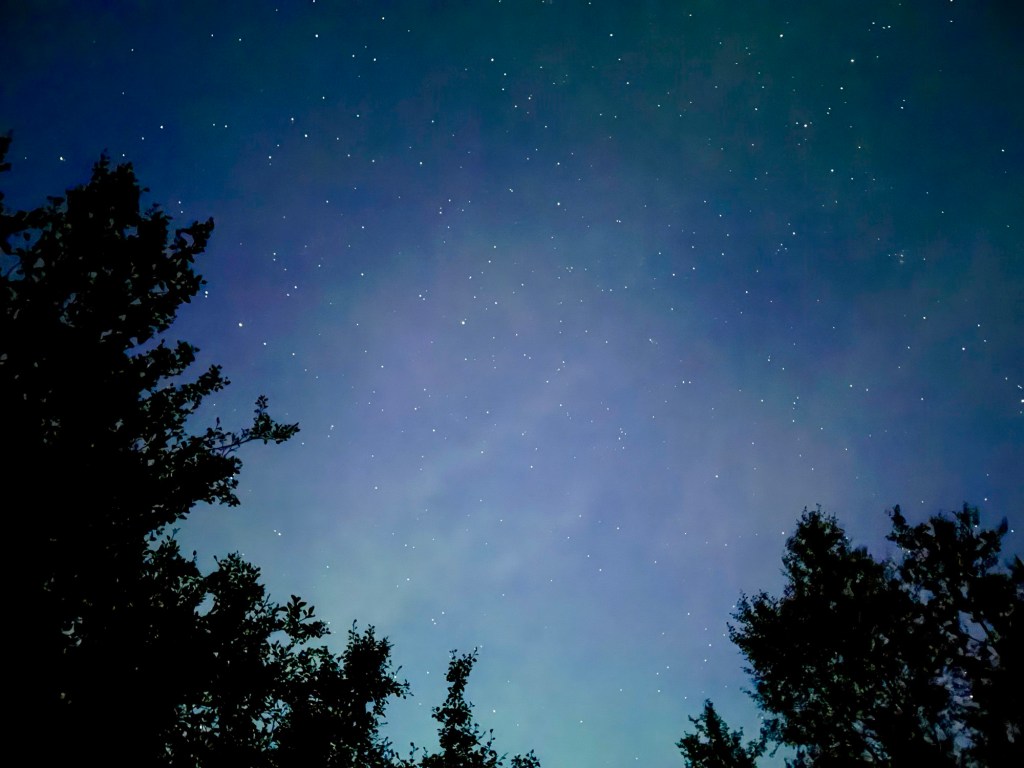
We began stirring early in our tents today… not because of the anticipation of one last epic day of hiking, but rather we were absolutely freezing throughout the night. Despite clear skies and no wind, the nighttime temperatures must have been around 25° F (-4° C) and we woke up to frost covered tents.
Cold, clear night with a faint glimpse of the northern lights
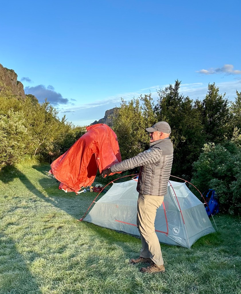
Shivering uncontrollably throughout much of the night is not an experience I’d recommend. So, rather than continue to huddle inside our sleeping bags wrapped in as many layers as possible, we ended up emerging from the tents around 5:45 am to a clear, bright, crisp day.
The now routine chore of re-packing and organizing our gear for the day served a secondary purpose of generating some much needed body heat. The night’s discomfort was behind us and it was time to focus on the challenge ahead, the Fimmvörðuháls Trail.
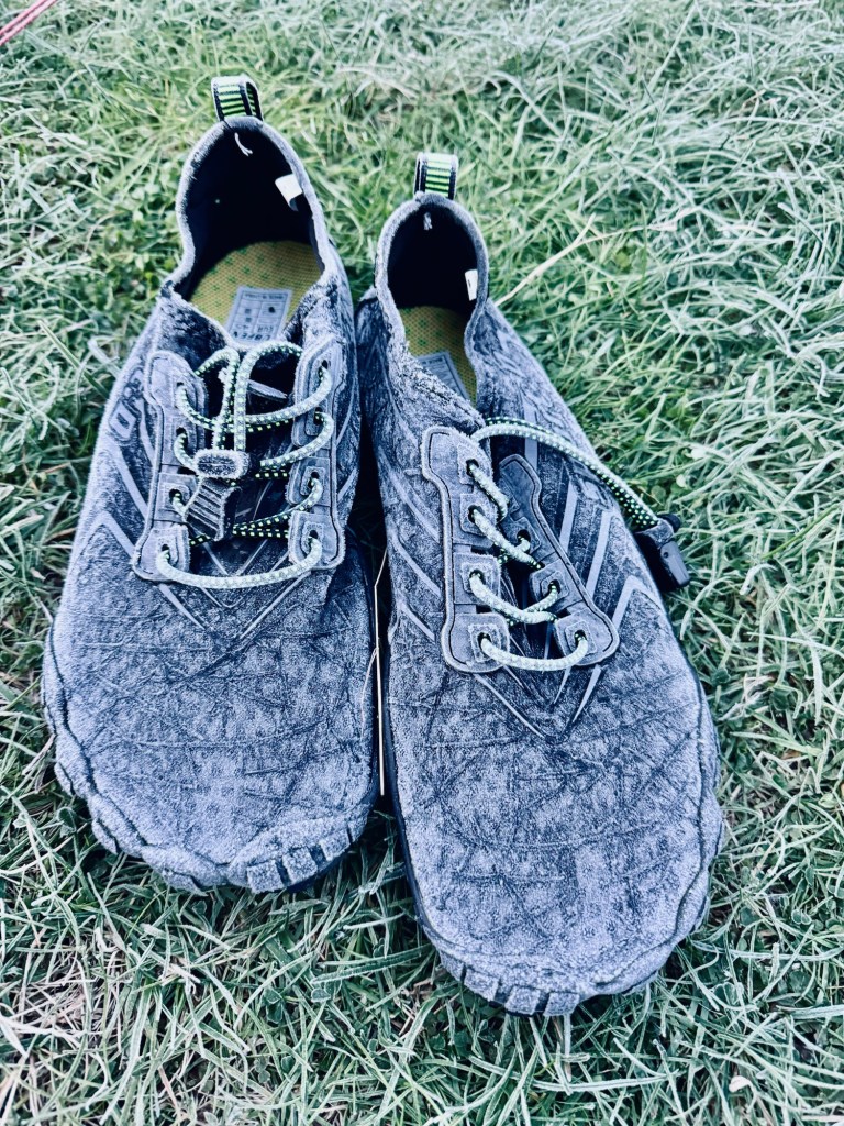
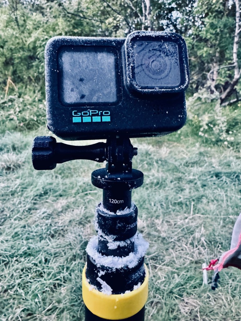
Brrr it’s cold… Frost covered gear
Having just completed the 34 mi (55 km) Laugavegur Trail over the last three days, we decided that we would tackle the “F” trail in a single day. Although many hikers will cover this 16.5 mile (25 km) trail in two days, just as many opt for the single day option. Our choice was based on the simple fact that the only available campsites are located at the Baldvinsskáli Hut that sits on a barren, rocky, and exposed site at around 3,000’ (≈900 m), between the Eyjafjallajökull and Mýrdalsjökull glaciers.
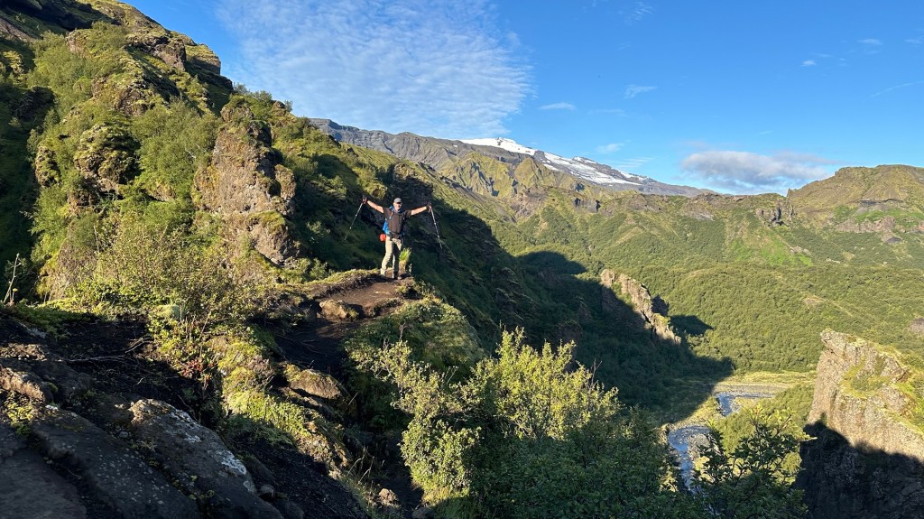
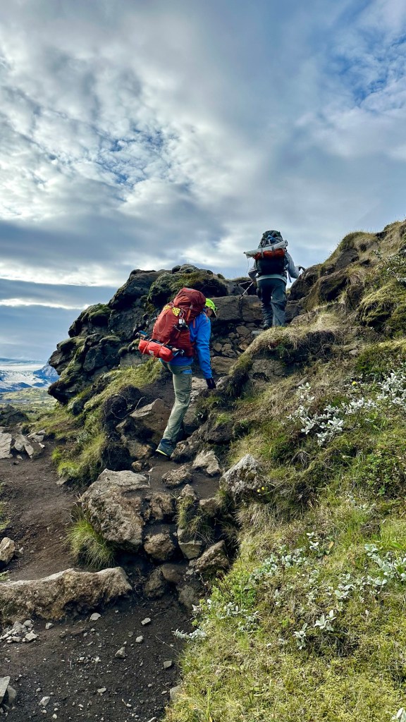
And so… our long final day of hiking begins at 7:30 am as we hit the trail. Although we start in a flat area along the Krossá River, the trail quickly turns away from the river valley as we begin a very steep climbing section that will have us gaining 3,330’ (1,000 m) in just 4.5 mi (7.2 km). The first portion of the climb passes through a lush green landscape blanketed with trees, shrubs and grasses. The terrain is dramatically carved, revealing its relative young age in geologic timescales.
Amazing topography This is where the stair climber pays off!The trail ahead
As we climb higher, the trail narrows in spots, sometimes a mere inches from a steep drop off to one side, and at other times we are totally exposed to steep drops on either side of the trail. Suffice it to say, we are staying focused to ensure solid footing as we carefully make our way forward. Along the way there are numerous outcroppings where we can stop and enjoy the dramatic scenery all around.
Views of the climb
Although the climb is seldom relenting, I remind myself that it is better to ascend sections like this than descend them (see author’s note at the end). I am also happy that we are climbing in dry conditions… rain would have significantly added to the “pucker factor” we were already experiencing.
Phil and Chris on the “chain” section… our day started down on the river valley far below.
As we looked far up the mountain in front of us, we could make out a small orange speck of another hiker’s backpack high on the trail above us. We used that person’s progress as our own inspiration to maintain a steady, constant pace until we finally crested the lower section of the steep climb and found ourselves on a wide, flat gravelly section that let to another steep section with loose rock and less than stable soil.
In this section, some chains had been installed to provide a handhold, but in some places the rebar anchoring the chain railing was completely torn from the ground, so we were prudent to not trust our lives on that precarious single handhold.
Steep, unstable section with questionable chain anchors… eek!
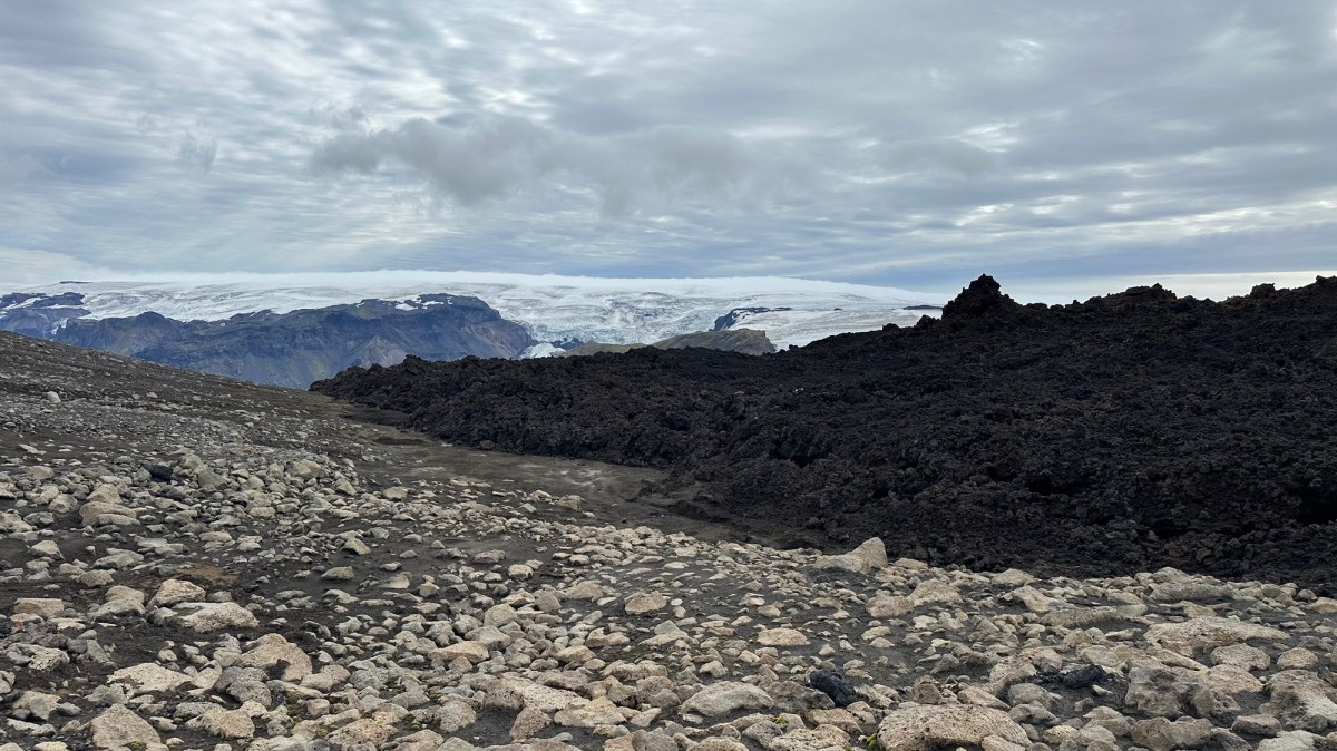
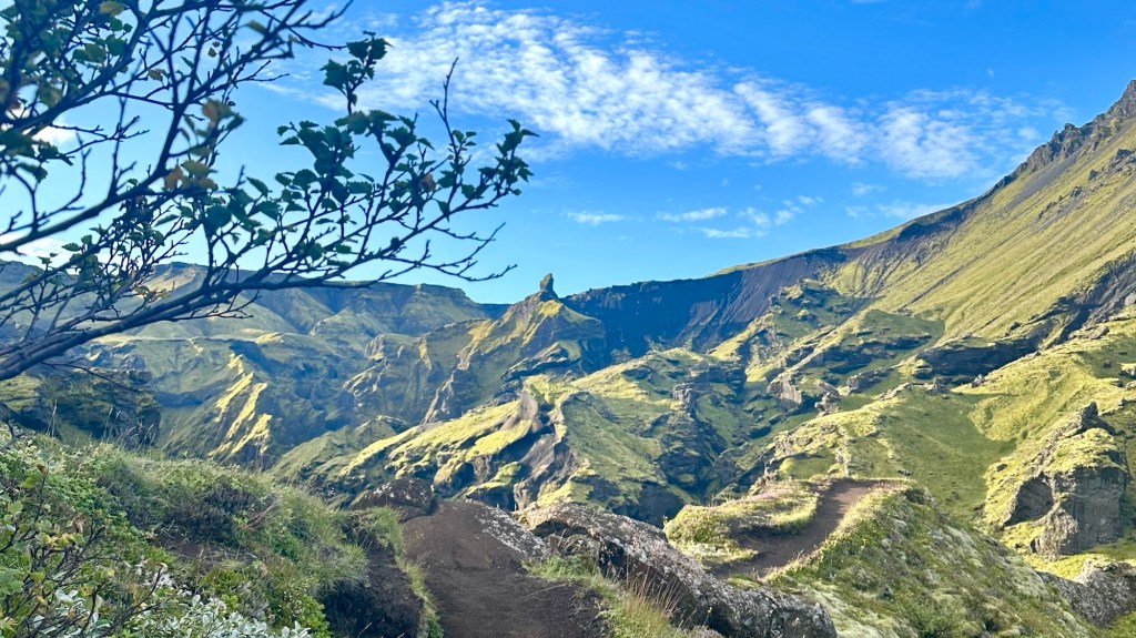
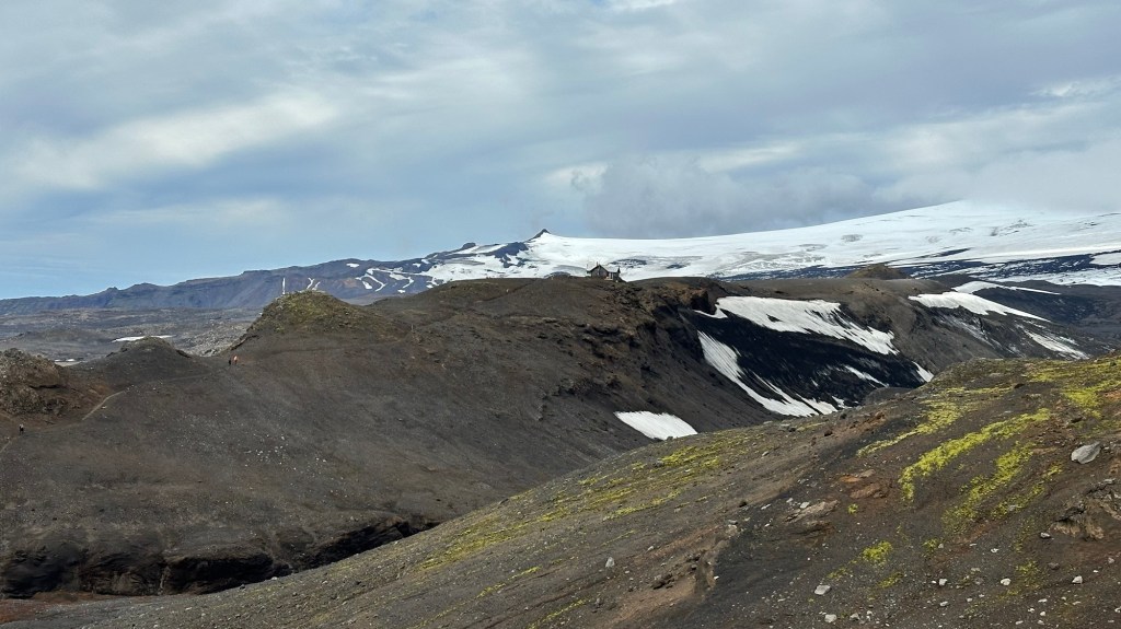
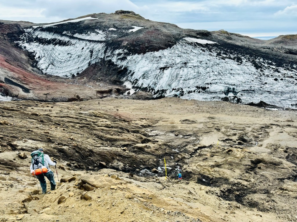
Finally, having reached the top of the steepest climbing sections, we are near the highest elevation of this multi-day adventure. As the terrain flattens in front of us, we are very close to the Eyjafjallajökull glacier on our left and the Mýrdalsjökull glacier to our right. What we didn’t know at this point was that the next 2.3 mi (4.2km) to the Baldvinsskáli Hut would be some of the toughest hiking any of us had ever done.
Eyjafjallajökull Glacier… site of 2010 eruption
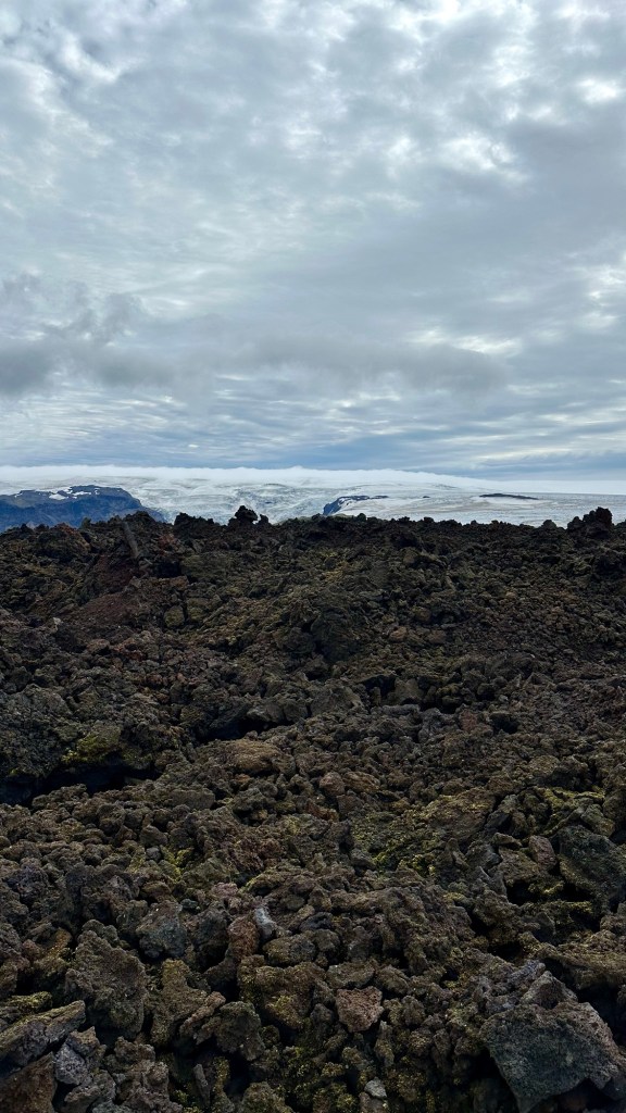
Just as we thought the difficult part was over, we encountered a large lava flow from the 2010 Eyjafjallajökull eruption that formed the Magni and Móði craters.
Authors note: The 2010 eruption created an ash cloud that caused 20 European countries to close their airspace for 6 days in April, affecting over 20 million air travelers.
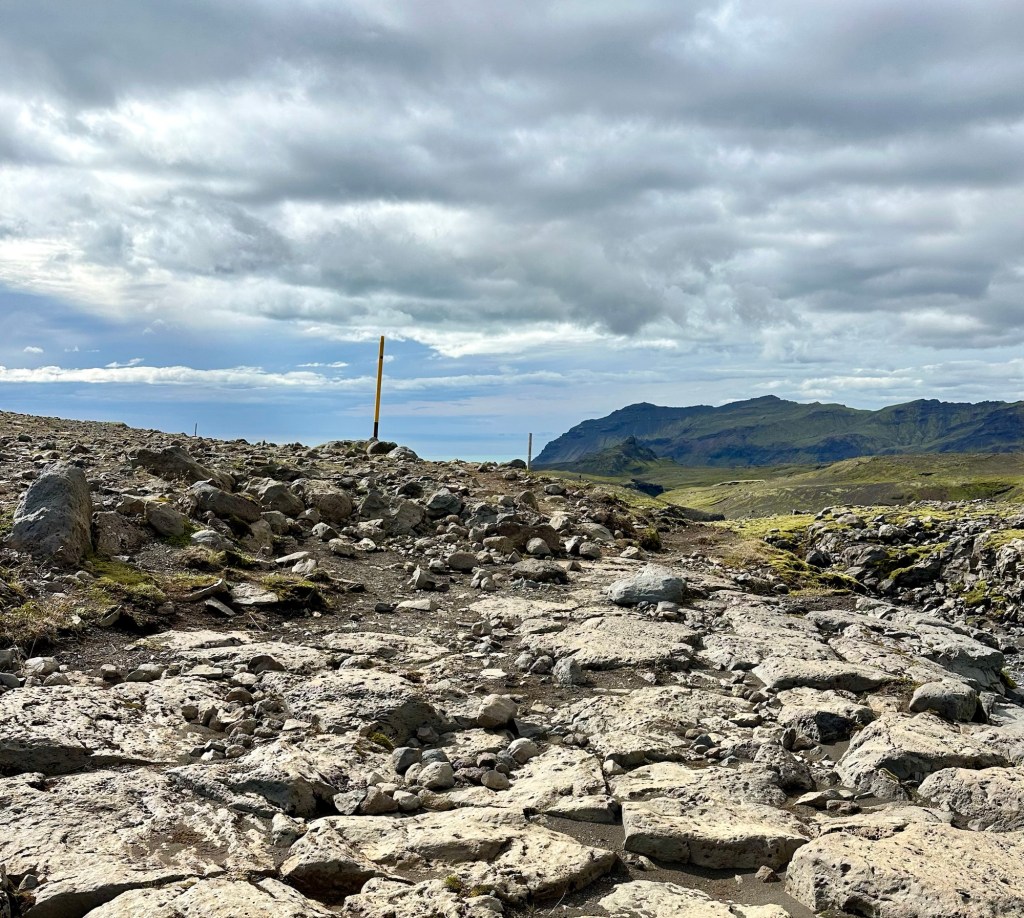
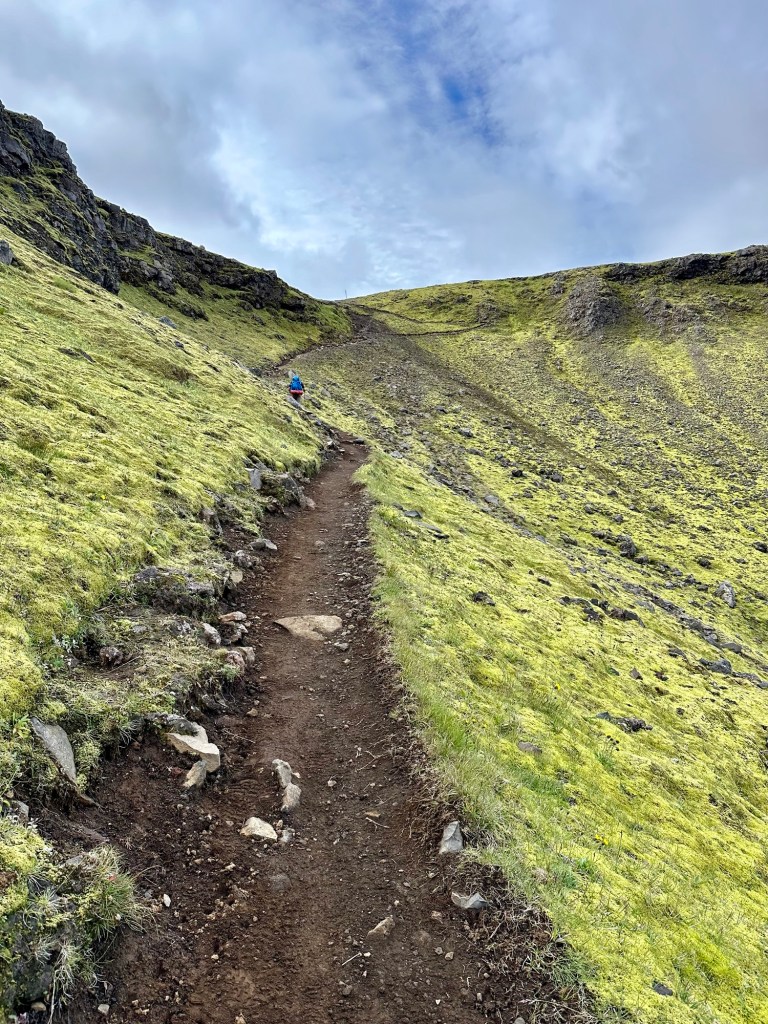
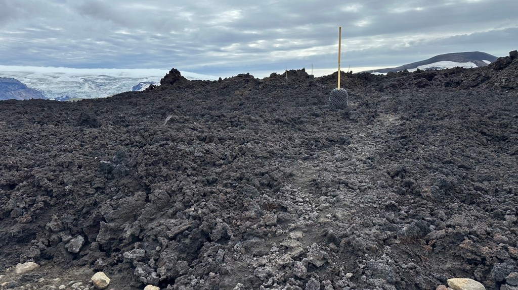
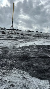
Our pace slowed to a mere crawl as we slowly navigated our way through jagged, porous volcanic rock, paying attention to the long yellow posts that had been placed to mark the route since there was no discernible trail.
Lava flow from 2010 eruption; Yellow route markers
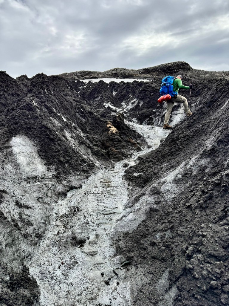
After about 45 minutes, we finally made it across the lava rock for a brief section of soft volcanic sand. Our respite, however, was to be short-lived because the next section required us to descend down the steep side of a glacial moraine, then cross over a series of 6 to 8 feet high sharp ice ridges covered by black volcanic cinder. In some cases we had to make multiple attempts to get an adequate foothold to get up one side only to slide down the opposite side. Our trekking poles were of little help since they couldn’t pierce the hard glacial ice.
Trail markers over glacial ice
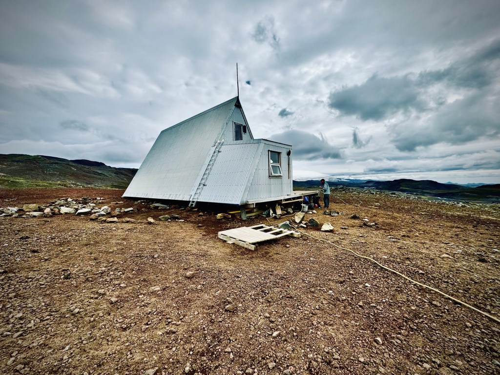
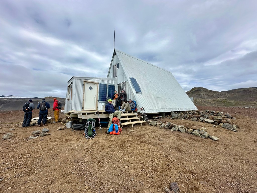
Descending into the glacier moraine Ice ridgesBaldvinsskáli Hut… don’t want to camp here!
Finally, with a lot of effort, we made it through this last challenging section as we climbed back out of the moraine to the Baldvinsskáli Hut that appeared off in the distance. By the time we got there, we were definitely in need of a short break and some food to restore the calories we had expended. Sitting there on the hut steps as the cold wind blew, we were thankful that we still had the energy and motivation keep going and finish the demanding “F” trail.
A short break for lunch
To be continued…
Author’s Note: For anyone who is considering this hike, I would emphatically recommend the north-to-south routing that begins at Þórsmörk, rather that the northbound option that starts in Skógar. The terrain profile out of Þórsmörk is significantly more aggressive which translates into steeper climbs going southbound, but if heading north, the descents on unstable rock and packed cinder can be treacherous.
It was a cold night at Emstrur, but fortunately our primo campsite was located out of the wind. Although we wore many layers to bed, the near freezing temps still allowed the cold to seep in. Once awake, we roused ourselves to make breakfast, fill water, and repack our gear for today’s 12.4 mi (23 km) hike.
A view from Emstrur camp at daybreak
The last two days we have been blessed with good hiking weather (… cool and dry), and it looks like today’s forecast will be the same! With our early wake-up, we were able to get on the trail at 7:30 am, well ahead of most of the camp.
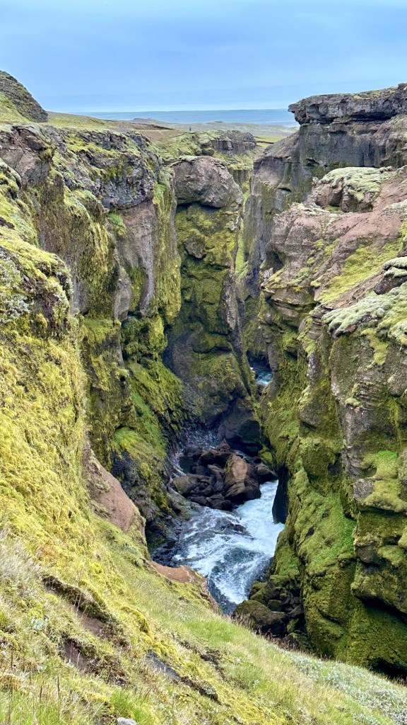
Once again the terrain proved to be the star. Today started on a black sand trail that allowed just enough cushioning for our less than supple bodies. We descended into the very narrow and steep section of the upper part of the Markarfljótsgljúfur Canyon, across a bridge over what appeared to be class 6 rapids originating from the melt from the Mýrdalsjökulla Glacier a few miles to the east.
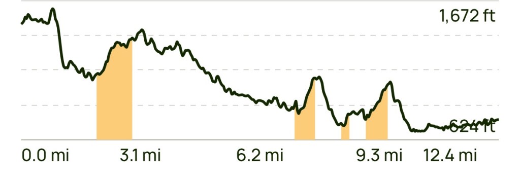
The so-called flat terrain profile for the day… hmmm!
Although the overall trail profile shows that we will be descending gradually over the course day, we still expect to encounter some sections with sharp climbs and steep descents. Although counterintuitive, the climbs are preferred over the descents.
Today’s trail profile from Emstrur to BasárPhil and Chris enjoying a rare flat, soft-sand section of trail
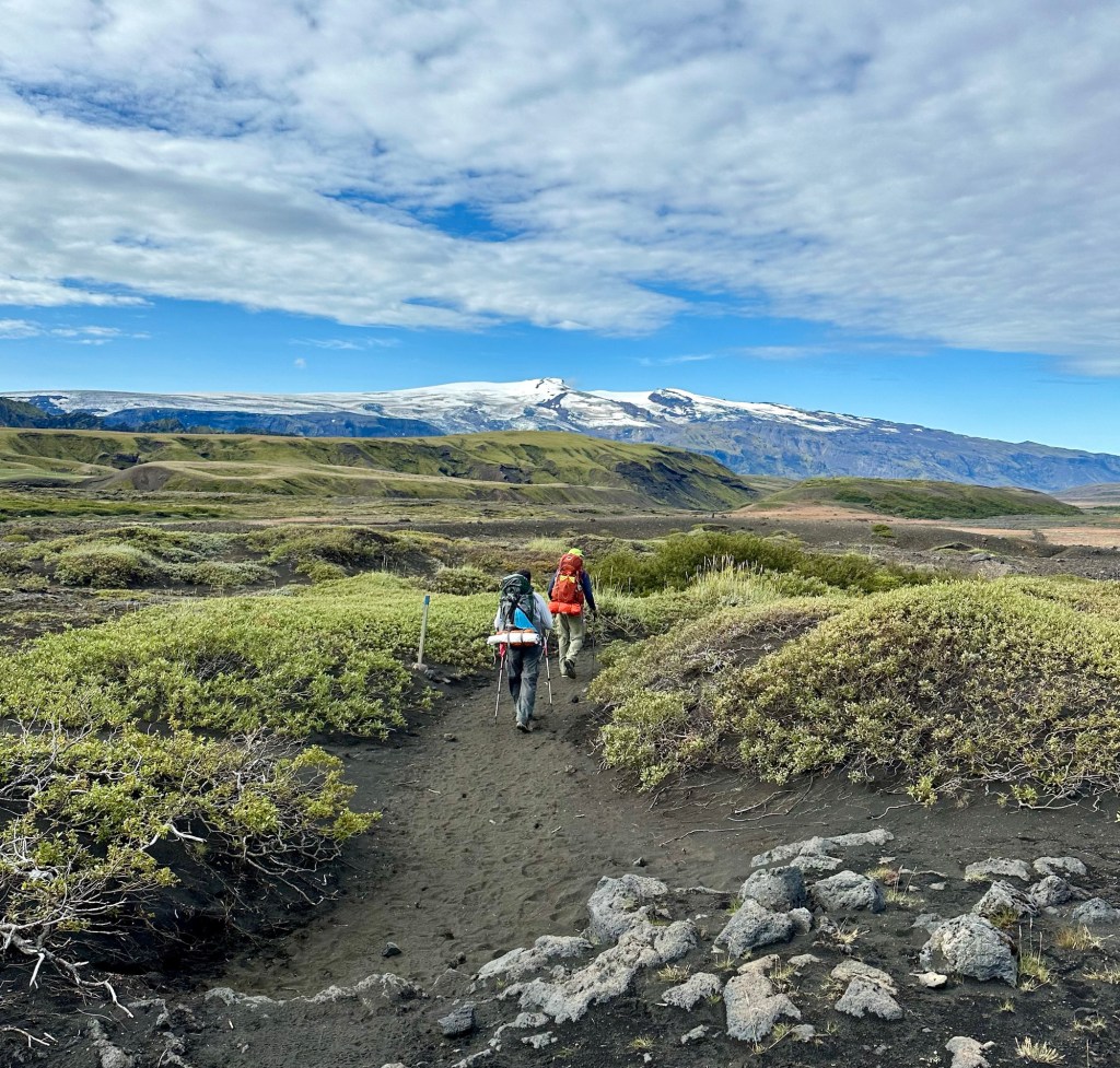
After climbing back out of the canyon we headed across a vast lava field to another distant climb to a higher plain. As we continued along, we began to notice some small signs of civilization… namely a very distant farmhouse with nothing around it as far as the eye could see, and some sheep grazing on the scrub grasses that were beginning to appear.
Only one structure in this vast landscape… try to find it!
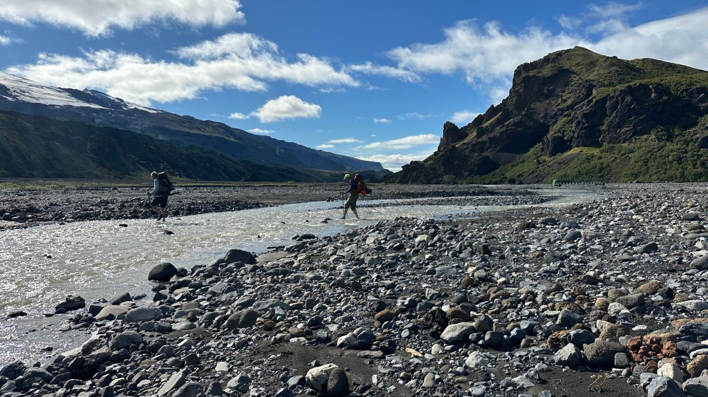
After enjoying a relatively long flatish section across the cinder and lava rock surface, we encountered another steep downhill section and began to see small shrubs and even a few small trees as we approached our first river crossing of the day. The crossings have all been manageable, but we do have to concentrate so as not to slip in the fast moving knee-deep water.
At this point we were about 2 mi (3.2km) from the end of the Laugavegur Trail and looking forward to a well needed break at the Þórsmörk camp. The last section after the river was through a lush forest of small downy birch trees… vastly different than the more barren terrain of the past several days. Þórsmörk was a welcome oasis at the end of the Laugavegur trail where we were able to stretch out on the grass and enjoy a late lunch. Chris even surprised Phil and I, with Snickers bars from the camp store!
Garden-like conditions near the end of Laugavegur Trail
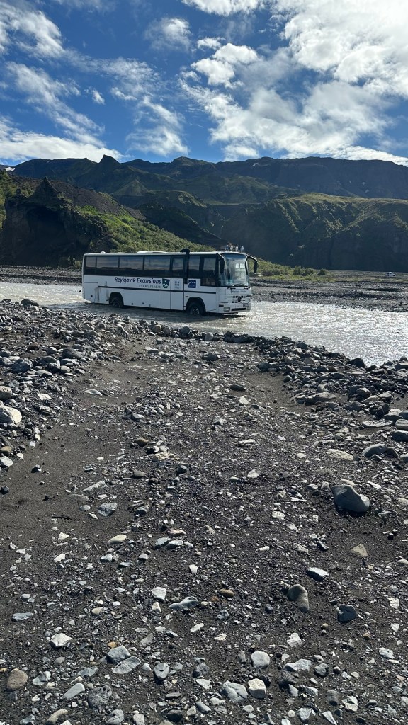
Finally it was time to get our stiff bodies up and moving again, because we wanted to get a head start on the Fimmvörðuháls Trail that officially began across a series of estuaries that make up the wide Krossá River plain.
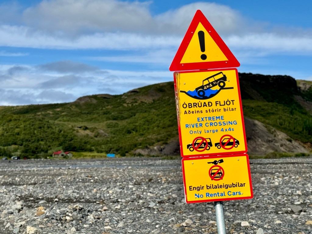
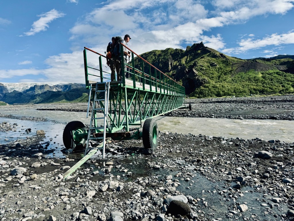
We had to navigate our way across several estuaries until we came to one requiring us to change out of our boots again to fjord a deep, fast moving section. Once across, we headed upriver to Básar Hut campsite and settled in for our last night, hoping to get a good night’s rest before tomorrow’s arduous single-day hike of the Fimmvörðuháls Trail.
Almost to ÞórsmörkRelaxing in the warm sunA variety of ways to cross the Krossá River… and some to avoid!
We woke up refreshed, with maybe a little stiffness, but eager to experience the day ahead. After the long haul and demanding terrain yesterday, we were looking forward the relatively flat lava fields we would be covering today on our 7.3 mi (11.8 km) hike to Emstrur-Botnar
A half hour into the hike we encountered another river crossing and went thru the routine of changing footwear and raising our pant legs above the knee. We decided this would be a great place for Chris to fly his drone to get some video of the crossing.
As an aside, I mentioned earlier that one of Chris’ goals was to unplug. Clearly I must have been mistaken, or his definition of unplugging means carrying a 4 lb drone and all its components; an insta360 panoramic camera, a GoPro, and multiple batteries and battery packs. He tells me that he’ll spend a few weeks to put all of the various clips into a stunning video of our adventure. When it’s available, I’ll be sure to link it to this blog. [Author’s Note: As of February 2025 I am still waiting for the video compilation… so I guess he was a little optimistic in his estimate!]
Major intersection; River gorge; Typical Icelandic campers
As we hiked southward on the relatively smooth lava sand trail, the massive Entujökull Glacier loomed above us to the east, while to the west were green, sharply rising hills jutting up from the barren charcoal gray lava field we were crossing. The hiking was easy and the sun warmed the air around us, allowing us to remove some layers and soak in the sun.
A variety of mosses add vivid color to the lava hills
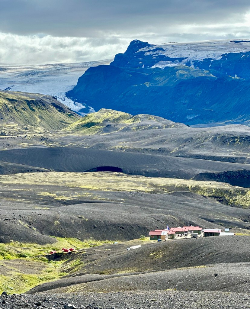
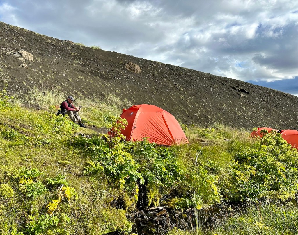
At around noon we crested the final lava bluff and could see our destination for the day, Emstrur-Botnar. Once again we paid the tent camping fee. Since we were some of the earliest hikers to arrive, we got to select some of the best tent sites in a protected area next to a gently babbling stream.
Emstrur Hut camp with Entujökull Glacier in the distance
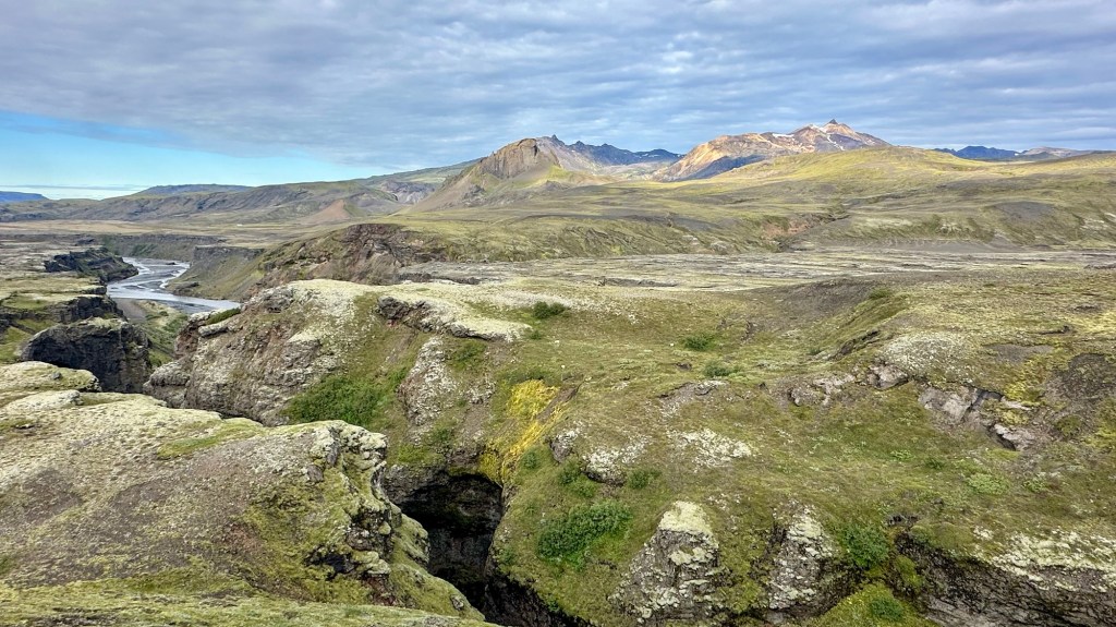
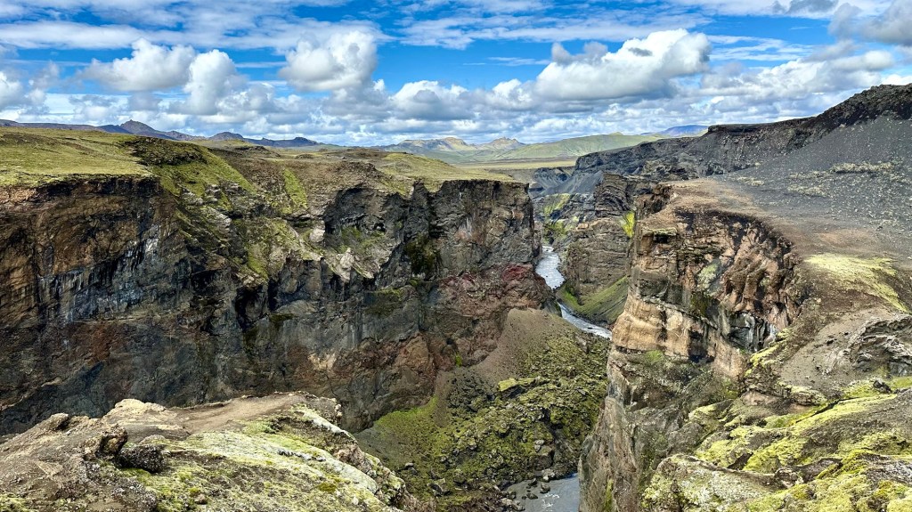
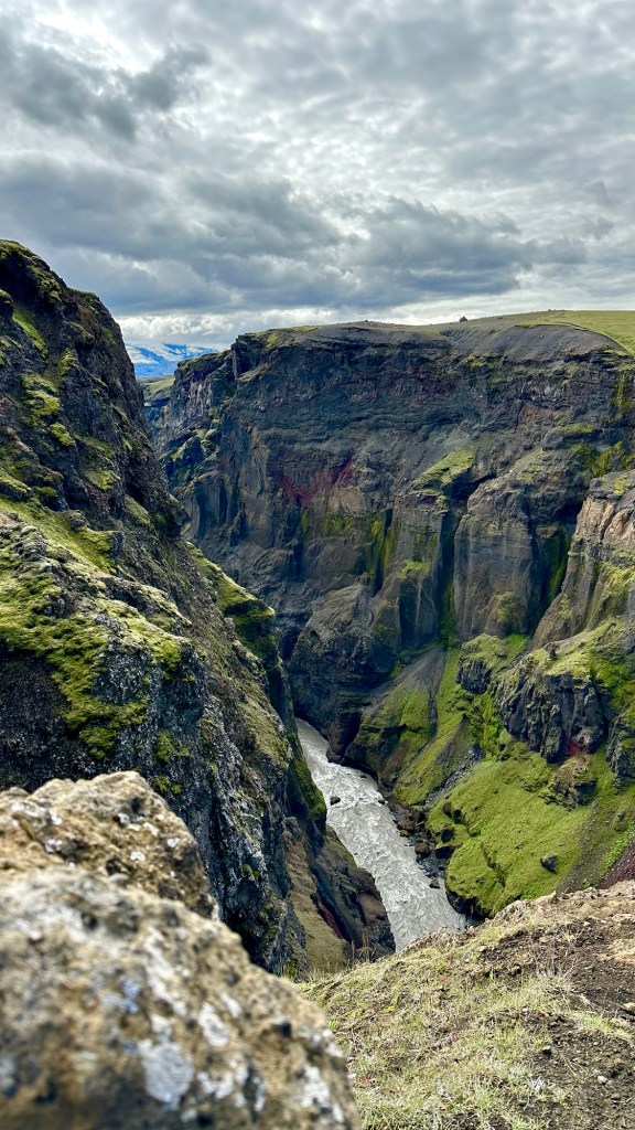
After lunch, we decided to take a short hike to the nearby Markarfljótsgljúfur Canyon. This extracurricular excursion was well worth the time and effort as we crested a hill and saw a massive gash in the landscape. The precipitous cliffs, over 200m high, were formed only 2,000 years ago by floodwaters produced by the melting of the Mýrdalsjökull Glacier.
Mýrdalsjökull Canyon
We carefully approached the edge to look down into the narrow chasm to the glacier fed river far below… a great way to wrap up day 2 of our Icelandic adventure.
Since we opted to forgo yesterday’s planned hike to Hrafntinnusker, we decided to combine our day 1 and day 2 hikes and go directly to Hvanngil, a long 17.2 mi (27.8 km) away. Fortunately the weather was forecast to be partly cloudy with light wind… a marked improvement from yesterday!
After a warm breakfast prepared over our camp stoves, we broke down our tents, repacked our gear, and began our long day with a nice uphill climb out of Landmannalaugar. We beat the rush out to the trail and enjoyed the solitude of having the trail to ourselves for awhile.
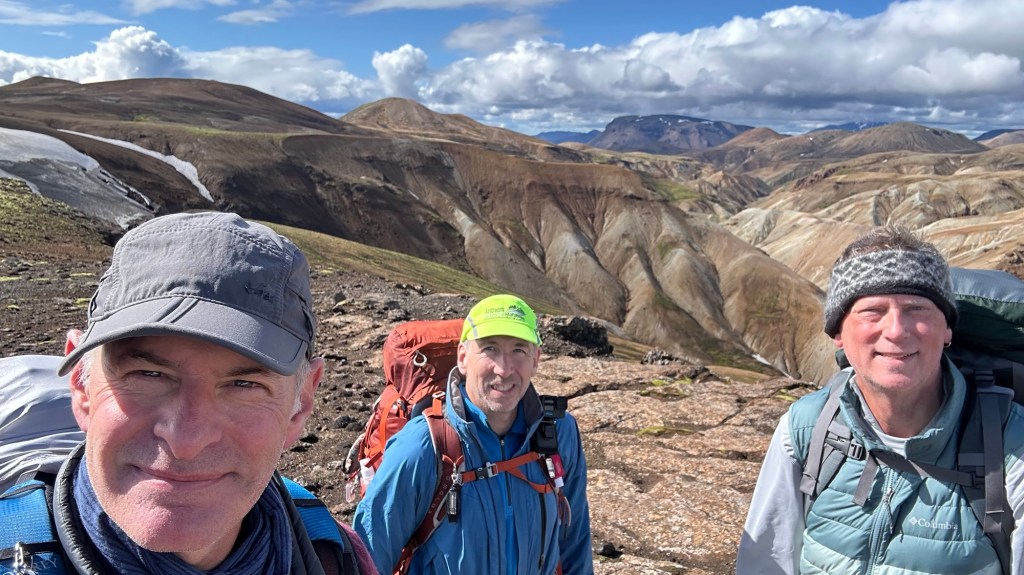
Laugavegur trailheadDon & Chris… where’s Phil!?
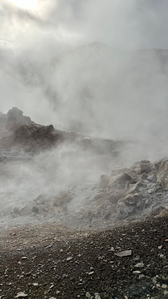
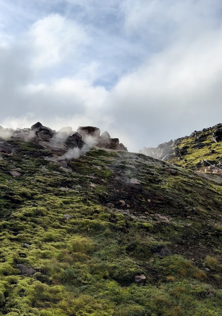
As the hike progressed it was quickly apparent that the land around us was alive with geothermal activity. The smell of sulfur was prevalent and all around us plumes of steam rose from holes in the ground called fumaroles. The steam forms when groundwater is heated by magma rock. We even encountered one fumarole that was gushing boiling water!
Fumaroles of steam, gasses, and boiling water
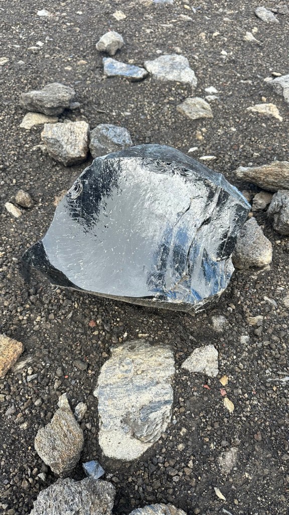
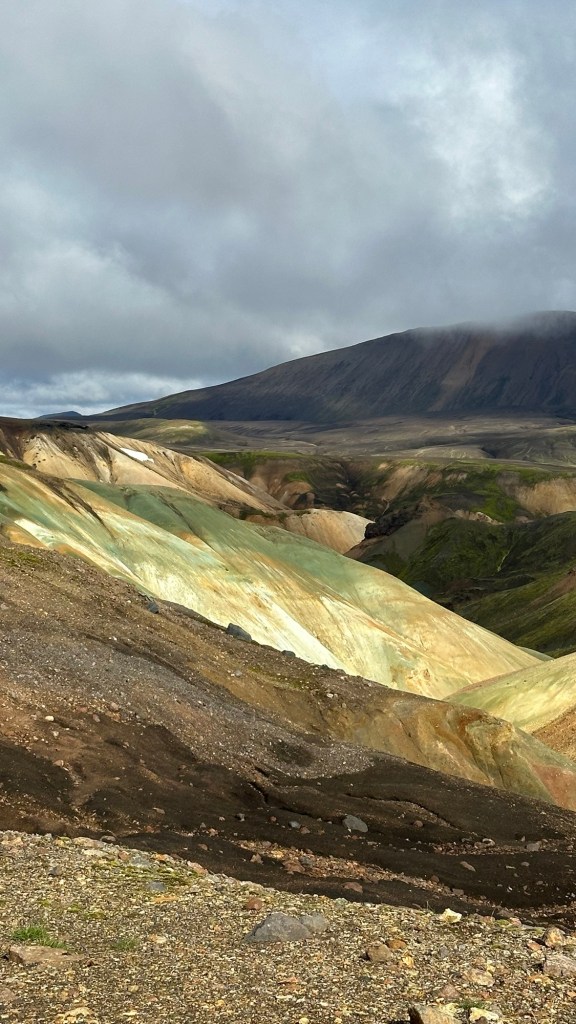
Another indication of the volcanic history of the landscape was seemingly endless fields of shiny black obsidian ( a glassy igneous rock formed when lava cools very quickly) and variegated hillsides showing rich mineral deposits in an array of colors. The challenge of the terrain was mitigated by the stunning and widely varying landscapes all around us.
Obsidian rock & Colorful minerals
By late morning, we reached our halfway point for the day Hrafntinnusker Hut, which was initially planned to be our first night camp. Instead we enjoyed a nice lunch at a virtually deserted camp. But, the few people we talked to over the course of the day who had spent the previous night at Hrafntinnusker, said the conditions were absolutely miserable at this high, barren camp outpost. The info underscored in our minds that we had made the right decision to delay our start the previous day.
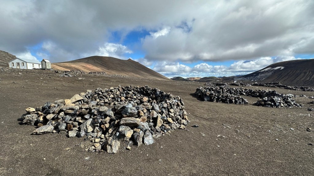
Stacked rock walls at Hrafntinnusker to protect tents from punishing winds at elevation
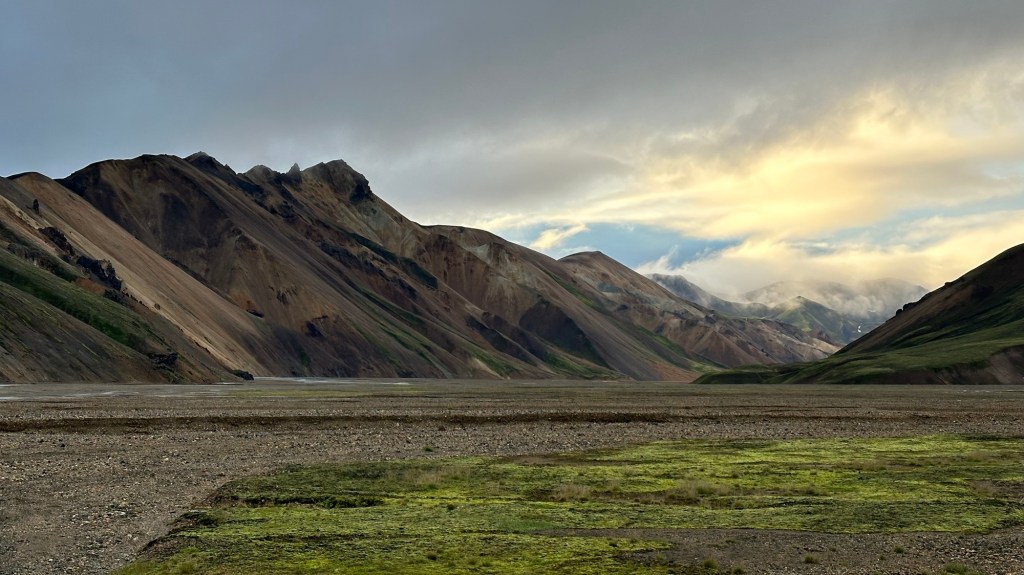
After lunch we geared up for the remaining 9.8 mi (15.8 km) to our camp for the night, Hvanngil. The morning hike was mostly uphill, the next section featured a series of steep up and downs as we moved across the barren lava field. Finally we reached our long, steep descent on broken rocks into the rich green moss covered valley below. A panoramic look around revealed glaciers off in the distance, mineralized slopes, and the beginnings of moss covered volcanic terrain and sparse grasses and flowers.
Don, Chris, and Phil and ALOT of rugged terrain to get thru!
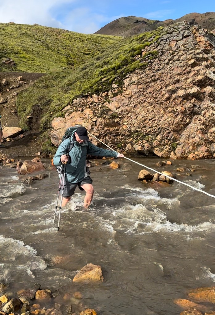
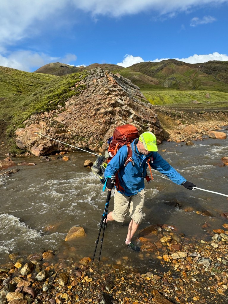
At the bottom of the steepest section, we encountered our first river crossing. To prepare, we removed our boots and socks, put on our water shoes, hiked up our pant legs, and carefully crossed the knee deep, ice cold river. Fortunately there was a convenient rope to hold onto while we made it across. The cold water felt good on our feet which, by this point, had endured many miles of rough terrain.
1st river crossing for Phil, Chris, and Don
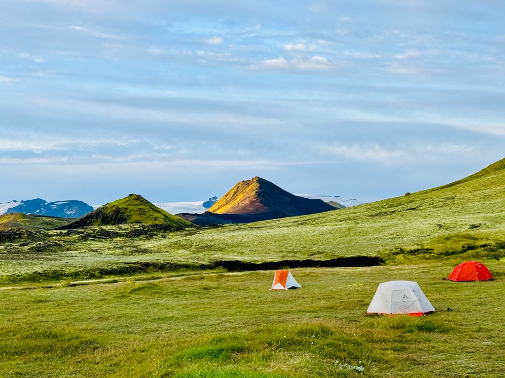
We briefly stopped at the lakeside Álftavatn Camp, before heading out for the final 3.8 km to our camp for the night, Hvanngil. After another river crossing and rolling terrain, we descended into the bucolic campsite where we would spend our second night. I can’t imagine a better camp…the moss covered ground was soft and dry, and the views of the sharply rising green hills and distant Slétjökull Glacier were breathtaking!
A perfect campsite after an amazing day
At last, our long first day of hiking was over and we were able to relax and enjoy dinner while visiting with hikers and campers from many different countries.
Author’s Note: Our group of 3 intrepid hikers has just completed 4 days of hiking in Iceland (3 days on the Laugavegur Trail and 1 day on the Fimmvörðuháls Trail. In the coming days there will be a series of postings about our adventure. But first…
Day 0 (Preamble and Getting There):
A long awaited adventure in Iceland has begun. Located in the North Atlantic, just south of the Arctic Circle, the land is dominated by the forces that created it, lava and ice. In fact the vast majority of the land is covered by sprawling glaciers and lava fields, features we would become very familiar with in the coming days.
The trip was conceived in the winter of 2023 by one of my traveling partners, Chris. He determined that for his own sanity, he needed a break that allowed him to unplug for a bit and commune with nature. Having previously traveled to Iceland, he mentioned a desire to backpack the famous Laugavegur and Fimmvörðuháls Trails.
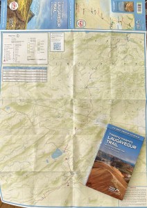
In December 2023 he approached me, knowing that I would soon be retiring, and asked if I’d be interested in joining him… with an important caveat: I would do the initial trip planning and coordination. Since I knew my calendar would be open for the near future, I eagerly agreed and began to research info about the trails, logistics, and timing. Afterall, it was opportunity to explore the vast empty expanses of Iceland and experience something most visitors never get to see.
Trail map and info book
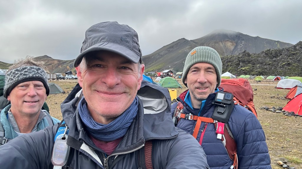
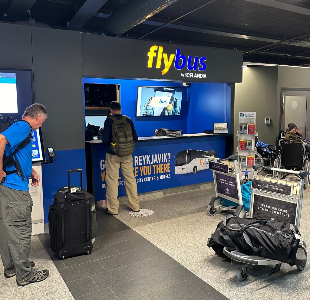
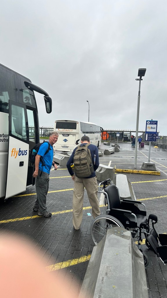
In the intervening months we invited another friend, Phil, and began planning in earnest. Fast forward to mid-August 2024, and all the planning and coordination has been completed. Early in the morning of 15 August, the three of us, bleary-eyed from an overnight flight, landed in Keflavik. Although the airport is located well outside of Iceland’s capital of Reykjavík, it was very easy to find bus transport for the 45 minute trip into the city where we would catch our afternoon bus to the Laugavegur trailhead at Landmannalaugar.
Phil and Chris getting bus tickets from the airport into Reykjavík
At the main BSI bus station in Reykjavík, we got our backpacks in order, purchased butane gas canisters for our camp stoves (since they are prohibited for air travel), and stowed our post-hike gear and luggage in a long-term locker.
Our afternoon bus to the trail would be departing at 12:30 pm from Reykjavik City Hall located about a mile from the BSI terminal. To get there we decided a little warmup hike was in order and promptly hefted our 42 lb packs and started walking. Along the way we successfully managed to avoid getting run over by a class of approximately 20 elementary kids and two teachers who were riding their bikes in a circuit along the same route we were taking.
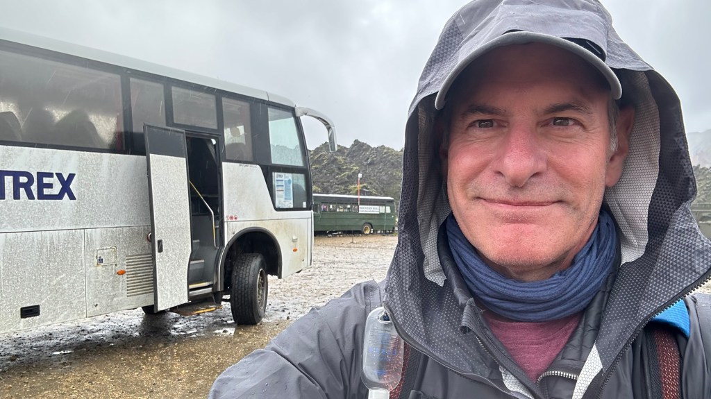
After relaxing for about 2 hours inside City Hall, our bus arrived promptly as scheduled. We stowed our packs and settled in for the 4 hour drive to the start of the Laugavegur trail, half of it on rough backroads through lava fields. As the trip progressed the weather took a decidedly nasty turn with a steady cold rain and hash wind.
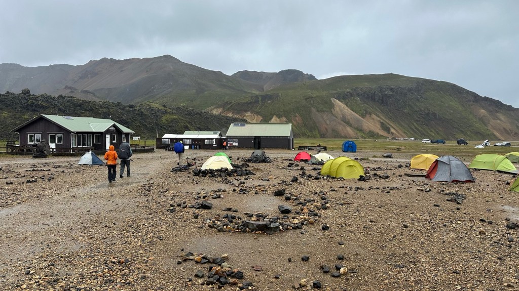
Arrival at the Landmannalaugar campsite at the start of the Laugavegur Trail
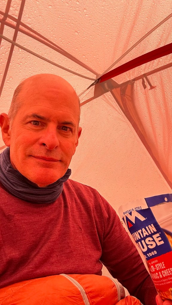
Our original plan was to get to Landmannalaugar and immediately begin our hike to the next campsite at Hrafntinusker, about 12 km (6.4 mi) away. Due to the wind and rain, we instead decided to camp at the Landmannalaugar trailhead. After paying for a tent site, we struggled to quickly erect our tents to avoid getting more wet than we already were. The entire camp was a muddy mess, so once the tents were ready, it was time to call it a day.
Hunkered down for the night, protected from the wind and rain.
The steady wind and rain throughout the night really tested the integrity of our lightweight backpacking tents. Fortunately, we all survived the night perhaps a little worse for wear, but we woke to dry weather and a clear forecast.
At precisely 2:39 pm on August 21, 2017, the decision was made to travel to the next total solar eclipse that would transit across the United States nearly seven years later on April 8, 2024.
We witnessed the 2017 eclipse, dubbed “The Great American Eclipse,” from the grounds of a bed & breakfast in the small town of Cross Hill, South Carolina. For 2 min and 32 seconds the Sun was fully covered by the Moon, creating a rare and surreal moment that awed all who witnessed it with us. At that moment, we knew we’d want to see this celestial dance again.
The Science of an Eclipse
The phenomenon of a total solar eclipse is caused by the unique geometry of Earth’s moon to the Sun. It is unlikely that this phenomenon exists anywhere else in the universe due simply to the number of factors that must be in perfect symmetry for an eclipse to occur.
Eclipses occur due to the special coincidence of the Moon and the Sun being the same angular size. This occurs because the Sun is 400 times wider that the Moon, but it is also 400 times farther away, so they coincidentally appear to be the same size in our sky. (Ref: https://sunearthday.nasa.gov/2006/faq.php)
Even with this unique symmetry, there are three other conditions that must occur simultaneously for a total solar eclipse to occur:
1. Alignment: The Moon’s orbital plane must intersect the straight line from the Sun to the Earth. Since the Moon’s orbital plan is tilted 5 degrees, this occurs two times per month when the moon crosses the orbital nodes (called the ascending and descending nodes).
2. Moon Phase: A total eclipse can only happen during a new moon that coincides with an ascending or descending orbital node.
3. Distance: The Moon’s orbit is elliptical, so it must be at or near its perigee (orbital point closest to Earth) for the Moon to fully cover the Sun. If the Moon is at or near apogee (orbital point furthest from Earth), an annular eclipse is likely.
Solar eclipses (annular or total) are observable twice per year somewhere on Earth (image credit: time and date.com)Left: Annular “ring of fire” eclipse; Right: Total eclipse
Hopefully my attempts to explain the science of the eclipse was helpful…
Back to the Story
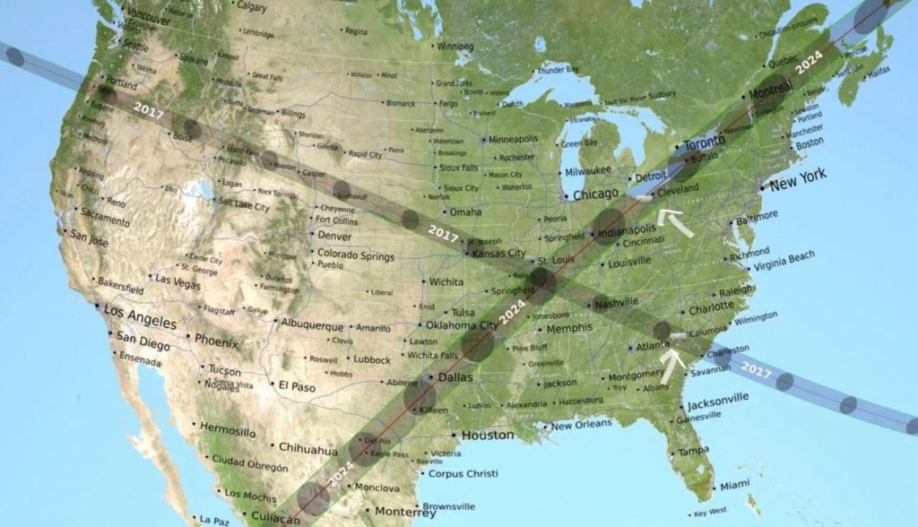
Knowing that the 2024 eclipse would be easily accessible from our home in Virginia, we set about planning a trip that would put us somewhere on the “line of totality.” After a bit of map study, we settled on the vicinity of Cleveland, Ohio, ultimately choosing the small town of Lorain (about 30 miles west of Cleveland on the southern shore of Lake Erie) where the period of totality would last for 3 min 52 sec.
The 2017 and 2024 Eclipse Maps (viewing locations marked)Driving to the eclipse zone in Lorain, OH with a cloudless sky for optimal viewing! (Warning: Do not wear eclipse glasses while driving!)
With the planning complete, all we could do was hope that the weather would cooperate. In the week leading up to our trip, the long range forecasts were calling for everything from rain to overcast conditions to partial clouds. We could only cross our fingers that as the date approached, the weather models would get more precise. Fortunately, as the day broke, the afternoon forecast couldn’t have been better… clear skies were expected!
Lorain is quintessential “small town America.” While eating lunch prior to the pending celestial show, we chatted with some friendly locals who were truly curious about how we selected to visit their town for our experience. Just as in 2017, the excitement all around was palpable. For an afternoon, our differences and preoccupations were forgotten and we bonded over the anticipation of an event so special that our innate human curiosity prevailed.
Since we were staying in a local hotel for the night after the eclipse, we could simply relax and enjoy the show, and not worry about the traffic jams that would inevitably occur when all the visitors to the region headed home at the conclusion of the eclipse. Our hotel, the Ariel Broadway Hotel, went all out to host a viewing party on the roof, so we joined about 300 other guests on the roof for the festive atmosphere as we awaited for the show to begin.
Donning our eclipse glasses,we looked skyward, fascinated as the Sun and Moon began to align in the bright afternoon sky. As the Moon began its slow transit across the face of the Sun, there was no discernible change is the brightness of the day. Only when we were nearing totality, when just a small sliver of the sun was visible, did the horizon appear to dim slightly and the remaining light seemed to become more flat or monochromatic.
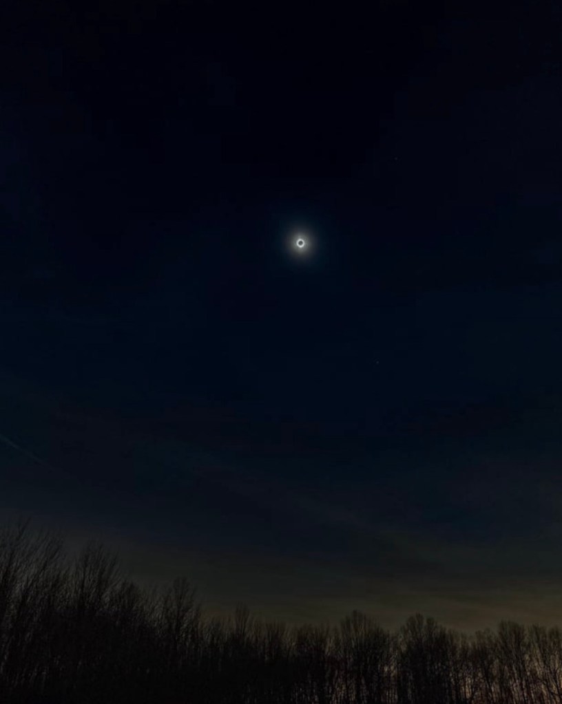
Suddenly, at the moment of totality, we could no longer see anything thru the eclipse glasses. There was a noticeable drop in the air temperature, and we removed the glasses. Words and pictures really can’t adequately describe the astounding sight in the sky above, but I’ll try!…
NASA image of totality as observed from Cleveland, OH
…the perfect black circle of the moon was surrounded by the pure white brightness of the Sun’s corona (the outermost layer of the Sun’s atmosphere). Although the sky was dark, it wasn’t entirely black. Instead, I would describe it as a deep indigo blue canvas on which we could easily see some stars and planets. Additionally, even with the naked eye, we were able to see an orange spot at the edge of the moon, which turned out to be a prominence. I later learned that a prominence is a large plasma and magnetic field connected to the Sun’s surface that can extend 200,000 miles into the solar corona.
Eclipse over Ohio on August 8, 2024
Even though the period of totality was going to last for 3 min 52 sec, we were reluctant to look away, knowing that the opportunity was fleeting… and rare. Regardless, we took a brief peak at the horizon to see the sensation of what appears to be a 360 degree sunset. The sunset effect is caused by the 170 mi wide moon shadow (umbra) as it moves across surface of the Earth.
The moment of totality with the 360 deg sunset on the horizon
The difference between a total solar eclipse and a partial eclipse is literally and figuratively like night and day. If you ever have the opportunity to witness a total eclipse, I strongly encourage you to do it. Put it on the calendar, take the time and make it happen. You won’t regret it! I am hoping my kids and grandkids (when they come) take me to the next eclipse that will transit across the U.S. on August 12, 2045.
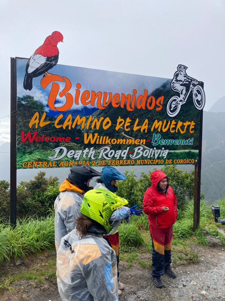
Our final day in La Paz was a full one. We were picked up at 6:00 am for transport to the Death Road for a downhill mountain biking experience.
Although a modern freeway was built between 1986 to 2006, the Camino de la Muerte or “Death Road” is still in use, primarily for residents and farmers who live near the road, and tour companies.
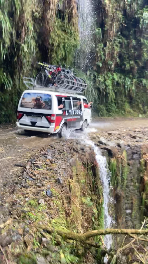
The road is dangerous because it is literally carved out of a mountainside that forms a deep valley that begins at roughly 4,600 meters (over 15,000’) and drops dramatically over 11,000’ to the Amazon forest across a distance of 64 km (40 mi). It features steep slopes, and a narrow single track that lacks guardrails (except when added at locations where accidents have occurred). On top of that, it is often shrouded in rain and fog, and the steep hillsides have a high risk of landslides and falling rocks.
Scary road… still in use by residents and tour companies
With vertical cliffs at the edge of the narrow road (less than 3 meters wide in some places), vehicles drive on the left (unlike the rest of the country) to allow the outer edge driver to assess the distance of their wheels from the abrupt edge of the road. Additionally, vehicles traveling downhill are required to pull close to the edge and stop to allow uphill traffic enough room to pass on the inside.
Passing on a narrow section where a previous accident resulted in a guardrail.
Part of this road was built by Paraguayan prisoners who were captured during the Chaco War between Bolivia and Paraguay in the 1930’s. Up until the modern freeway was built, it was of one of the few routes that connected the Amazon region in the north with the capital city of La Paz.
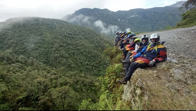
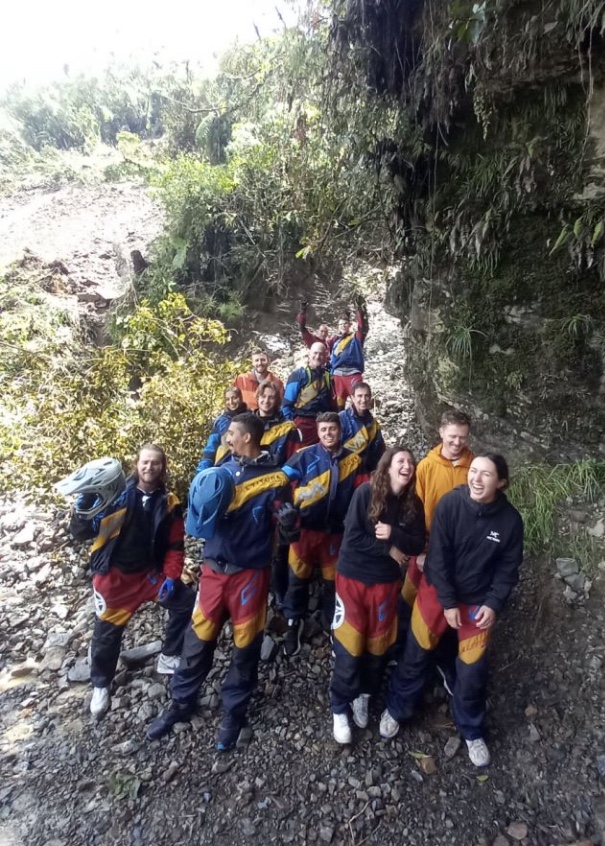
Of course our group of twelve riders and three Altitude Travel guides (Nelson, Gandalf, and Israel), were here to experience a thrilling morning of downhill mountain biking and taking in the natural grandeur of this deep valley.
After a warm up ride… (actually a very cold, wet ride) on the paved national highway to get acquainted with the bikes and gear, we hopped back into the vans for the short ride to the top of the Death Road. Due to a significant landslide that made the road impassable further down the valley, we would only be able to ride to the site of the landslide. Although unable to ride the entire distance, we had plenty of thrills on the steep 6,000’ descent of the part we were able to ride.
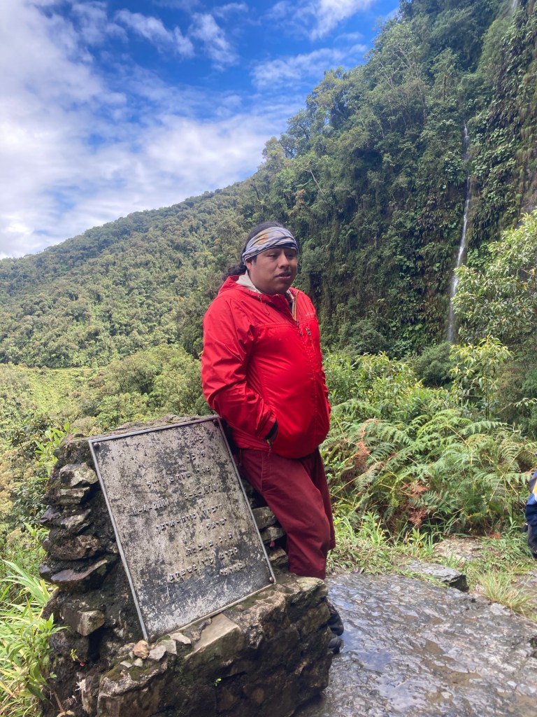
Nelson (in red) sharing some history and safety rules
During each section, our head guide Nelson, told stories about the history of the area, how the biking adventure touring industry was born, and other interesting tales. He would always end his talk with the same three safety points: 1) Always keep both hands on the handlebars, 2) Control your speed by braking before corners, and 3) Focus only on yourself while riding… later in the day during lunch after the riding was over, Nelson shared vivid stories that underscored why each of the rules were constantly reinforced.
A bit wet!
Riding down the road was a thrilling experience, full of speed, adrenaline, and the jarring sensation of vibrations from the rough road translated through the full suspension bike frame to our bodies. The equipment was top notch, adding to our confidence that the bike could absorb the most punishing parts of the very rough road, and we could easily control our speed with the well-maintained disc brakes.
Along the way during each section, the Altitude Travel staff was pre-positioned to take pictures of each rider, allowing our entire focus to remain solely on the road ahead.
The end of the road… literally! Behind us is the result of a recent landslide.
All said it was a fantastic way to end this trip. Bolivia is a richly varied country that ranges from high mountains, dense rain forest, vast salt flats, and rugged, mineral rich terrain. Everywhere we went, the people were kind, helpful and open. I hope you enjoyed following this Bolivian experience. Special thanks to mi hermano, Ron for inspiring this adventure. ¡Adios y gracias Bolivia!