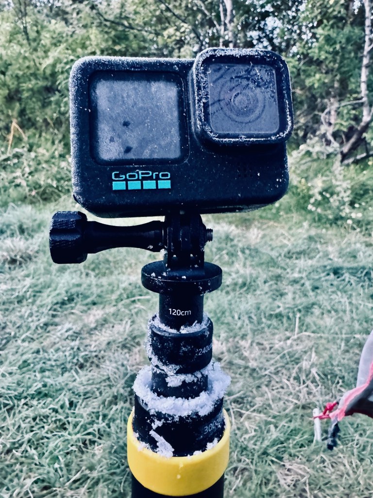
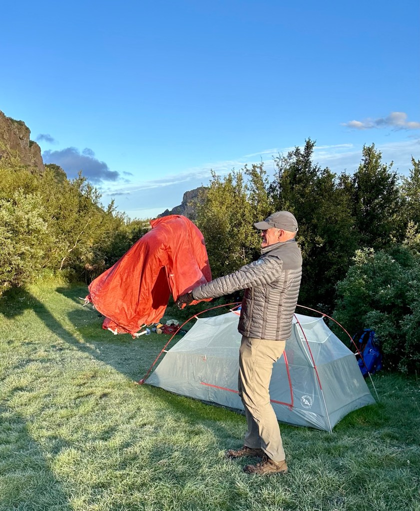
We began stirring early in our tents today… not because of the anticipation of one last epic day of hiking, but rather we were absolutely freezing throughout the night. Despite clear skies and no wind, the nighttime temperatures must have been around 25° F (-4° C) and we woke up to frost covered tents.
Shivering uncontrollably throughout much of the night is not an experience I’d recommend. So, rather than continue to huddle inside our sleeping bags wrapped in as many layers as possible, we ended up emerging from the tents around 5:45 am to a clear, bright, crisp day.
The now routine chore of re-packing and organizing our gear for the day served a secondary purpose of generating some much needed body heat. The night’s discomfort was behind us and it was time to focus on the challenge ahead, the Fimmvörðuháls Trail.
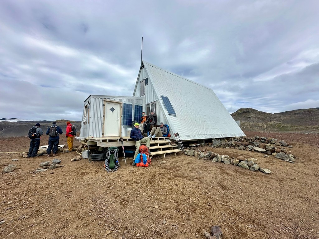
Having just completed the 34 mi (55 km) Laugavegur Trail over the last three days, we decided that we would tackle the “F” trail in a single day. Although many hikers will cover this 16.5 mile (25 km) trail in two days, just as many opt for the single day option. Our choice was based on the simple fact that the only available campsites are located at the Baldvinsskáli Hut that sits on a barren, rocky, and exposed site at around 3,000’ (≈900 m), between the Eyjafjallajökull and Mýrdalsjökull glaciers.
And so… our long final day of hiking begins at 7:30 am as we hit the trail. Although we start in a flat area along the Krossá River, the trail quickly turns away from the river valley as we begin a very steep climbing section that will have us gaining 3,330’ (1,000 m) in just 4.5 mi (7.2 km). The first portion of the climb passes through a lush green landscape blanketed with trees, shrubs and grasses. The terrain is dramatically carved, revealing its relative young age in geologic timescales.
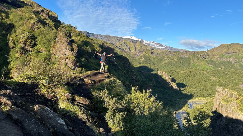
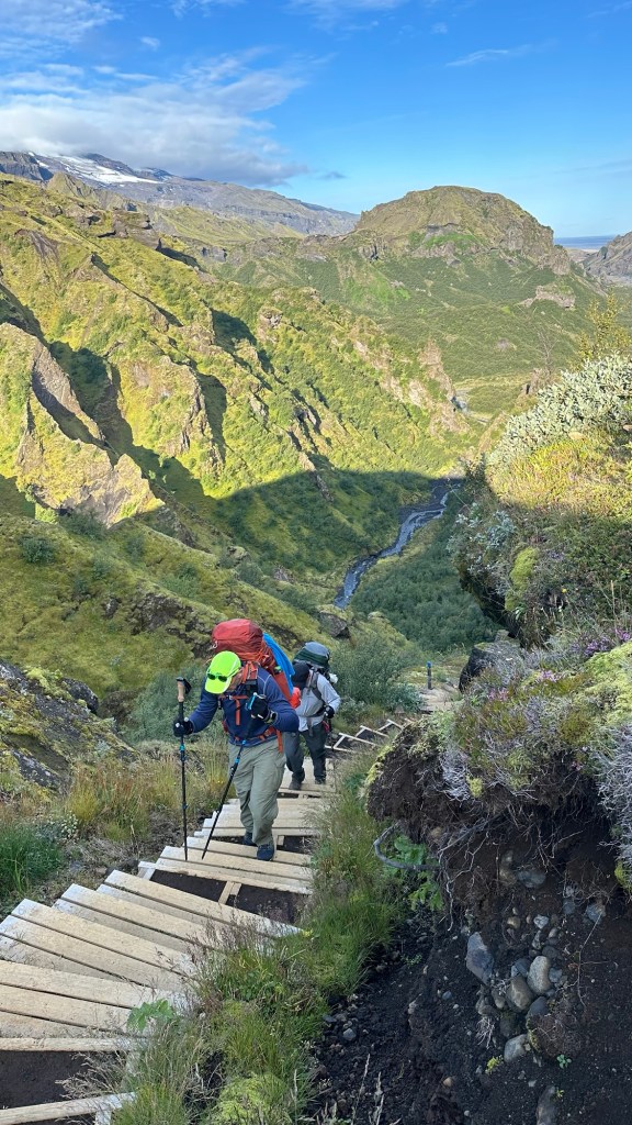
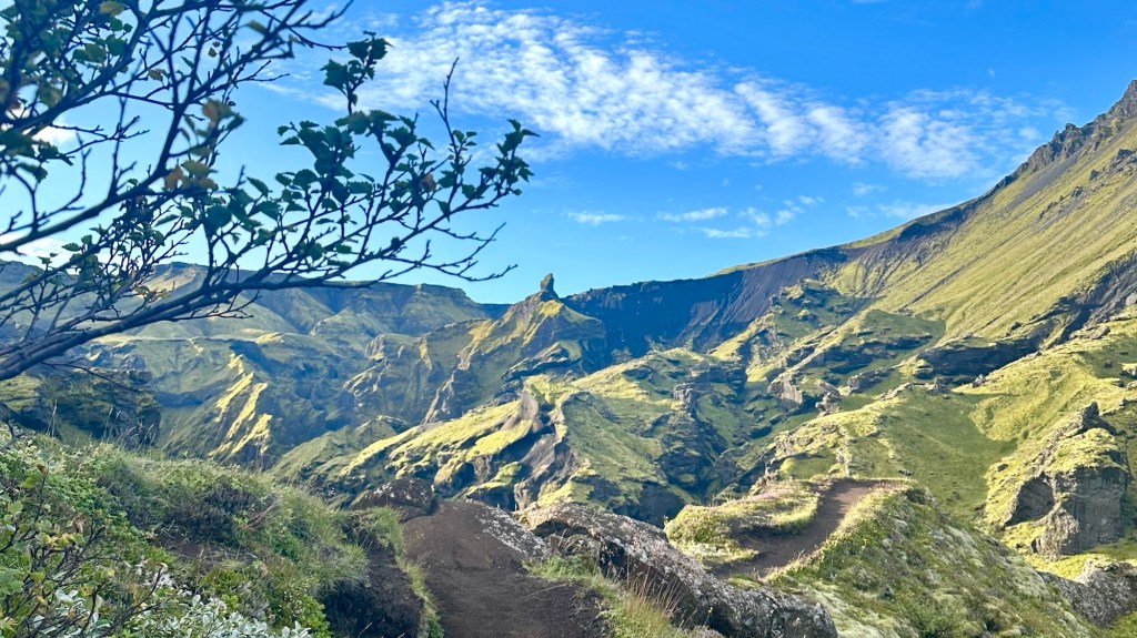
As we climb higher, the trail narrows in spots, sometimes a mere inches from a steep drop off to one side, and at other times we are totally exposed to steep drops on either side of the trail. Suffice it to say, we are staying focused to ensure solid footing as we carefully make our way forward. Along the way there are numerous outcroppings where we can stop and enjoy the dramatic scenery all around.

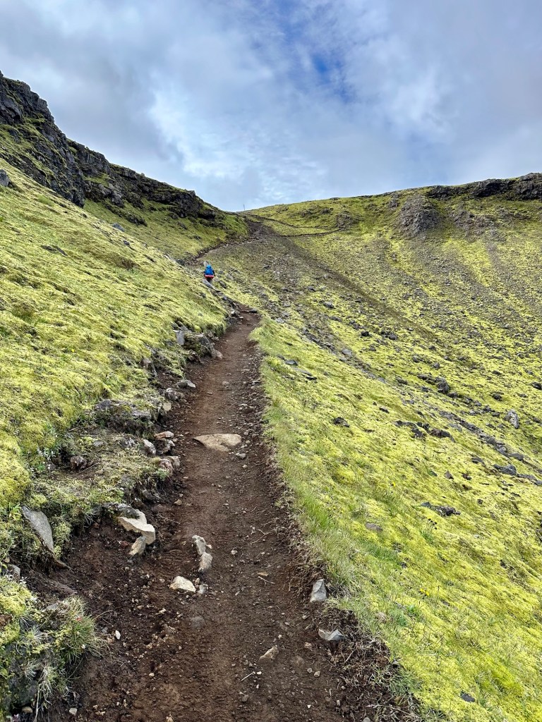
Although the climb is seldom relenting, I remind myself that it is better to ascend sections like this than descend them (see author’s note at the end). I am also happy that we are climbing in dry conditions… rain would have significantly added to the “pucker factor” we were already experiencing.

As we looked far up the mountain in front of us, we could make out a small orange speck of another hiker’s backpack high on the trail above us. We used that person’s progress as our own inspiration to maintain a steady, constant pace until we finally crested the lower section of the steep climb and found ourselves on a wide, flat gravelly section that let to another steep section with loose rock and less than stable soil.
In this section, some chains had been installed to provide a handhold, but in some places the rebar anchoring the chain railing was completely torn from the ground, so we were prudent to not trust our lives on that precarious single handhold.

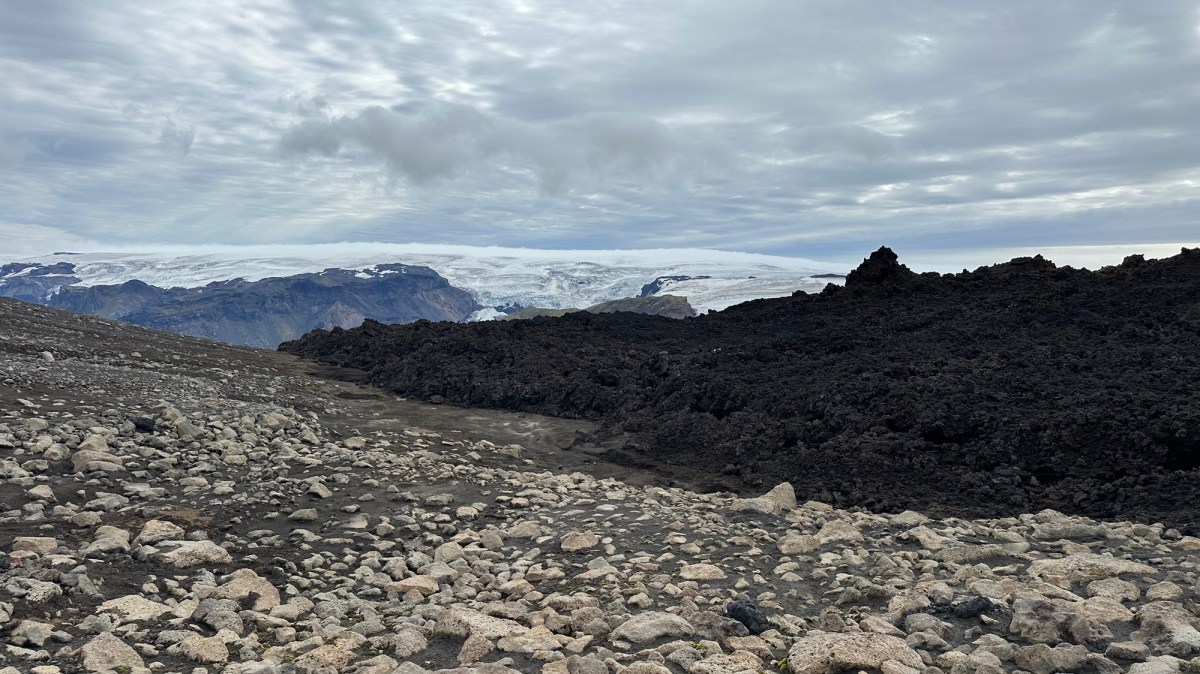
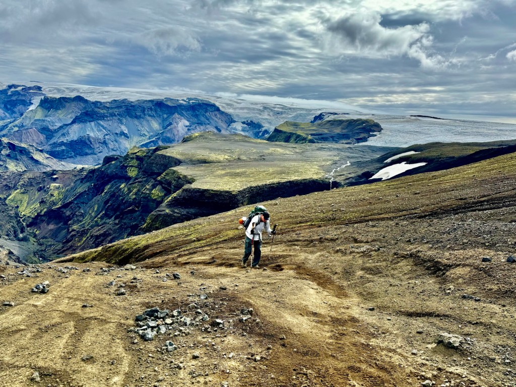
Finally, having reached the top of the steepest climbing sections, we are near the highest elevation of this multi-day adventure. As the terrain flattens in front of us, we are very close to the Eyjafjallajökull glacier on our left and the Mýrdalsjökull glacier to our right. What we didn’t know at this point was that the next 2.3 mi (4.2km) to the Baldvinsskáli Hut would be some of the toughest hiking any of us had ever done.
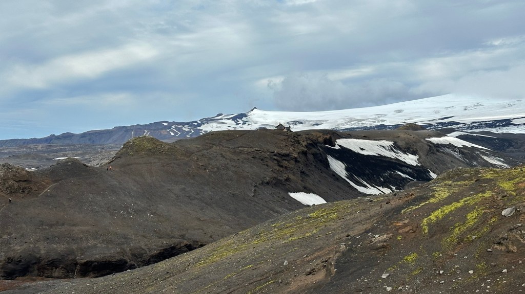
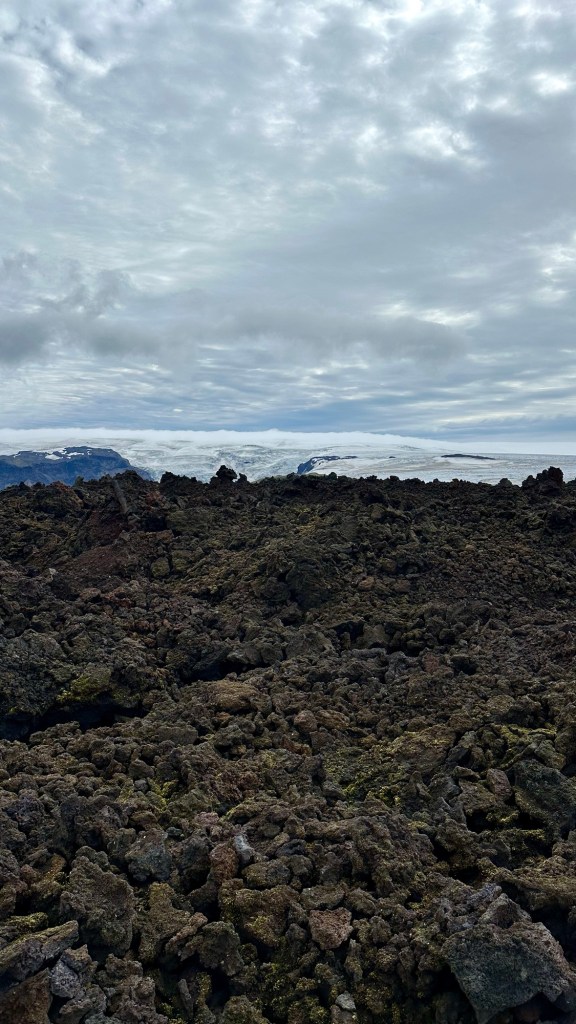
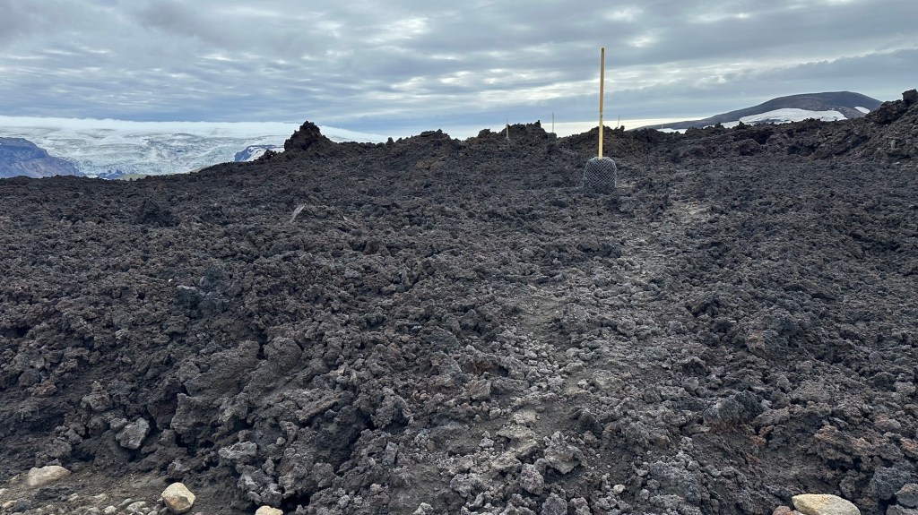
Just as we thought the difficult part was over, we encountered a large lava flow from the 2010 Eyjafjallajökull eruption that formed the Magni and Móði craters.
Authors note: The 2010 eruption created an ash cloud that caused 20 European countries to close their airspace for 6 days in April, affecting over 20 million air travelers.
Our pace slowed to a mere crawl as we slowly navigated our way through jagged, porous volcanic rock, paying attention to the long yellow posts that had been placed to mark the route since there was no discernible trail.
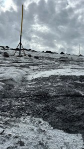
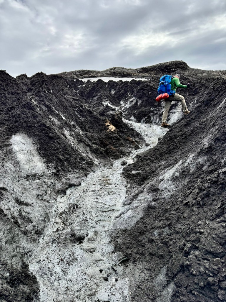
After about 45 minutes, we finally made it across the lava rock for a brief section of soft volcanic sand. Our respite, however, was to be short-lived because the next section required us to descend down the steep side of a glacial moraine, then cross over a series of 6 to 8 feet high sharp ice ridges covered by black volcanic cinder. In some cases we had to make multiple attempts to get an adequate foothold to get up one side only to slide down the opposite side. Our trekking poles were of little help since they couldn’t pierce the hard glacial ice.
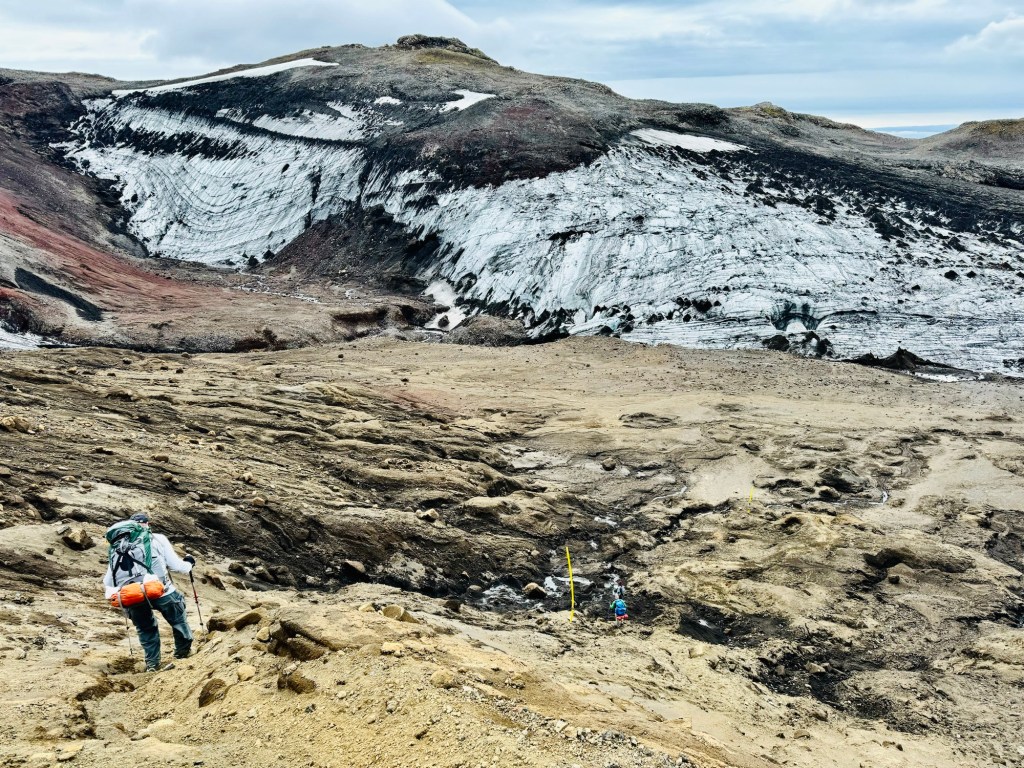
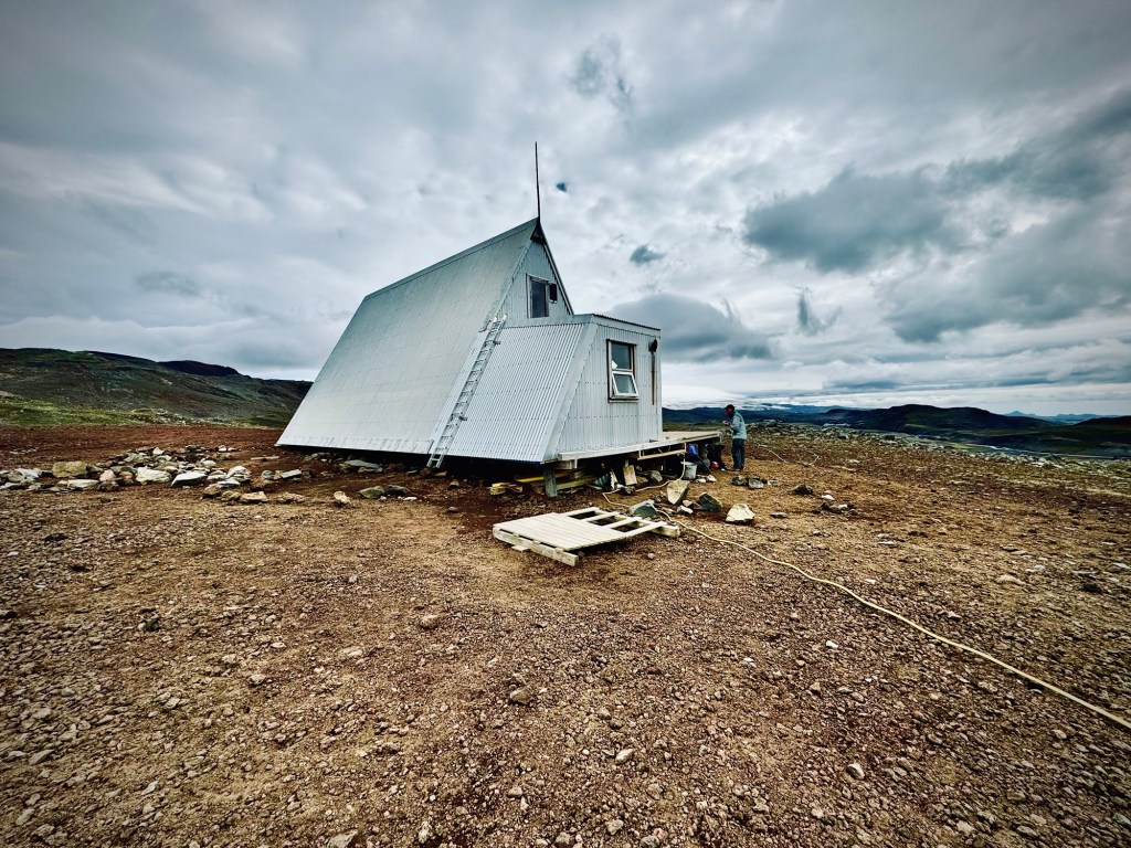
Finally, with a lot of effort, we made it through this last challenging section as we climbed back out of the moraine to the Baldvinsskáli Hut that appeared off in the distance. By the time we got there, we were definitely in need of a short break and some food to restore the calories we had expended. Sitting there on the hut steps as the cold wind blew, we were thankful that we still had the energy and motivation keep going and finish the demanding “F” trail.
To be continued…
Author’s Note: For anyone who is considering this hike, I would emphatically recommend the north-to-south routing that begins at Þórsmörk, rather that the northbound option that starts in Skógar. The terrain profile out of Þórsmörk is significantly more aggressive which translates into steeper climbs going southbound, but if heading north, the descents on unstable rock and packed cinder can be treacherous.