

Day 3 (Emstrur-Botnar to Básar):
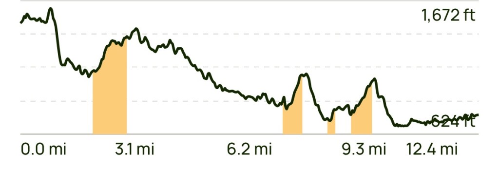
It was a cold night at Emstrur, but fortunately our primo campsite was located out of the wind. Although we wore many layers to bed, the near freezing temps still allowed the cold to seep in. Once awake, we roused ourselves to make breakfast, fill water, and repack our gear for today’s 12.4 mi (23 km) hike.

The last two days we have been blessed with good hiking weather (… cool and dry), and it looks like today’s forecast will be the same! With our early wake-up, we were able to get on the trail at 7:30 am, well ahead of most of the camp.
Once again the terrain proved to be the star. Today started on a black sand trail that allowed just enough cushioning for our less than supple bodies. We descended into the very narrow and steep section of the upper part of the Markarfljótsgljúfur Canyon, across a bridge over what appeared to be class 6 rapids originating from the melt from the Mýrdalsjökulla Glacier a few miles to the east.

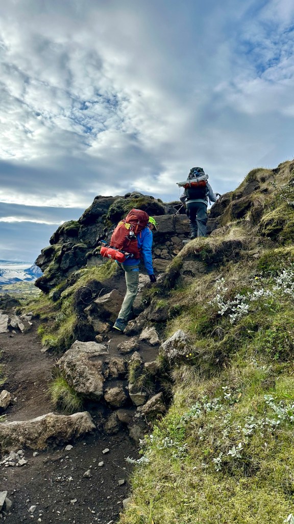

Although the overall trail profile shows that we will be descending gradually over the course day, we still expect to encounter some sections with sharp climbs and steep descents. Although counterintuitive, the climbs are preferred over the descents.
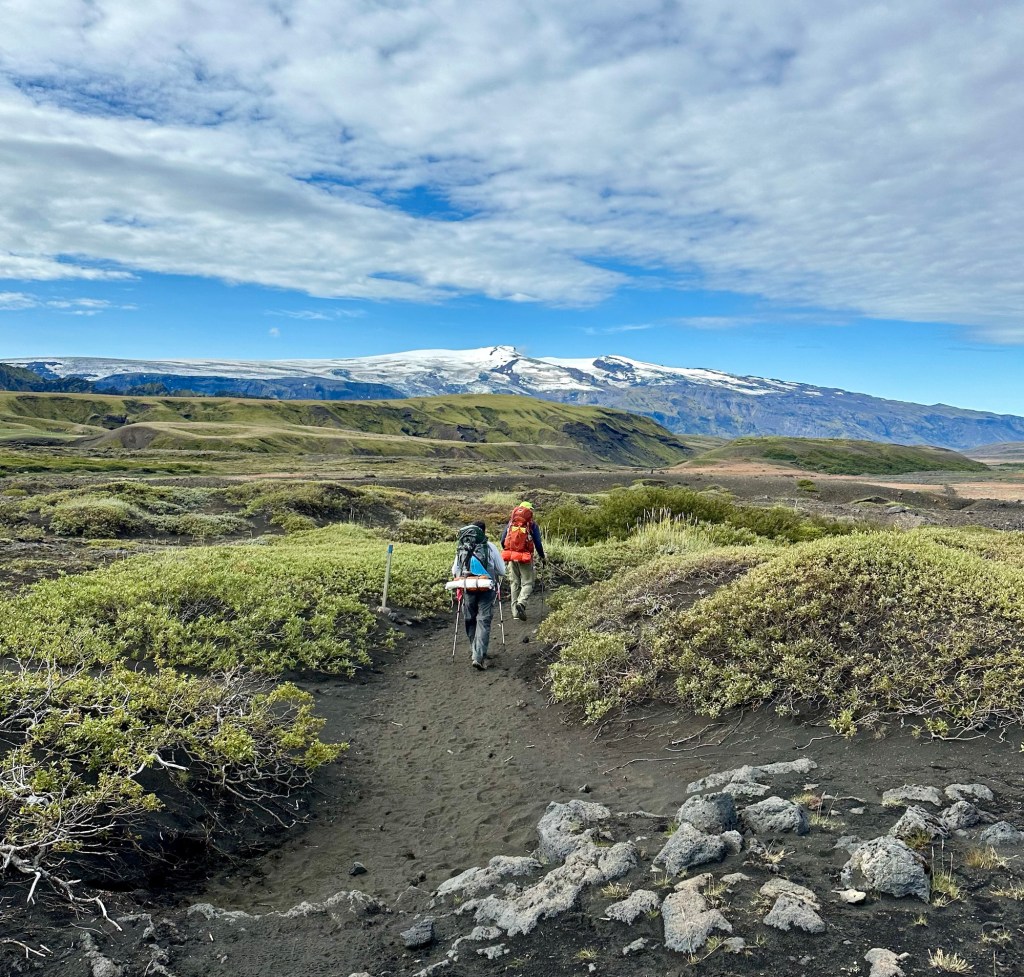
After climbing back out of the canyon we headed across a vast lava field to another distant climb to a higher plain. As we continued along, we began to notice some small signs of civilization… namely a very distant farmhouse with nothing around it as far as the eye could see, and some sheep grazing on the scrub grasses that were beginning to appear.
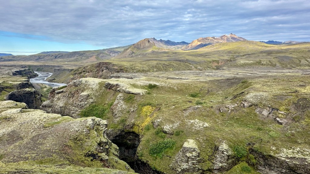
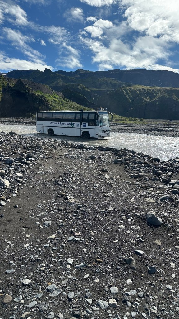
After enjoying a relatively long flatish section across the cinder and lava rock surface, we encountered another steep downhill section and began to see small shrubs and even a few small trees as we approached our first river crossing of the day. The crossings have all been manageable, but we do have to concentrate so as not to slip in the fast moving knee-deep water.
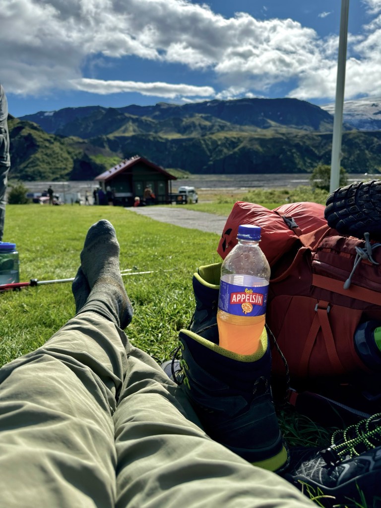
At this point we were about 2 mi (3.2km) from the end of the Laugavegur Trail and looking forward to a well needed break at the Þórsmörk camp. The last section after the river was through a lush forest of small downy birch trees… vastly different than the more barren terrain of the past several days. Þórsmörk was a welcome oasis at the end of the Laugavegur trail where we were able to stretch out on the grass and enjoy a late lunch. Chris even surprised Phil and I, with Snickers bars from the camp store!

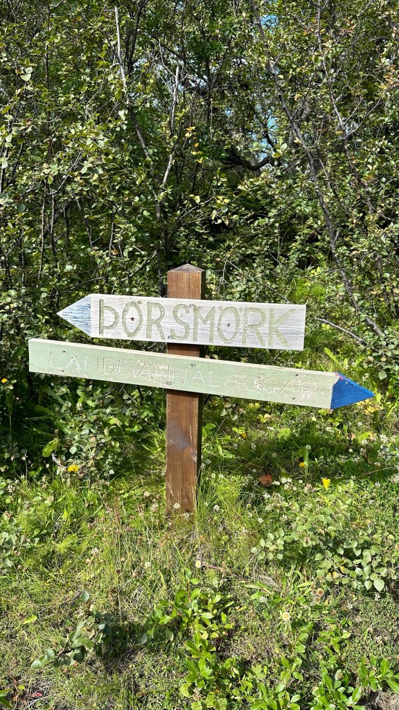
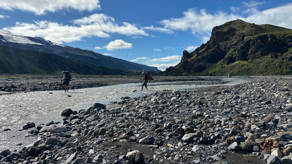
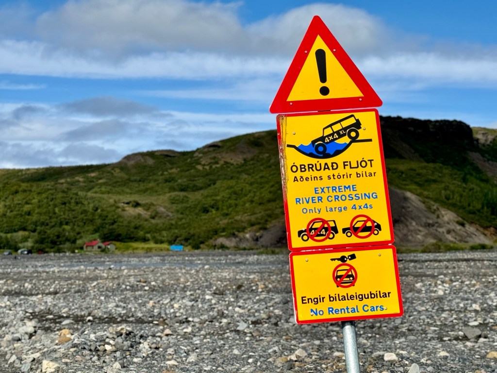
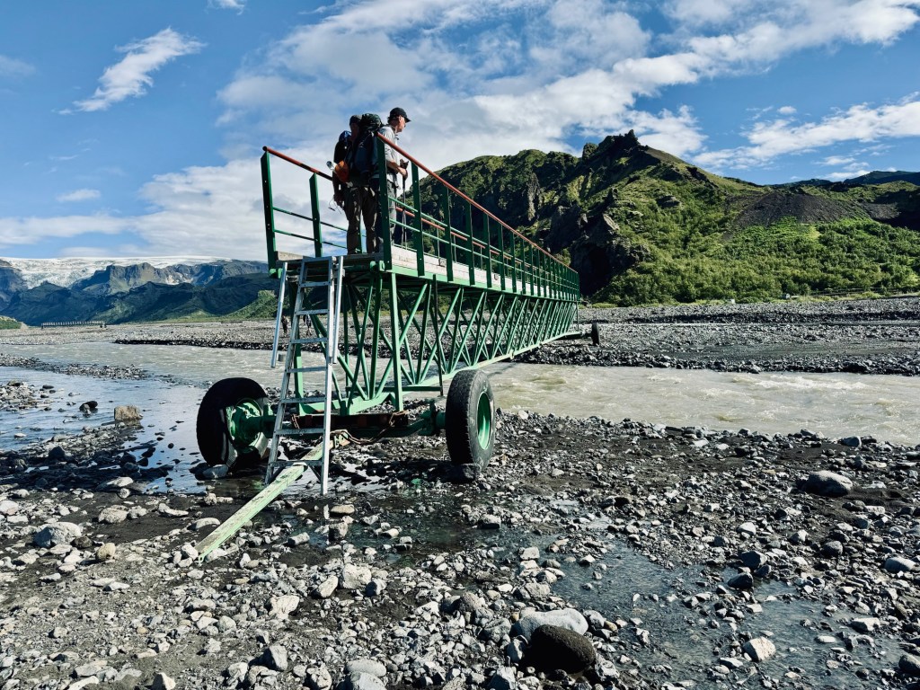
Finally it was time to get our stiff bodies up and moving again, because we wanted to get a head start on the Fimmvörðuháls Trail that officially began across a series of estuaries that make up the wide Krossá River plain.
We had to navigate our way across several estuaries until we came to one requiring us to change out of our boots again to fjord a deep, fast moving section. Once across, we headed upriver to Básar Hut campsite and settled in for our last night, hoping to get a good night’s rest before tomorrow’s arduous single-day hike of the Fimmvörðuháls Trail.


Looks and sounds amazing! Nice to visualize the beauty through your descriptions. Warning – inside home coming…. I was a little taken aback by the “less than supple” acknowledgement. I was visualizing 3 “supple leopards” nimbly traversing that rugged, beautiful landscape. 😊 thanks for sharing!!!
LikeLike
Shame I can type or proofread…. Inside joke not home….
LikeLike